The old forestry road faded away as I climbed upwards and away from the roadside. I was warned by my ride that there would be many signs saying ‘private property’ and ‘trespassers would be prosecuted’, but it was a right of way. The person who bought land on both sides of the road a little way in didn’t want anybody coming down this public access road and did their best to make it seem private. When I came to the property I understood exactly what he meant. I was told you can be on the road but don’t camp around here, don’t sit at the roadside for lunch, don’t even stand still. The property only lasted a couple of hundred yards and was back to regular forest with forestry carparks and trailheads afterwards. I’m glad I didn’t meet the property owner. All I could think was ‘who buys a couple of acres of land on either side of a road and tries to close the road that runs behind their property for the next 20 miles’? I soon forgot about it as the road climbed up. I would hike until dark and pitch tent on a small patch of flat ground between trees.
In the morning, within a few minutes, I would come across a black bear in the middle of the trail. I fumbled around in my pack for my phone to take a picture and tried running after it but the bear had disappeared. It’s not recommended to run after a bear, but after seeing four or five bears in total in the past months, I really wanted to get a photo of one. A few hours later I would spot a second black bear ten miles further down trail. The scenery here was good and trail relatively straight forward, apart from where it suddenly branched from the main route without there being any trail or marker. I spotted the mistake quickly and lost only a second. Again painting a mental picture of my route, and keeping check on my rough compass direction would save a lot of incorrect miles. It takes focus.
Time for a rant. While re-checking parts of this route before writing today to jog my memory, I came across a blog written by a hiker. They stated the whole CDT is straightforward for navigation, she didn’t need to use a compass once and didn’t think it was necessary. Only the guthook mobile app was needed to navigate (a mobile app popular with hiking the route). The app is undeniably brilliant, giving both your location and the exact location of the footpath within 6ft the whole 3000 miles. It is quite honestly impossible to get lost if you have this on all day. You keep yourself on the blue line and follow it to the next pass. But that doesn’t mean phone batteries don’t die, it doesn’t mean electrical means of navigation won’t get drowned in rivers or in wet pockets on rainy days. I usually find when someone navigates solely with a mobile app, their ability to use a map and compass lacks quite severely. And they spend most of the day with a nose glued to the screen, keeping their dot on the thin blue line of the trail. As well as the hikers I have mentioned in my blogs who I respect, I have met quite a few I didn’t mention because of this kind of thing.
There was one time to me when the route was obvious. I would look up at the features around me and go in the right direction, and a hiker I was with at the time was solely using the App. He traipsed back and forwards getting himself on and off the blue line on his screen, but the trail wasn’t there. I think the people who hiked this trail through the 70s and 80s had a real adventure and had to learn how to navigate. It’s too easy now to turn on a phone and think navigation is easy. Think about it like sat nav in a car, with modern mobiles you sit the phone on the dash and it tells you where to go, when to turn and you are never lost. But, go back to when there were only paper maps and either only yourself or a friend riding shotgun to navigate. Then take away the odometer so you don’t know how far you have come. Gets a little harder doesn’t it. For the trail now, factor in there are between 300 and 700 miles of trail that just don’t exist (it gets less each year as more trail is complete and re-signed). Combine that with a path occasionally splitting 4 ways but the map shows only one. Or maybe your trail branches off but there is no trail where it should be. Then consider there are no roads signs over the mountains and through dense forest. Add in low visibility some days, add in miles of downed trees through sections. I guess what I’m trying to say is, I think her skills lacked. To not understand why a compass needs to be carried and to say navigation is easy on a trail reputed for hard navigation, shows a misunderstanding of what navigation is. I have ten times the respect for people who bothered to learn how to handle a map and compass. When I came back and hiked sections of the CDT in 2017, I used a navigation app. I didn’t need to navigate, I just had to follow a line on a screen. I’m not against them. But when using an app, you aren’t navigating.
Back on trail, I would hike the day mainly on ridge lines where the tree line faded out and windswept gravel and patchy grass was my only companion. The mountains were getting higher and cooler and less water was needed compared to the heat back at the start. Towards the end of this second day I was racing another lighting storm to a peak. It is a daily occurrence. There was a shelter on top of this peak and if I made it I could spend the night there safely. The sky grumbled around me, a warning from the ancient gods to descend. I really didn’t want to be delayed by this storm, but some days you lose. Lightening started striking higher than me on the mountain forcing me to turn tail. I half ran, half skipped straight down from the ridge towards the trees below. I hid in the forest and pitched my tent on rather slanted ground. I know they say to stay away from trees in lightening storms, but my odds felt better when tucked away from the brunt of a bolt. It crossed my mind if I did get hurt here, it would be unlikely anybody would ever find me. I was off trail, and in an area without trail. Nobody would have reason to clamber down a hillside to nothing. I hoped the storm would subside but eventually gave up hope and went to sleep. There was a possibility of descending down to an old forestry trail that would wind around the mountain, but I felt a compulsion to make the top of this peak.
The next morning I climbed back up to the ridge and carried onto the summit at around 13,300ft. It was a beautiful day with nice cirrus clouds scattered in the sky. I descended feeling good. As the day went on I would listen to music, enjoy the odd coffee break and a walk into further storm.
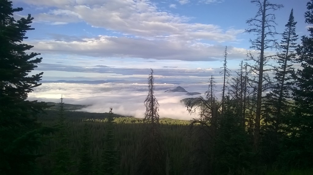
a cloud inversion on the second day 
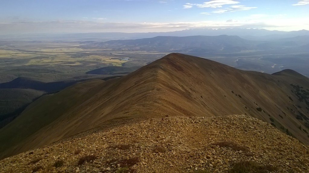
classic CDT 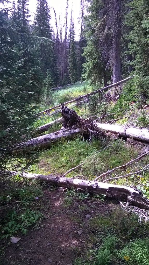
clambering over logs becomes tiring after a while 


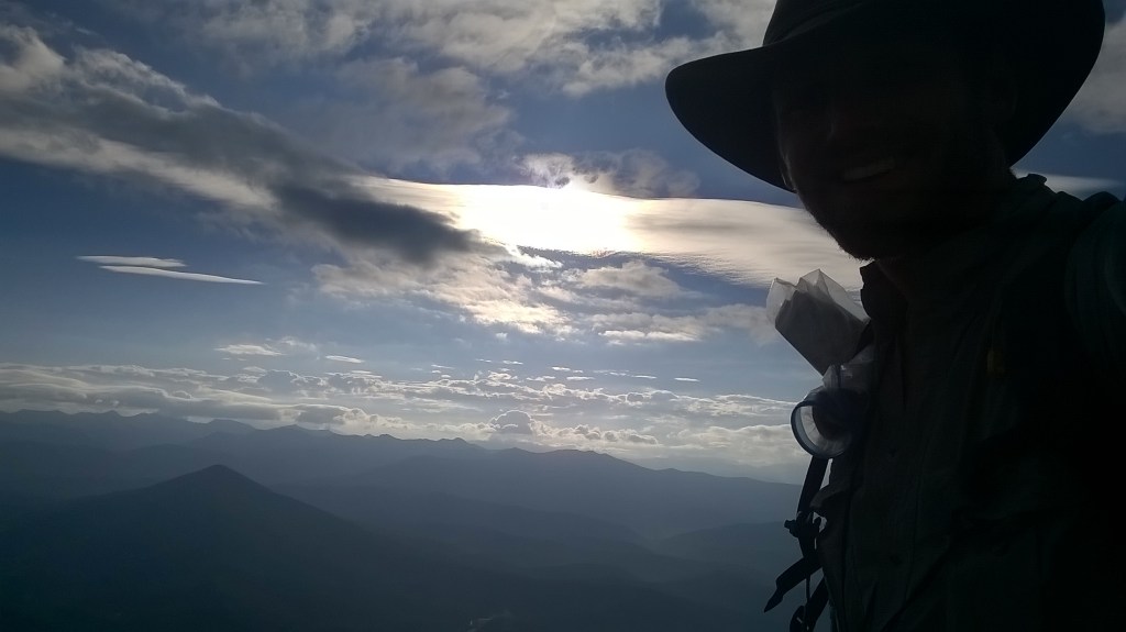
the ridge I retreated from in the evening before reclimbingthe next day 
views the next day
I had intended on a slight deviation keeping higher than the official route went in search of better views, but a very large cumulonimbus cloud put and end to the idea. Keeping to the official route I found myself running as lightening flashed all over the hillside. Rain started but hail followed, so thick and heavy I couldn’t see more than twenty feet in front of me. I ran down a trail that soon turned into a river. I considered running straight down the hillside but lighting struck lower down on the hill. Sack that! I followed the path with an inch or two of water streaming down and turning it into a river, some hail would stay on the surface to be swept away giving an awesome spectacle. Bright white light would flash blindingly and honestly it was hard to tell if the strikes were in front of me or behind me, but I knew they were very close. The deafening crack was on top of me. I tried to keep out of this stream of a trail, thinking to myself how stupid it might be to be ankle deep in a perfect long energy conductor. Trying to keep off the trail was muddy and caused me to slip. What a mess this was. To add, this icy torrent started chilling me. I couldn’t feel my hands, my feet, my legs. I was struggling to keep my body warm. It was getting a touch hardcore, but the only option was to keep moving. I kept up a jog down into the valley forcing my cold and rigid muscles to do work. There aren’t too many times in my life I have felt threatened, but this time made the list. With the low visibility I couldn’t tell if I was on a small ridge or near the valley base, but there is no good place to be in a lighting storm. I kept running down. After twenty minutes the strikes were not as close. I dropped to a flatt-ish clearing. This would do. I struggled to pitch the tent and did a poor job, but it was enough to be watertight (ish). I climbed in and pulled off the wet layers, shivering. I inflated the camping pad and sat on it to keep me insulated from the ground. When I felt dry enough after a few minutes I climbed into my sleeping bag. I would wait til the rain stopped then eat some food and carry on.
fun ridge line walking 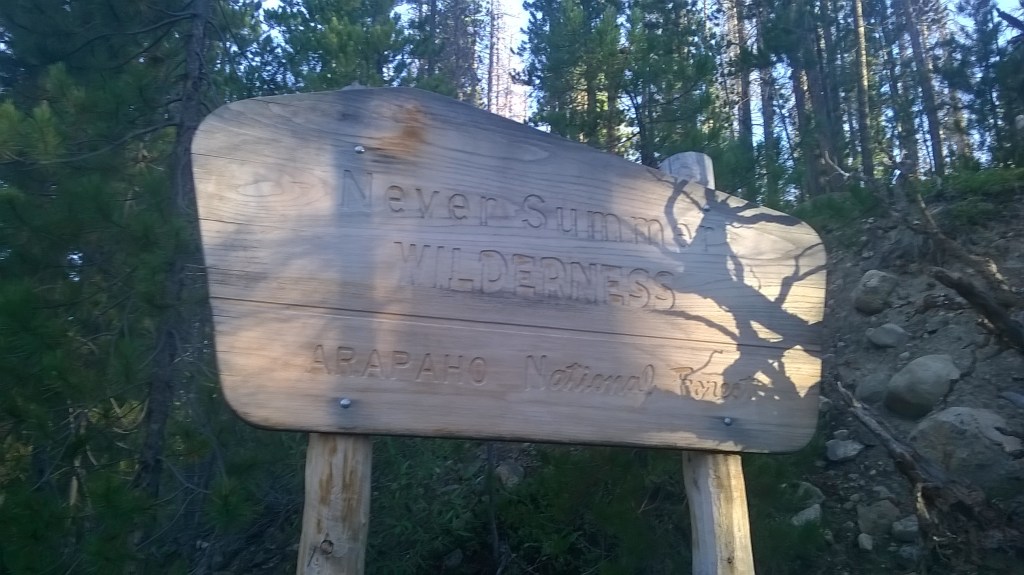


a building storm 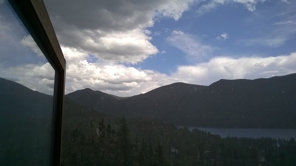
grand lake the next day
I woke after dark, hungry and tired. It was silent. I had been out like a lamp for a few good hours. I was disappointed in myself for not hiking on, as Grand Lake was only a few miles further down. This was the Never Summer Wilderness area, even its name beat me down. I cooked some Ramen, ate some chocolate and went back to sleep. In the morning I woke to cold wet clothes in a pile outside the tent. It was a touch miserable, On a scale of one to ten lets give it a solid 5. I say five because at least they weren’t frozen, that would have elevated the situation to completely miserable. I was soaking, and felt like everything I owned was wet and smelly. I could feel mosquito bites from previous days itching. I held onto the knowledge that in a few hours I could be in the Grand Lake Hostel having a warm shower. Nothing sounded better than that. After an hour of walking I broke out of forest into a meadow, I was in the Rocky Mountain National Park and the sun was shining. It was still a couple of hours walking at least, almost teeth grinding agonisingly tedious. But fresh air picked me up and by the time the sun hit, I was feeling fine. I didn’t want to repeat my experience in a lighting storm like that and from here on decided I would play things safer. If such a thing exists on the divide.
In the hostel a couple of people were behind the reception desk. They asked where I had hiked from.
‘Oh man, did you see that lighting storm up there last night, that was insane! You were up there in it? No Way!!!’