I felt energised as I charged up the trail and over my first small pass of the day. Like a tuned machine with one purpose. I was given a set of hiking poles in Helena and it was like being given an extra set of legs. The speed I could climb at was phenomenal. If Glacier or the Bob was the starter, I was coming into the main course. The next days were hypnotic, crunching 10 miles before breakfast, a cup of tea, quick study of the map lining it up to the peaks around me then blasting away again. By lunch 20 or more miles down, by 4pm, 30 or more. I felt unstoppable. I had my limited music collection of around 15 songs on my mobile on repeat and how I came to know every word. I passed one other hiker doing a section hike over 120 miles.
The trail would wind up and down from one pass to the next, I was climbing thousands and thousands of feet every day. I loved it. One thing I should note is, the miles I was hiking were in fact higher than the miles I thought I was doing. The annotations on the maps included rough distances, but the author acknowledges they often are shy of the actual mileage by 10-15 percent. To my knowledge my days would have 34miles or so. In reality I believe I did more.
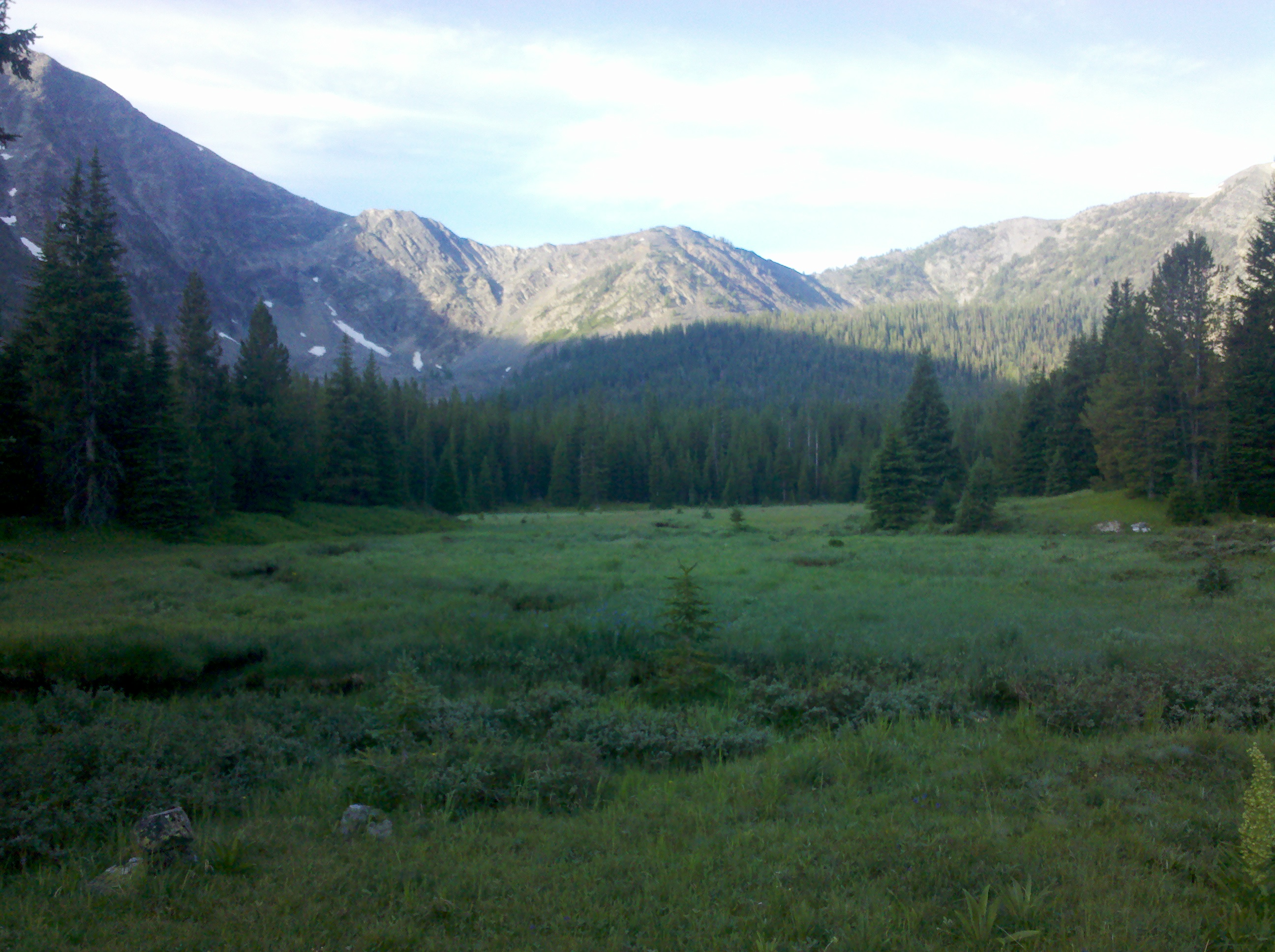
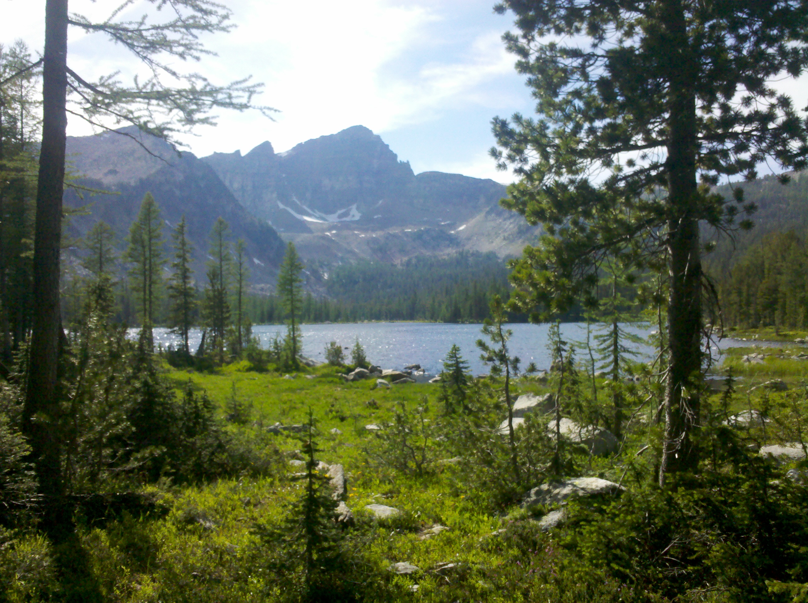
I felt until a few years ago I wasn’t particularly skilled at much in life until this scrappy bunch of maps landed in my hand while hiking in poorly marked out terrain and I was let loose. I felt more at home than I ever had before, like this was what my body was meant to do. Below me was Surprise View Lake and it was breathtaking. I figured I would have lunch here but the mosquitoes were intolerable. I hiked on, miles and miles on before I finally sat down for lunch that day. The evening also didn’t disappoint giving another fantastic lake to eat an evening meal by. I can’t remember all of the camps I did through here. It was sensory overload.
The second to last day I climbed into a burned out area after a lake and hiked my shoes off, the sun seemed to move incredibly slowly, and the trees had an eerie feeling. After hiking on my own for several days this beautiful area felt like something out of the Blair Witch. Was I hiking in circles? As the sun set shadows would dance, and I found myself hiking faster hoping to camp in a clearing. In the bottom of a valley ahead I saw my clearing. I always love coming across large meadows and while they aren’t the perfect place to pitch a tent, they are spacious and free. Being the first days camped completely alone, I still feared anything possibly resembling the sound a a grizzly in the night.
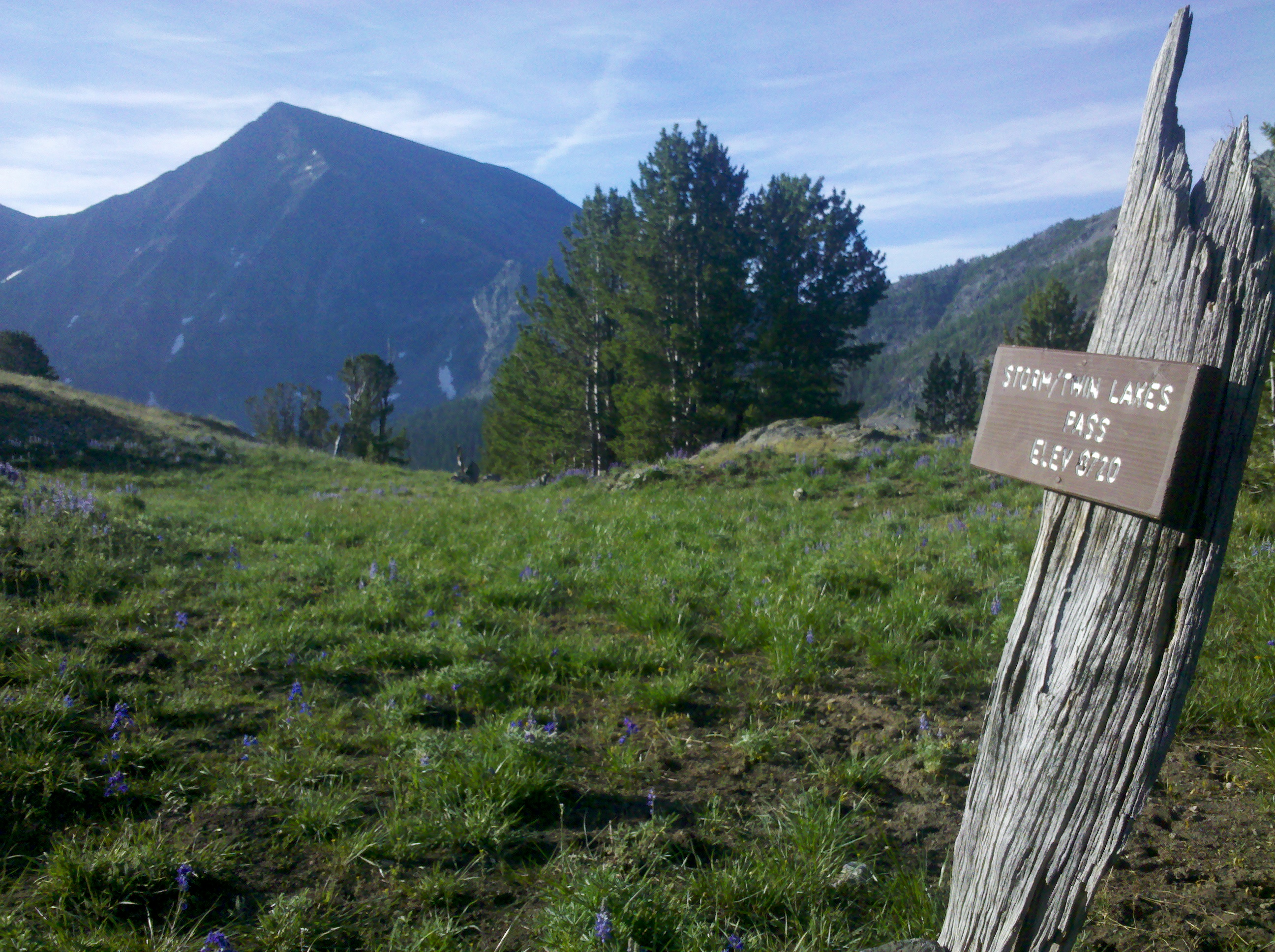
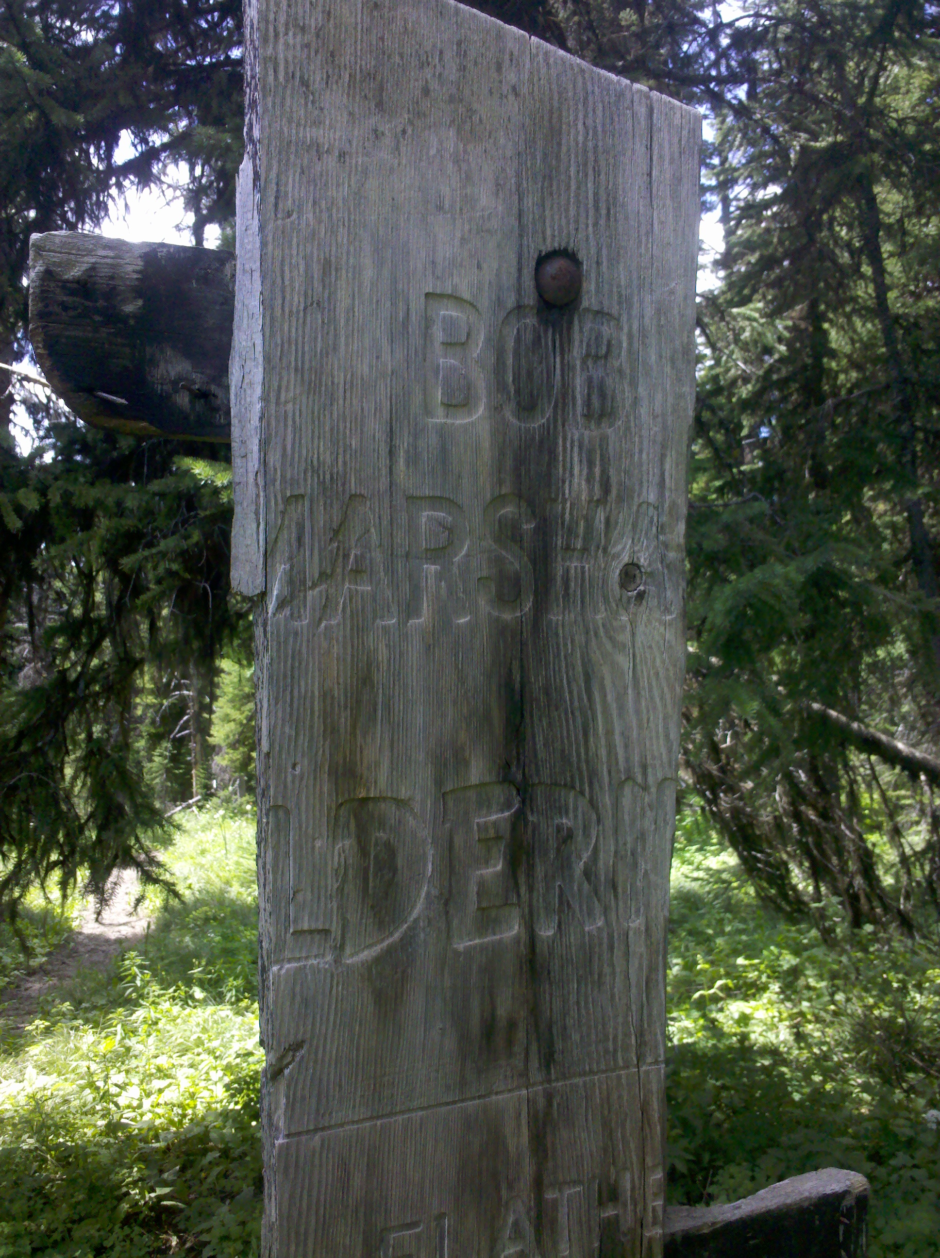
The final morning out I had a choice of the official route, or a more cross country route. The cross country route was more appealing as it featured a river and that meant I wouldn’t be thirsty. I came by a log cabin. I wasn’t aware of the date but it was around July 4. There was an old man with many dog residing there, I shouted from a long distance so as not to startle him and sat for a little while talking. He told me he served in Vietnam and fireworks bring back a lot of bad memories to him, so he prefers to be away from them around independence day. As such, he also takes his neighbours dogs as well every year and has a couple of days to himself out here in the quiet. He also told me about the history of the area, the Nez Pierce Tribe, Chief Joseph, and the removal of tribe from land and subsequent 1170 mile chase by the US military before finally surrendering to terms that were never met. I felt happy to have sat and chat for a half hour or so and learn about the area. It is shocking this was in 1877. Almost the modern world. It was refreshing to talk to someone not in a hurry. He offered an orange but I turned it down. A second offer ensued, if he sees me at the pass, he would offer again. I hiked on until I joined a well trodden trail, Then, picked up the pace again. A while later I came out at Chief Joseph Pass, moments later a pickup pulled over and the drive passed me an orange. I was glad he did. He informed me of the towns in different directions and offered a ride to the town of Salomon, but I already intended on the town of Darby and had a subsequent long wait. This was the Montana/Idaho borderline, and Idaho was not very receptive to outsiders, especially hikers that have no car. Most my day was waiting for a ride to and from the town, with many cars passing. It was probably the worst hitching place on the whole divide. I guess some of that is the luck of the draw. On the way back from Darby, a pickup gave me a lift and a couple of beers to drink on route. Combined with the salad I packed it made for a nice evening back near the trail.
Back at the pass after a successful pit stop in Helena, Kathleen and I hiked on, starting early afternoon. At this point my feet were toughening up and developing thick callus. I ditched my uncomfortable hiking shoes and picked up a set of cheap trainers. With a new level of comfort we advanced. Most of this day was spent walking through thick forest, breaking into meadows, some old forestry trail long since disused and overgrown. Reclaimed by nature, the trail either wasn’t well marked or we just weren’t on it. At one point a tree on the other side of the valley fell and we were there to see and hear it. In the hundreds of years it had stood tall and grown, surviving storms, droughts, fires and weathering. In this blink of an eye it was gone., the last day of its long life. I would be on this earth for half its own life span if I am so lucky, of the thousands of trees over the thousands of years, that moment was its last and life goes on, just like mine one day will. I hope it left a good dent.
We were cutting across country on a rough bearing according to where we thought we should be on the map. It was a little cooler today and we went at a steady pace. We knew ahead of us somewhere was a hiker bubble. The ‘bubble’ is a main group of hikers much like a peloton in a cycle tour. One fact I hadn’t mentioned so far is all the hikers that started on the Mexican border and hike up to the San Juans in Southern Colorado had been stopped by high snowfall, but this stoppage coincided with the trail opening up enough at the Canadian Border, so many of the hikers did what is know as a flip-flop. A jump to another part of the trail, to start hiking South. We knew from the last trail log (a small ledger kept at trailheads, signed by everyone who passes) that the bubble was on this trail earlier in the morning. And we were likely to see them the next day. Kathleen hoped her two friends would be near by. We were taking a break at the side of a gravel forestry road close to sunset, and, while deciding which route to take, heard a shout from the brush beside the road. Another hiker was at down relaxing waiting for the bubble to catch up. Some how we had trimmed time by cutting across country and managed to get ahead of them. A few minutes later they arrived. We all pitched up inside the brush and sat chatting till dark. Waking the next day the whole group set off in a broken manner. After hiking til around mid day with some of the group, we came across Kathleen’s friends having lunch by the river. The next day was spent ambling along and chatting. I was running on solar power and my phone spent most the time dead so I didn’t get many photos of this section. I won’t start on the hassle with the roll up solar panel I thought was the solution to all my life’s problems, but in the next town would replace it with more suitable means. The penultimate day of this section, was known as the Anaconda Cutoff .
The Anaconda Cutoff, as in title, cuts off a large loop from the official trail, 90 miles to be exact off the 3100mile hike, and most CDT hikers opt for it. By opting for it you pass through the town of Anaconda. Which is a cracking small town with shops, motels and even a small bowling alley. Logistically easier but with the downside- a very long boring roadwalk for 15 or so miles into the town.
The walk was long and passes both a juvenile Penitentiary and a state prison, with signs warning not to pick up hitch hikers from the roadside. I imagine the look of a bunch of scraggly people hiking outside them causes nervousness among the locals. We approached the road section on the evening and a local informed us the campsite we were aiming for on the edge had closed down, and invited us to camp on his front lawn instead. The so called trail magic had struck again. I was quite surprised a stranger would show this kindness to a group of 8 hikers. I had more expected a pointed shotgun and ‘Get away from my property!’. The next morning we completed the trudge along the road and into town. First port of call- Mcdonalds. Everybody likes a good burger and a group of lean calorie consuming hikers are no exception. The bubble of hikers intended on spending the night in town but I knew a town stay would kill the bank and I was hungry for more miles. I did a shop for food and while I was on the pavement outside the store a police man came over and asked what I was doing. I looked near homeless, with a dirty shirt and mud-up shoes. I told him what I was attempting. “Wait here” he exclaimed before driving off. Ten minutes passed and he pulled back in. In a bag were maybe 10-15 dehydrated hikers meals, the kind that weren’t in my budget but sold at any good outdoor store for $5-10 dollars a piece. Having the option of scrambled eggs for breakfast, chilli con carne for lunch and a curry for supper was a real treat. He also gave me a fabric police badge from his precinct as a memento and a story behind the numbers on it with a reference to lawless times. Being something you cant just buy easily, its a favourite memento. I still have it.
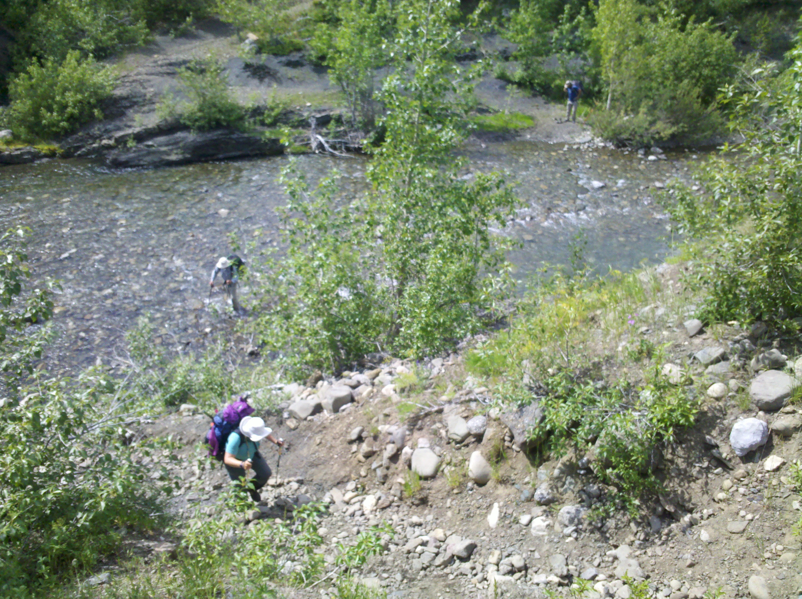
the other hikers
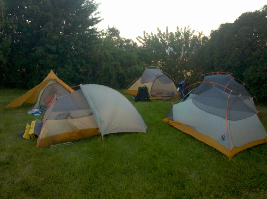
the weapon of choice for a thruhike, a Big Agnes tent, weighing a couple of pounds
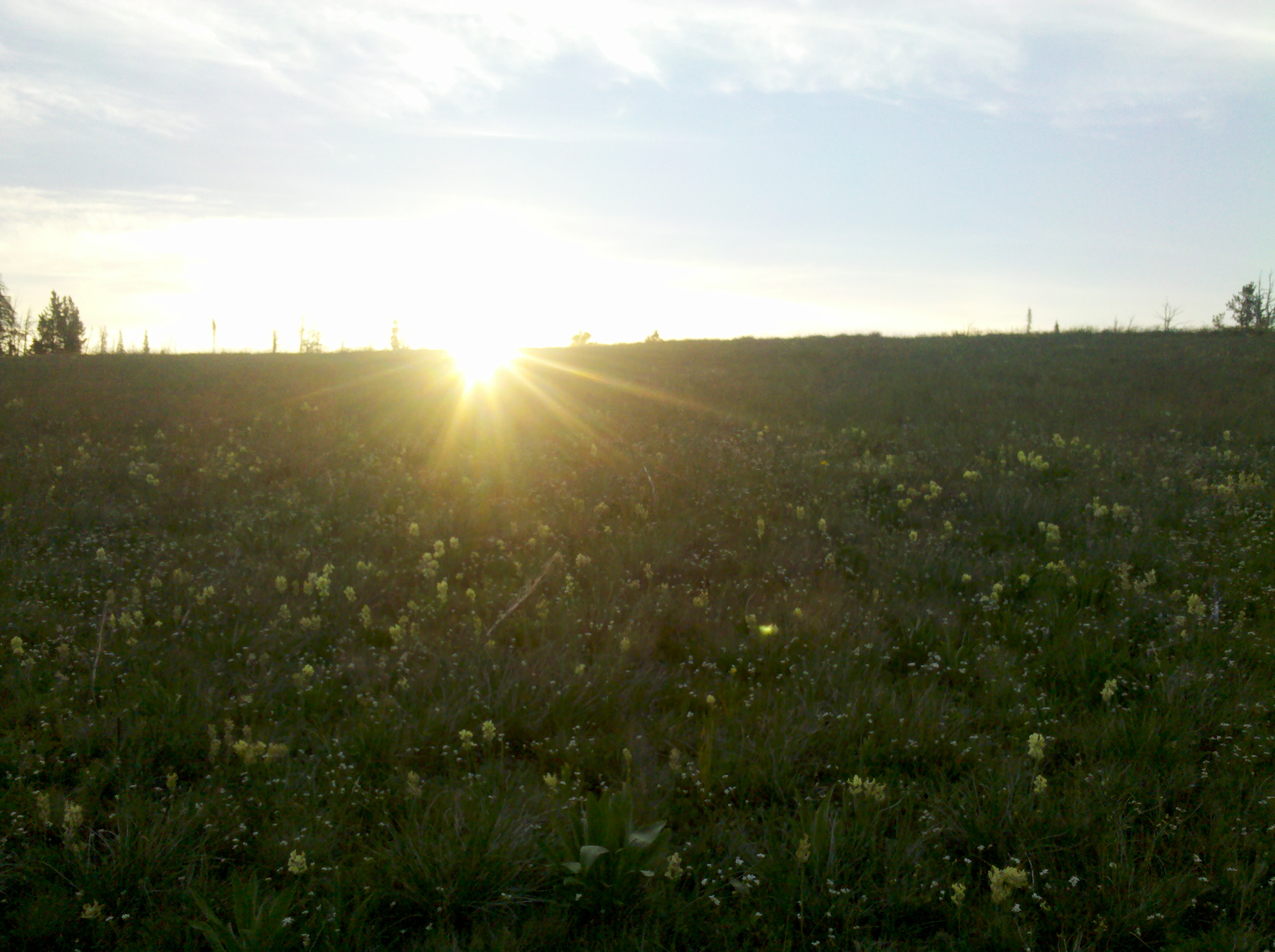
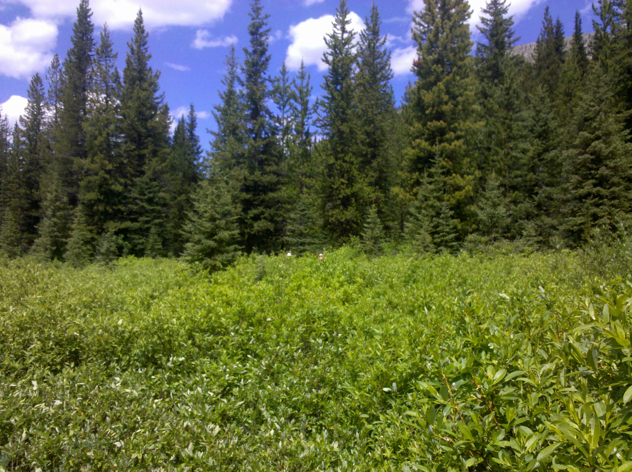
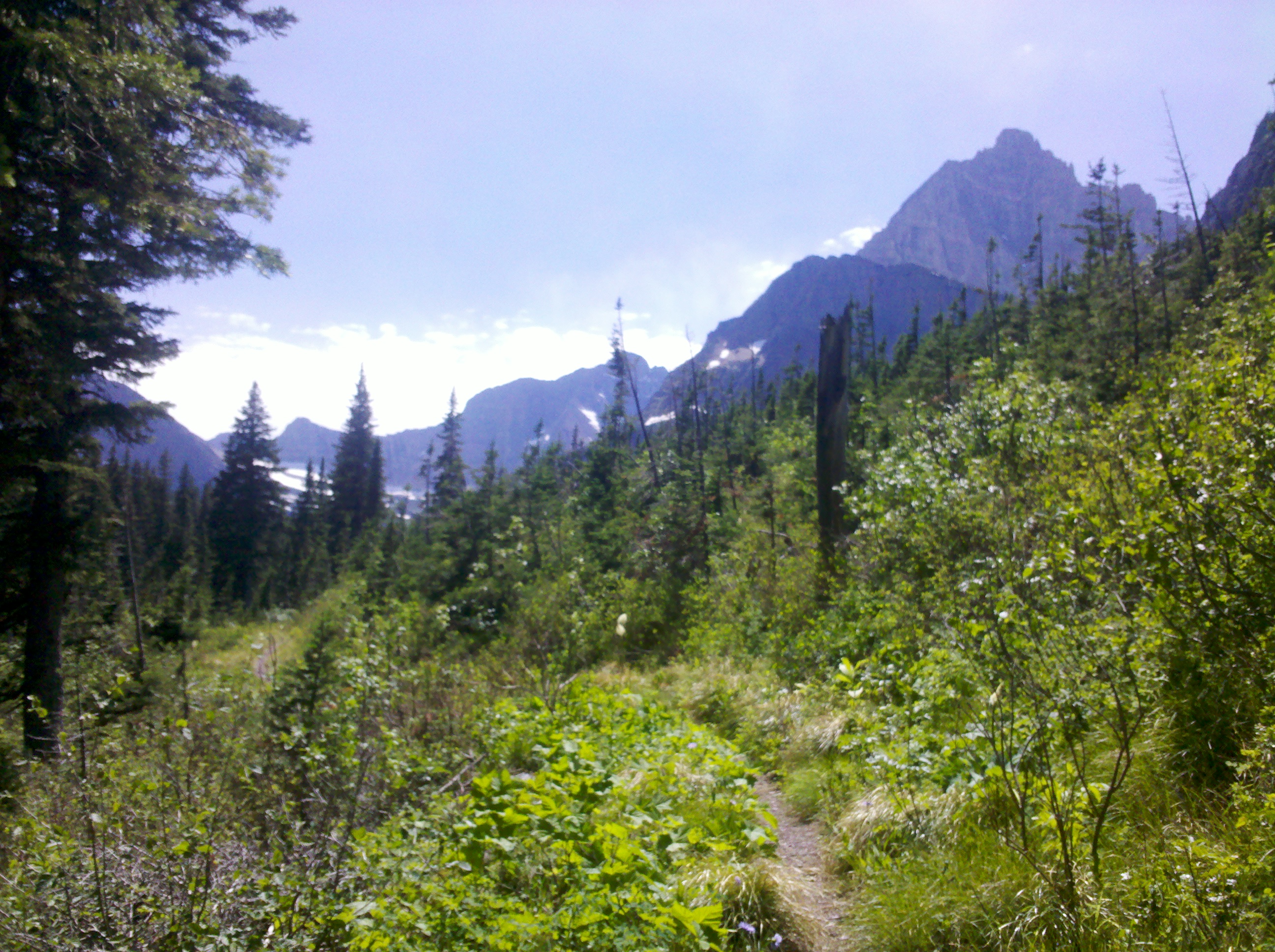
I love hiking through miles of open scenery
I said goodbye to the bunch and hiked off down the road to the start of the next range I would hike. This had a great feel, my legs sped along. It was another ten or so miles of road walking, which was interrupted by a local running out her house to give me an ice cream. I could get used to these surprises. I found the forestry trail that would lead onto my next footpath. The target I picked for the night was a lake. I was glad not to be stopping in a town for a day off. Here is a rough equation, if I pay $70 for a motel room the night I get into town, $20 on breakfast, $20 on lunch, $35 on dinner, $70 more for the final night’s sleep then I’ve spent $215 for the 24 hour town stop as a minimum. A stop like that every 150miles on a trail like the CDT would be around an extra $4000. To hike a bit further and have a better chance of finishing my hike, more like it. I carried on climbing the 4×4 track until I passed a sign banning bikes and cars, from here it deteriorated significantly until I was smashing through brush knowing I must have taken a wrong branch earlier. But in words echoed eternally through the minds of many a hiker ‘Always push forwards’, and so I did.
Eventually I pushed far forwards enough to break through to the trail I was supposed to be on. As the sun began to dip I pitched my tent beside a lake, ate one of my new tasty meals, and zipped into my tent to sleep. I felt a little lonely that night knowing everybody else would be back in the town bowling and drinking the night away. It was also a strangely spooky place, I had bad vibes from it and didn’t sleep easy. It looked so idyllic when I had arrived, but as I lay I imagined this grassy constriction being visited by larger creatures in the night. But enough, tomorrow, I would start hiking big miles in a way I didn’t know was possible. It was time to let loose.
On a Sunday morning we rose up and went to the roadside to hitch back up to the pass. It was quiet, with the odd car heading to church I guessed. Not many rides going for three people. It took an hour before a van pulled over and a gent told us to hop in. Dropping us at the pass we climbed straight up, thousands of feet til the vistas opened up. A beautiful day. Today each of us went at our own pace, with me out ahead. I sat on a rock for a while. Now, you might guess I’m about to paint a perfect picture, taking in scenery before me. But it is on this rock I left my first pair of sunglasses. A pair I bought from the gas station for $19.99, and honestly, I liked them. But didn’t like them enough to hike back 5 miles. Sod it, I would hike without. And how painful it proved on the eyes. I learned from this to make it so I couldn’t possibly lose another pair again, by using a bit of cord around the neck. I would have mocked it as a child but my how I now understood why people with glasses do it.
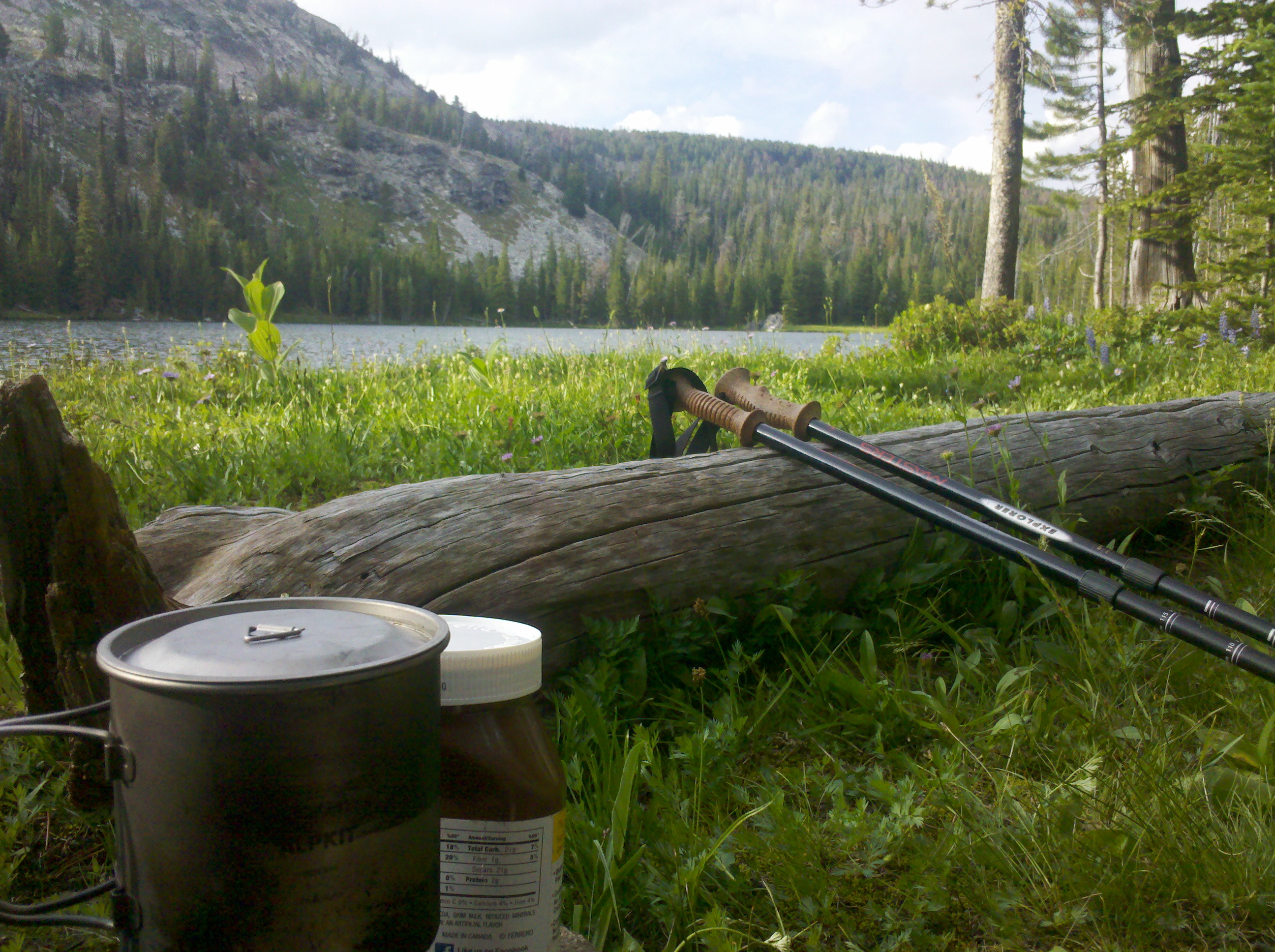
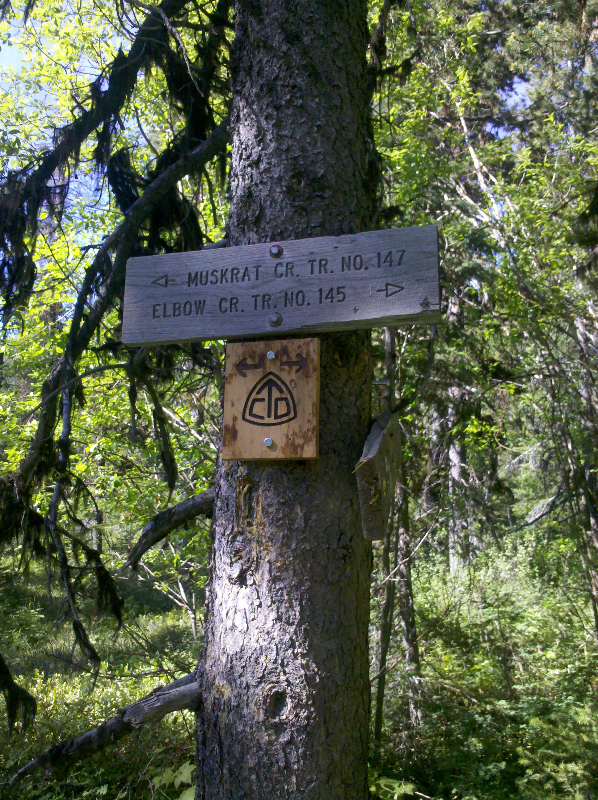
On we walked until the next pass over the road. Early in the day I sat and read the map waiting for the others. The maps- Now, over the years of people attempting to hike this trail a man called Jonathan Ley decided to make a downloadable version of them designed for A4 letterhead paper which we all have a printer for. On these map are annotated details, thinks like ‘spring located here’ which, when mainly following a ridgeline, is mighty handy to know and helps plan where your next water source is. Or contact details for local Motel owners willing to give a ride to the pass and back. At this particular point on the map where I sat the annotation said ‘this is the only water source for the next 18 miles’. I’ll be honest – I cant remember if that’s exactly what it said, but know it well, I filled up to capacity my 4 litres of water and let the others know.
As we walked I also told Oldschool and Kathleen that after the next town I planned on picking up the pace and trying for some bigger days. As my aspiration was growing but bank account was not. We finished the day camped at the roadside below the next climb. The next day would be one to remember.
At a time of year when one expects cool temperatures, Helena Montana was experiencing a heatwave. Up the mountain it was no different. It was scalding heat. Missing sunglasses was tolerable, but this heat was not. Combined with the heat was a 24 mile dirt roller coaster with no source of water, which doesn’t sound bad but it was. Lots of up and down, for mile after mile. With little in the way of respite. The issue with the continental divide is it tries to follow a dividing ridgeline. My dehydration was so bad my tongue would stick to which ever part of my mouth it touched, and pull off painfully when I tried to move it. Salt was crystallising all over my body and face. Down at Helena it was 38c (100f) and while it was a little cooler a couple of thousand feet up, it was no joke. We were aiming at a dot on the map marked as a spring. The hours ground by painfully. This was probably the worst dehydration I had ever experienced. Dust kicked off the path with every step. I was a long way past sweating, there was no water left to sweat out. When the spring came in to site it was joyous. I was ahead of the others and walked towards it confident in my saviour of a small puddle of water. Fenced off to prevent cattle contaminating it I climbed over and approached the boxed off cool water, cool fresh clean water, an ice cold beverage of mountain spring water which was… full of dead rodents. My heart sank. The lid to the spring was ajar, and inside many dead rodent, possibly squirrel like, but in their state, hard to make out. It was torture, the choice between this contaminated water, or dehydration. The others arrive. I showed both of them. Even with a filter it wasn’t a prospect I would look forwards to.
The next spring on the map was 5 mile further. After for how far we had walked, that isn’t far. But after a day of being dried out slowly by the burning sun. It was. Sometimes luck in life is low, but for us it changed so quickly. A couple on a quad bike in the distance were passing, we waved at them and they came over. Explaining our situation we asked if they had any water. They said no. But, the husband reaches over to the cooler box on the back of the quad bike. He pulls out an ice covered bottle of Cocacola. ‘We do have these though, and some fresh fruit on the ice’. If ever there has been a commercial worthy moment on the face of this planet, this was the moment. The planets had aligned. I took the bottle….. Slowly unscrewed the cap. Paused, the condensation ran down the side onto my leathered hand. I held it up into the light to experience the translucent syrup in all its glory… turned sideways… and poured. At that moment, no one had ever experienced a more perfect silhouette of a man drinking ice cold heaven. Sounds good huh? In reality flies were buzzing around driving me insane and the Cola almost felt like a burning cold, I gasped for breathe and drank again. Man it was good. The couple gave us a mobile number and an invitation to their house when we made it to the pass for showers, food and laundry. What a day.
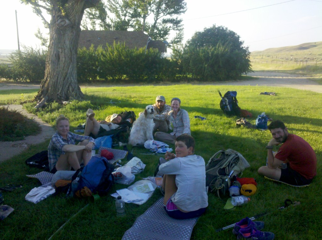
Feeling like a million dollars we hiked on into the evening. It started raining. Then came the lighting. I watched from the edge of the tree line, seeing it cracking across the sky and striking the field before me. The flat land between me and the next car ride. That was enough for the day. We went back into the trees a little way and pitched up for the night. Flashes bringing full illumination to the inside of my tent before reverting to blackness. I sipped a small amount of Black Velvet Whisky I had in my pack and went to sleep. This was a pass day, Oldschool was up in the dark and ready to go. These are the days you want to get into town early, enjoy civilisation to the max then get out by evening. We hiked on through down beautiful lanes the last 10 miles. Arriving at the pass we stuck thumbs out and moments later were on the way down again. This time riding in a pickup with a man shocked about the news of Caitlyn Jenner. Its funny five how years on I still remember that detail. Down in the town Oldschool told us he was taking some time off the trail, it had been a rough few days. The trail was living up to reputation. I don’t think it’s the trail itself that is hard, but the massive variation of extremes over such a long distance as a body is pushed hard. In the town, Kathleen rang the number we had and the wife came down with ice cold spring water from their home for us. Man, the simple things in life. We went to our new friends house, showered, had our clothes washed then headed back to the supermarket to resupply and go on. By this time over 400 miles into the hike and half of my intended hike I thought was possible. On the way over to the main road we passed a bunch of kids selling fresh lemonade, which in the heat couldn’t be more welcome.
Maybe this whole hike is just about making cold drinks taste better than ever.
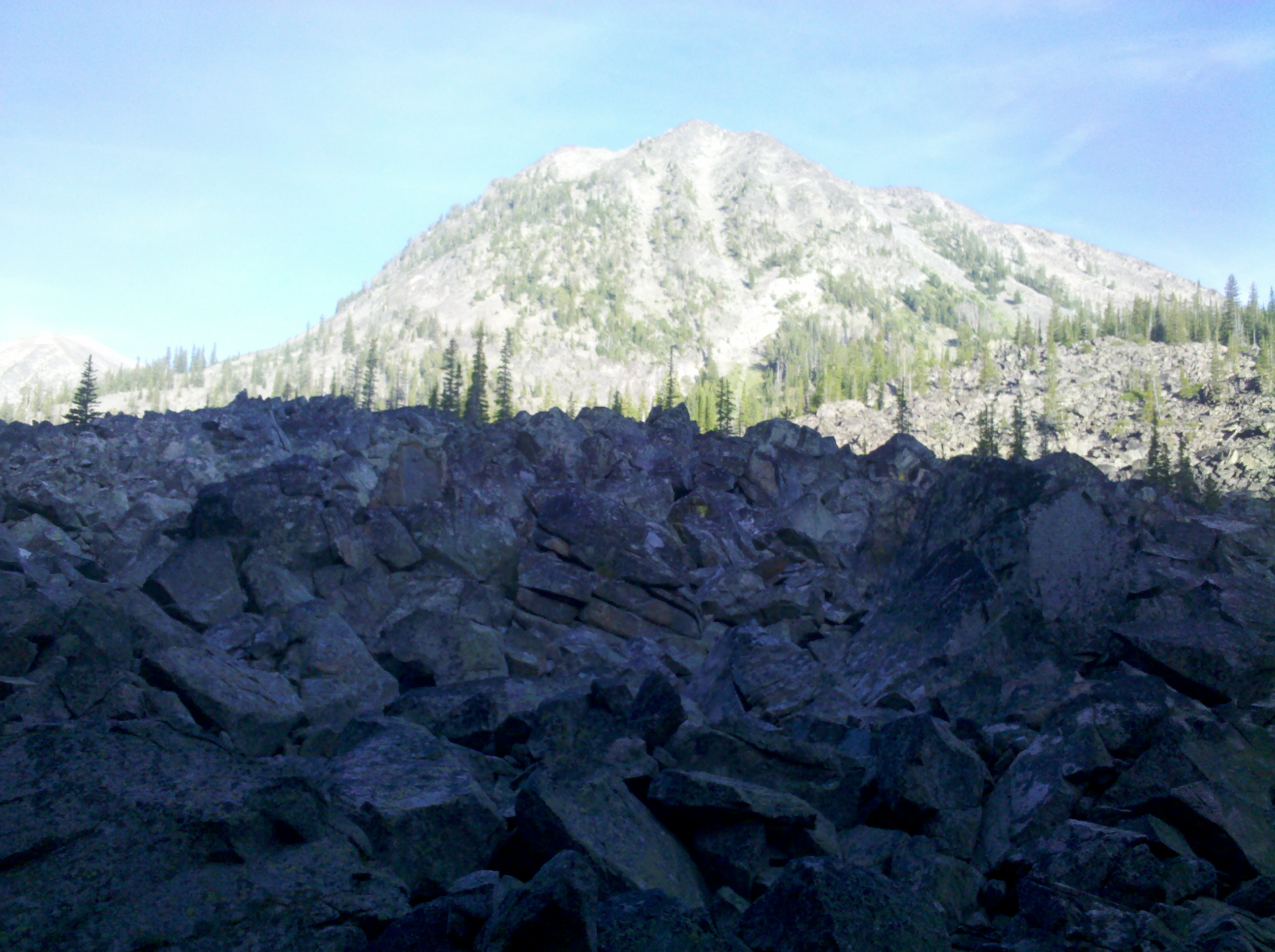
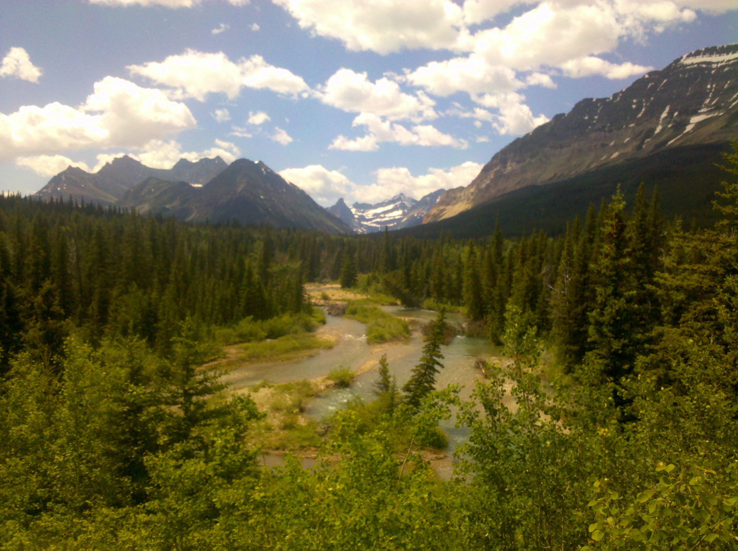
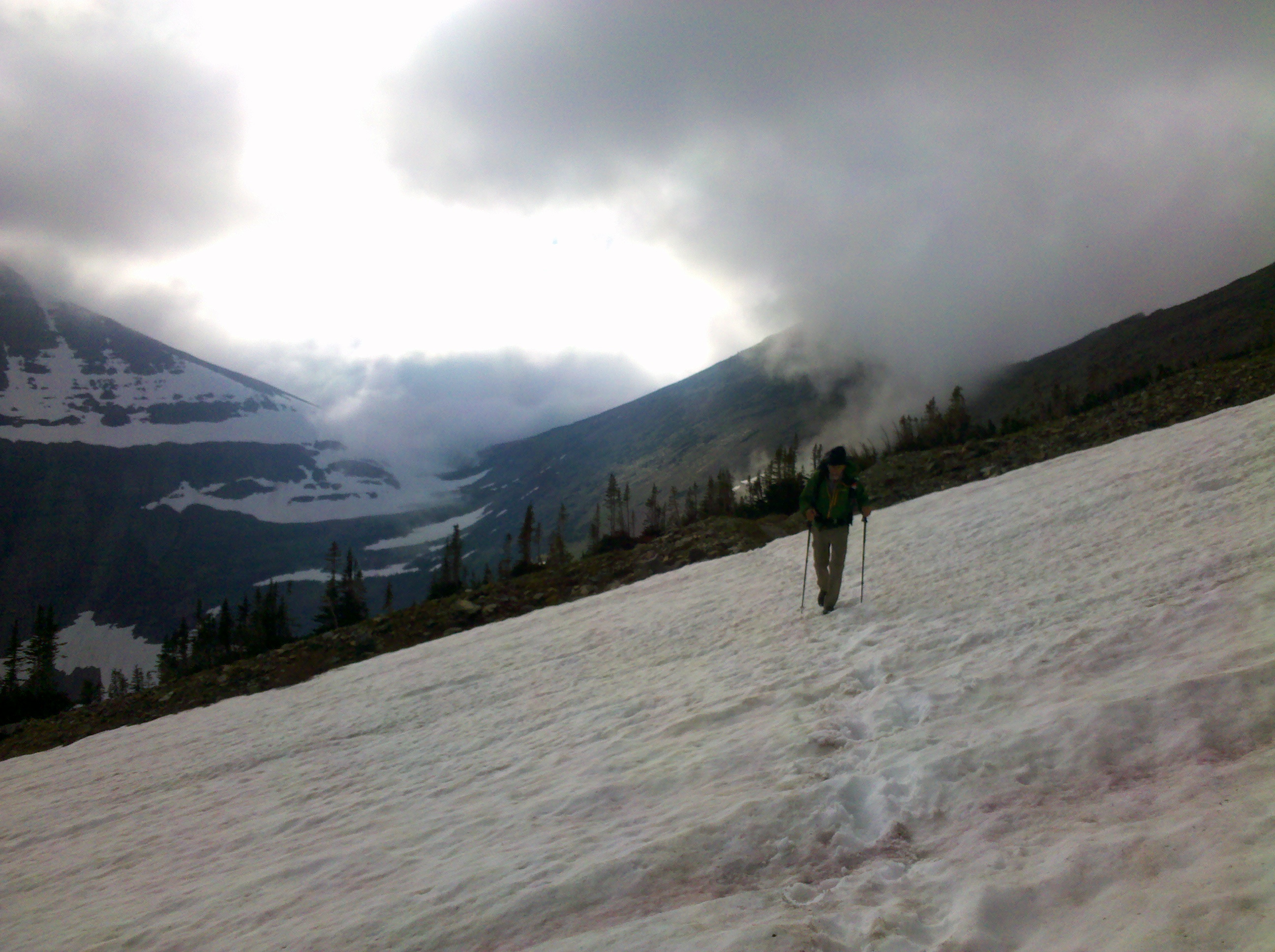
Back in the Hostel in East Glacier I was having a day 4 off. I was sat around other hikers and being given useful but not useful unconfirmed facts like ‘the Bob’ has the highest population density of Grizzly Bears anywhere in the lower 48 states. But this wasn’t the concern, the concern was that now the easy part was over, the real trail begins, the reason the CDT had its reputation. The Bob Marshall Wilderness section covers approximately 200miles of trail. For hikers that planned it, you can mail a package to a ranch at around mile 160 that will collect if from a town and hold it for a fee, but I hadn’t planned thus didn’t have the luxury. I would have to carry enough food for 200miles. 200miles, over 8 days that would be 25 miles a day. Food for 8 days. in hydrated food around 2kilo a day (the weight of a 4500kcal ration pack, which i wouldn’t be using, but it was a good point of reference) or 16 kilos for the 8 days. 33lbs of food. That didn’t seem reasonable. I needed to do more miles. Having just done that kind of mileage through glacier park at over 30 miles per day, it seemed doable. I would aim for 6 days through ‘The Bob’. 33miles per day.
This seemed like a fun kind of challenge, a bet which had me pitting myself against nature. The weight of my bag when packed was heavy, but I streamlined and scraped away every possible gram. The clothes I arrived with, gone to the hiker box, the extra wrapping from food, gone, and just enough fuel to get to the next town. Oldschool asked what I planned on doing about resupply and after telling him my plan we agreed to hike together. At this early point I was already thinking beyond the first 800 miles I set myself the challenge of hiking. My intended daily mileage had just doubled from 18 per day to 33. Early in the morning while the others in the hostel slept we crept out the door and headed for the trail. Inside the National park the trails are well marked and mostly maintained. Outside, the maintenance drops. It gets wilder.
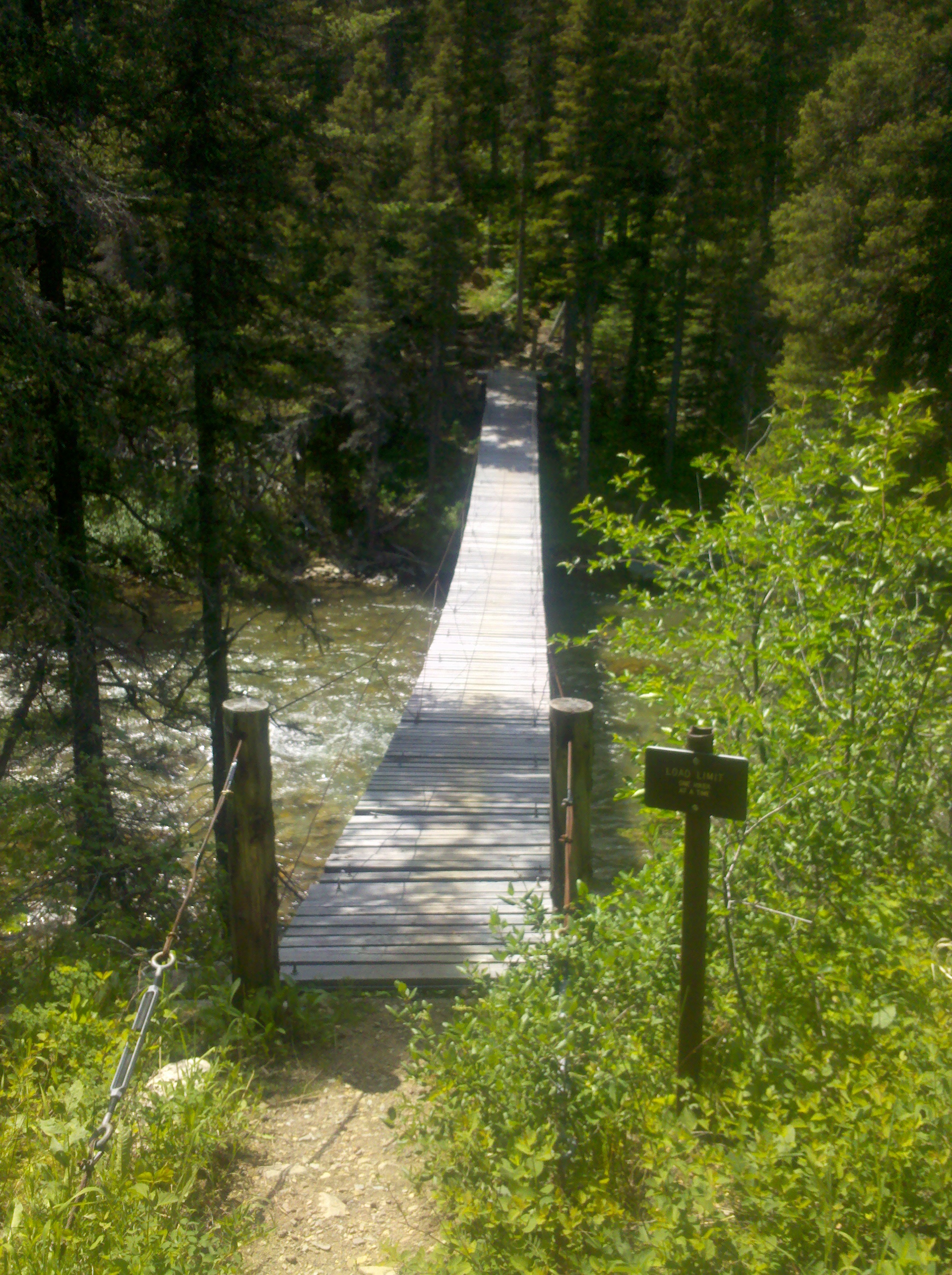
The day off allowed my feet to recover fully and we were motoring along at a steady pace, we picked a crossing over the highway as our place to have a break, 15 to 20 miles down the way. Marked with a large spire memorial to Theodore Roosevelt. Here we met a small group of hikers already having lunch that set off the evening prior. We hiked together a few miles before one in their numbers decided she wanted to cross the bob faster and so joined us. 185 miles to go. Hotsprings, our new hiker called herself, was also aiming to hike the divide and liked the slightly faster pace we were at. The first few miles were pleasant, after which, for maybe 10 miles we crossed the same river maybe 20-30 times. Each time the shock of icey water stabbing into our feet. The crossings were interspersed with meadows that were alive with birds and fresh air. Towards the end of the first day we chanced upon a cabin, a trail worker had taken up residence in ready to start clearing downed trees from the winter. I enjoyed chatting with him but as the sun began to fade we headed off to find a camp of our own. When travelling in bear country there are three options for camping and food storage. First is a bear canister, a great way to store food, screw the lid on, place it a small way from your tent and your done. Simple, but it takes up space and adds a kilo or two to your pack. Second is a bear bag and cord for hanging it in a tree, my chosen method. Its light, cheap, sometimes easy. What they don’t mention is when it is darkening, and you try to find a tree high enough and with a limb wide enough to be out of reach of a bear, your options are not plentiful and often non existent, taking precious time you wish you were off your feet. Time after time I chucked a small stick with my cord attached high into the tree, only for it not to clear the branch. Or get nervous about how close to the tree the bag was, or worry about the bear knocking the cord from the small tree it was tied off to. After what felt like an hour of attempted hanging, I crawled into my sleeping bag and started dreaming of a bear running off with my food.
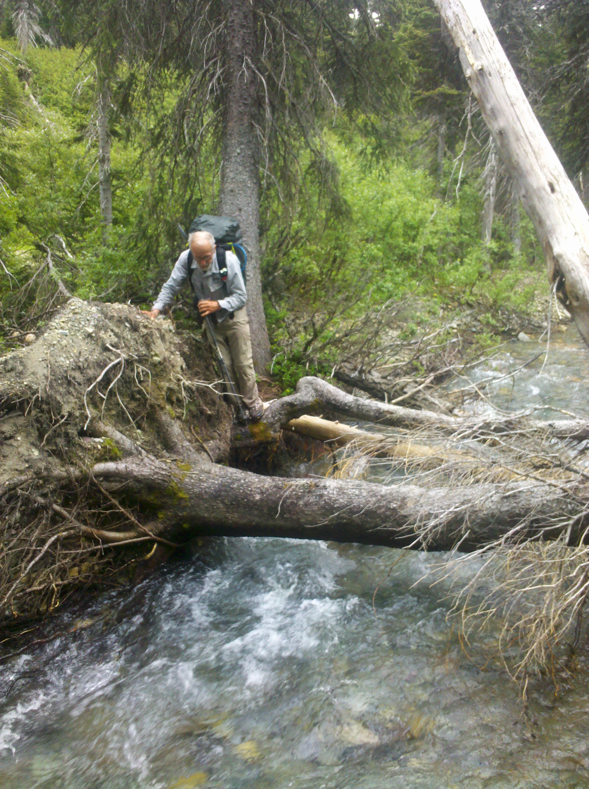
We woke in the morning and hiked on, miles and miles up and down valleys twisting and winding, clambering over downed trees, deciding which route to take. We started hiking through an area of burned forest, which is pretty at first, but gets tiring and provides little shade from a burning sun. I still had my ice axe and crampons in pack just in case but in the baking heat it felt ridiculous carrying these useless lumps of metal. This day was mainly uneventful, coffee breaks, hiking, river crossings until I came across a mobile phone off in the grass to the side of the path, still charged but without its owner. Towards the end of the day while still in the burn area, we opted to camp on a small island in the middle of a river crossing giving us a safe distance from potential falling trees. I wonder what could have happened to the owner. Likely being a thru hiker I could post it on a hiker forum when we get out. Tonight we used the third option of food storage and least advised, sleeping with it in the tent.
In the morning we carried on through the burn and as the valley narrowed we came to what appeared to be an abandoned ranger station, except, there was a tent on the porch, it wasn’t a reach to imagine this tent with a hiker on the trail in front of us could have lost a mobile being used for navigation. ‘Hello!!’ I shout expectantly, hoping not to startle. The response came back and a minute later there stood Kathleen, I discovered she had entered the wilderness a few days before us hiking with a couple of friends, lost her phone, ran back to find it saying she would catch up in a day and walking miles back and not finding it, and not sure which way her friends went, opted to stay put with an educated guess more people will pass. Extremely happy her phone was back she opted to join us and we shared a little food to help top her supplies up. Not a lot, but a token of help. Now we were four. She packed up and our procession carried on. We climbed up and up to Switchback Pass, legend has it there are 99 switchbacks (zigzags to make the ascent easier). I’ll be honest, some of the switchbacks went uphill on the downhills and were a little infuriating when you hike a half mile and finish 20 yards from where you started. I was hungry by the bottom, the pointless turns ground at me as I imagined how far down the trail I could have been otherwise. Five miles on was a station where we had a small fire and washed in the river. It marked the next camp and the start of a bad habit sleeping with food in the tent. I told myself it was reasonably safe, with each days food being divided into ziplock bags and then packing into a rolled up drybag it was reasonably odour proof. Maybe the bears will be offended by my smell before they ever smell the food.
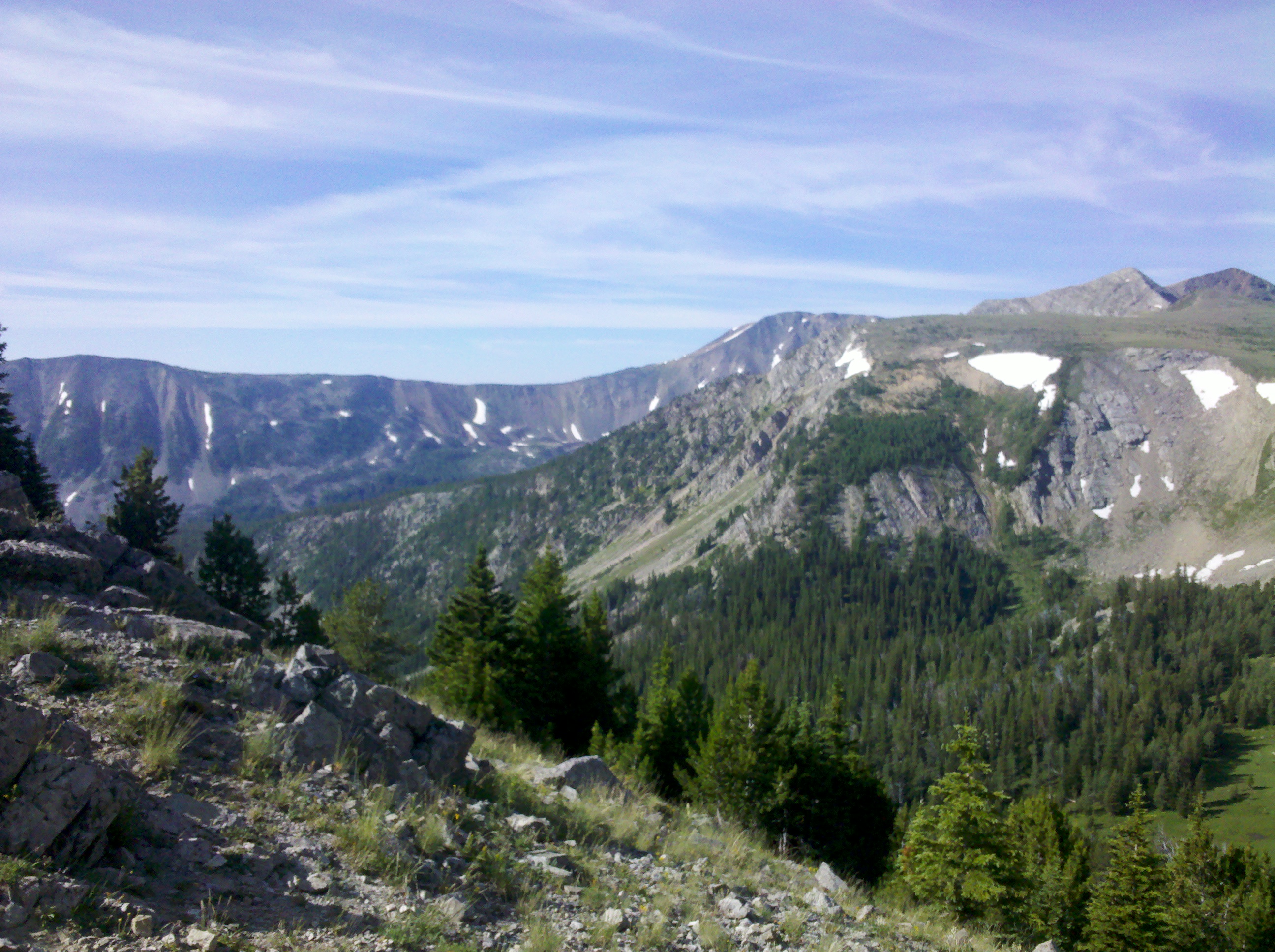
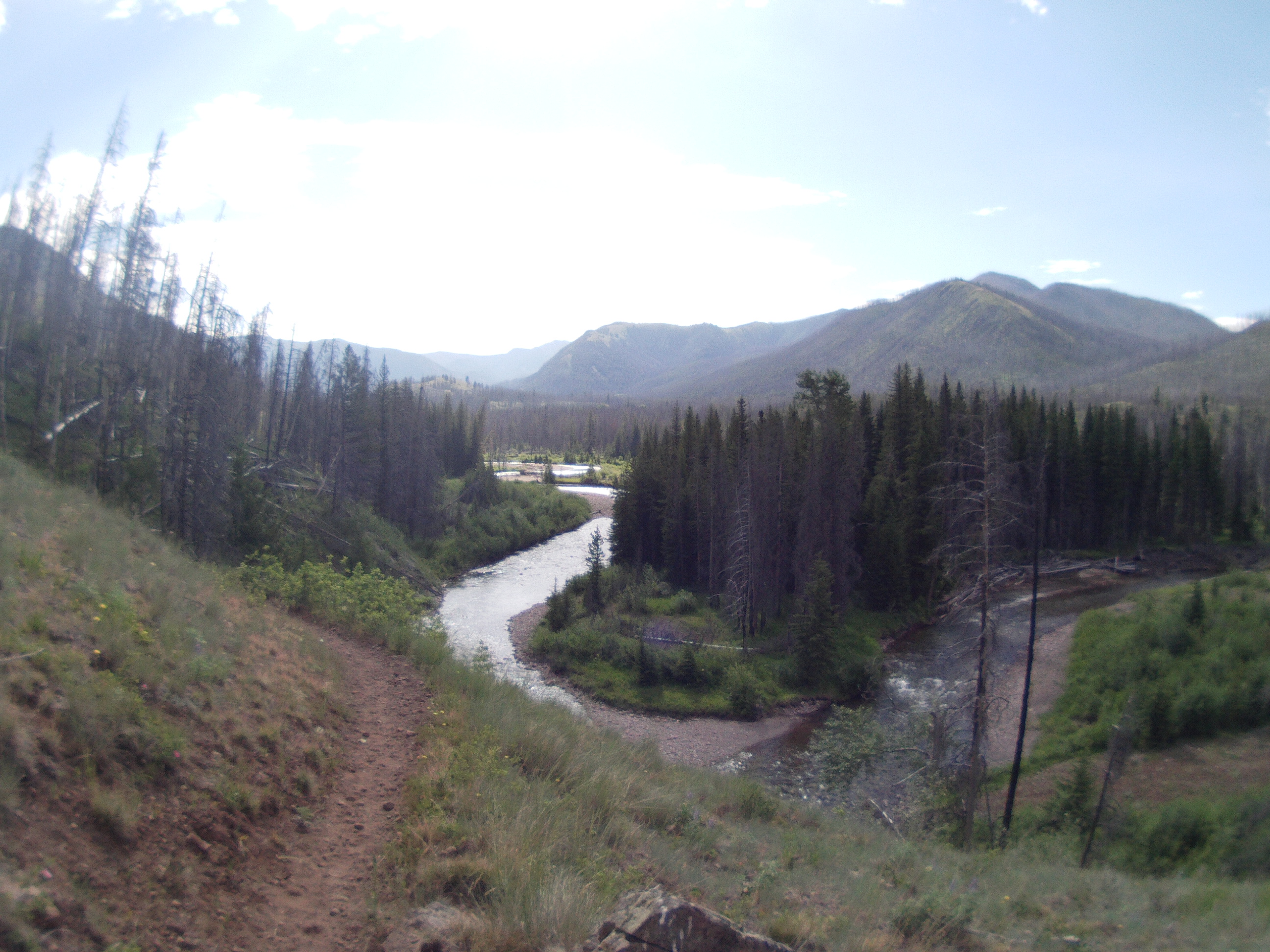
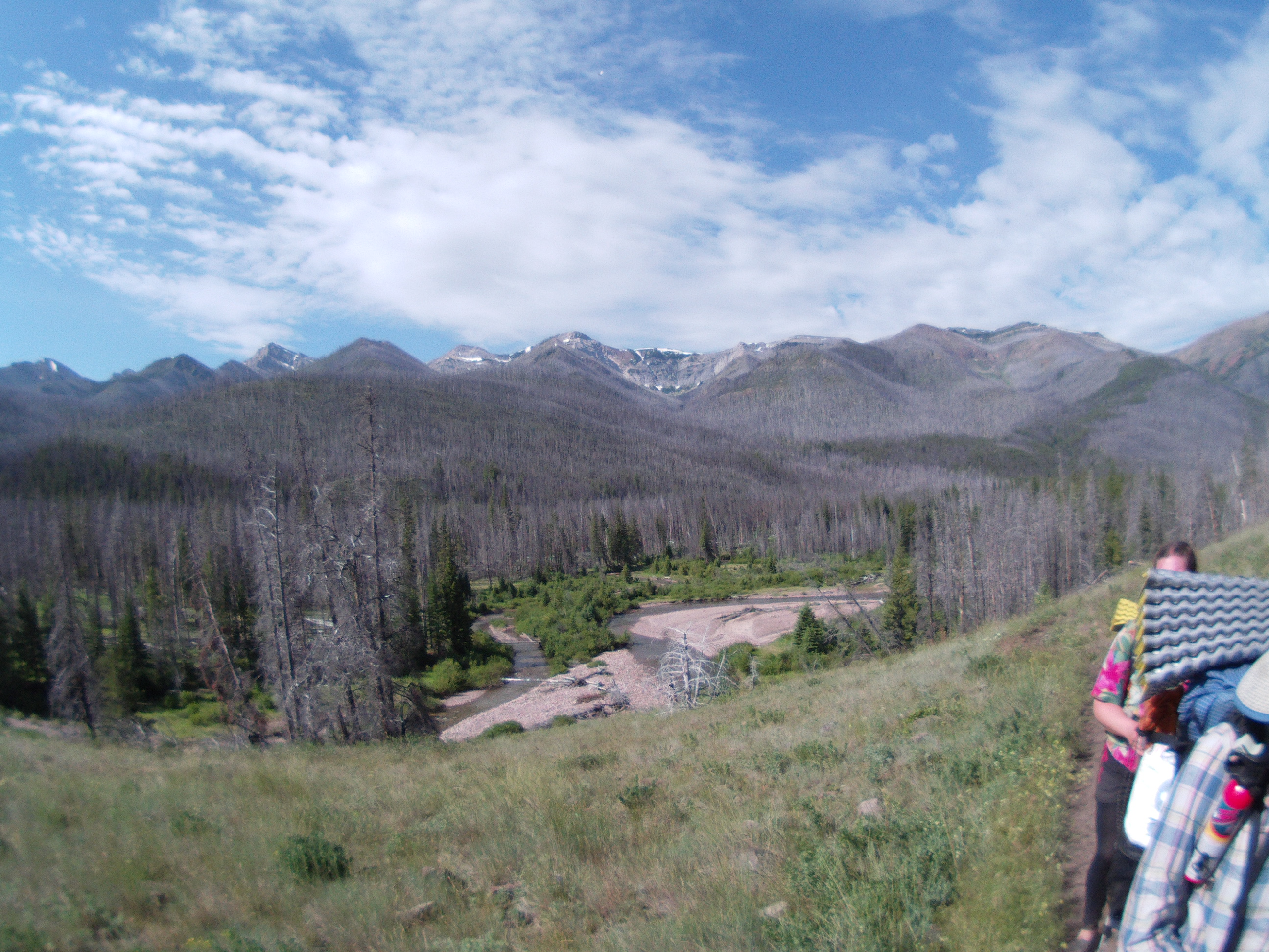
I hadn’t been paying any attention to mileage too much, just knowing walking dawn till dusk would be enough to fulfil the feat. I did notice hiking in a bigger crowd of people, the pace slows significantly. I kept walking ahead on my own, then relaxing and waiting for the others to catch up. I enjoyed this and feel it gave a lot more space to enjoy the wilderness at its own level but still be social. The next day we climbed a pass and stopped by a lake for lunch. I went ahead and dropped over to the Chinese Wall, a spectacular 12 mile cliff with lush green meadow at its foot. Lots of wild cat prints make me keep an eye over my shoulder. I waited for the others at the other end then we dropped down the valley, down and down thousands of feet as we exited the wilderness area. Camping beside the river I stretched out, feeling it a little in my back. We were 10 miles short of the 160mile ranch.
This was day five and right on track we arrived near the ranch mid day. Meaning if we kept pace by tomorrow evening we would be in a town eating good food. The potato, chocolate, and oats diet gets a bit bland, and even the odd bite of beef jerky still leaves me feeling empty. The small forest carpark we spilled out onto would be the end of the hike for many, but we start climbing the next valley up and up. We also left behind Hotsprings, who was having foot problems and I would bet was relieved to be somewhere she could stop. Wishing I had something tasty to eat consumed a lot of my thought process as the climb carried on. This section I didn’t take too many photos, but I had fun, As the light dulled we pitched up and were done, safe in the knowledge the next day would have less than 25miles. By mid afternoon my shoulders could take off the pack.
Day Six- the heat, Oh the unrelenting heat, and the pointless ups and downs, who made this trail? Why are we going over every single bump? This time Oldschool was ahead after getting up earlier, leaving me and Kathleen to catch up the rest of the day, we felt sure he would be around the next corner at every bend but somehow was burning the miles quicker than we could. We arrived at the pass and stuck our thumbs out. Within a few minutes a ride drove past, then on noting us drove past again, then finally on the return stopped. ‘I was trying to decide if I should or not?’ we hopped in. It was a student who was pretty high and proudly blasting Pulp through the stereo when he realised I was British. Down we sped in the town. Oldschool was already waiting and relaxing. I went into the gas station and bought a large Cola, drinking it in seconds. For some reason the water had started tasting bland in the mountains. Every sip I had was sucked through a micro filter screwed onto the water bottle, and it was effort. But the CocaCola flowed free! I was keen to get resupplied and going back to the pass, but Oldschool was pretty burned. We sorted a motel room between the three of us for around 30 dollars, I took the floor. I hadn’t planned on any town stops after East Glacier, my budget was a shoe string. It felt good knowing the longest section of hiking was over though. No other section was 200 miles.
I was looking for something to do once upon a time and pulled out a book called the ‘Worlds Greatest Adventure Treks’. In it a large series of treks around the world for those who’s minds would wander. I learned within a hour or so of reading that hiking has a season in most places, dictated by cold, heat and rain. In the time slot coming up for me was the CDT, most hikers were already on trail walking North from the Mexican border, but the book hinted that at the start of June, one or two battle hardened warriors with nothing to live for have the gall to hike South. I could be that guy!
For those unaware, the Continental Divide Trail is a trail that runs from the Mexican Border approximately 3000 miles to Canada, following the water divide of the Rockies. In many places, one side of the path drains to the Pacific, the other side to the Atlantic. It is recommended for hardened vets of the hiking world. I remember being told a comparison to the other USA long trails while on it. The Appalachian trail is like a kitten, gentle, places you can order fast food to the trail and a good many people to hike with. The Pacific Crest trail like a grown cat, fun to pet but can bite and scratch once in a while. But ‘the Divide’, it’s a raging mountain lion you’re holding by the ears’. I do wonder how hard it really is in comparison to the others, having no time on them. But my experience was the best of my life
It started a month or so before, reading up on this trail, there were things called resupply packages people would prepare months in advance, I didn’t have time to sort these. My food preparations were made in Seattle to cover me for the first 4 days mainly consisting of powdered potato and M&Ms. The maps, I was too late to order good ones. I printed off 800 miles of trail on my computer on letter sized paper that seemed to make the bulk of my hiking pack. The low print quality wasn’t great, but I knew there had to be real maps out around the national parks so I wasn’t too concerned.
I bought a two season sleeping bag with the thought I can wear extra clothes if I am cold. A pair of Merrell Moab Ventilator shoes, reputedly great for hiking but the bane of my life most the time I wore them, a titanium cup and spirit stove for cooking, and a new waterproof top. The pack all in weighed non too much. I had a spare pair of socks, a warm top, and lots of micropore tape to fix myself. I also had an adventure time hat that looked befitting for any budding angler.
I arrived in Glacier Park Ready but feeling kind of stupid. I booked into a hostel for a few days to get used to the area and get my bearings. I didn’t want to push to hard in these first days, a few months before I had a herniated disc in my back so painful I couldn’t take one step forwards without pain shooting through my butt and down my leg. I accepted coming out here was a risk and if on day one I had to abandon the trip, at least it would have been a scenic break. I met a guy called Axle, who had just ran a half marathon nearby and we decided to do a few hikes together. It was nice and chilled hiking in the overpowering pine forests. It felt high on the resin smell. After a few days I decided it was time to start. I picked up a permit and stuck my thumb out at the roadside to hitch to the trailhead. Committed, hiked in.
The first day was 20miles. Not a big target, but a good first day. I passed most of it clapping my hands and shouting ‘Hey Bear’ to ward away fear until the sun began to set. Climbing over a pass as the sun began to set I raced down thinking of making camp before nightfall. Then, it happened… what my parents told me would be the death of me weeks before, the fear I said would not happen. In a clearing, on the middle of the trail Beelzebub incarnate, a monstrous Grizzly Bear. I felt feeble and small. The canister of bear spray i bought in the town seemed pointless. I wondered how quickly it would charge through the red mist. How quickly it would tear though my skin to the bone and chuck me about. How my family would read the headline the next day, that was it over. Gone.
The bear did not charge, but after a few seconds or minutes, he turned and walked off into the forest and quiet filled the air. Just like that, most the fear I had felt vanished. I was buzzing. A grizzly bear! I jogged along silent but ecstatic. The last mile to camp passed fast, arriving at the camp there were others. I told them of the Grizzly bear encounter. ‘Your first one hey?’ came the response.
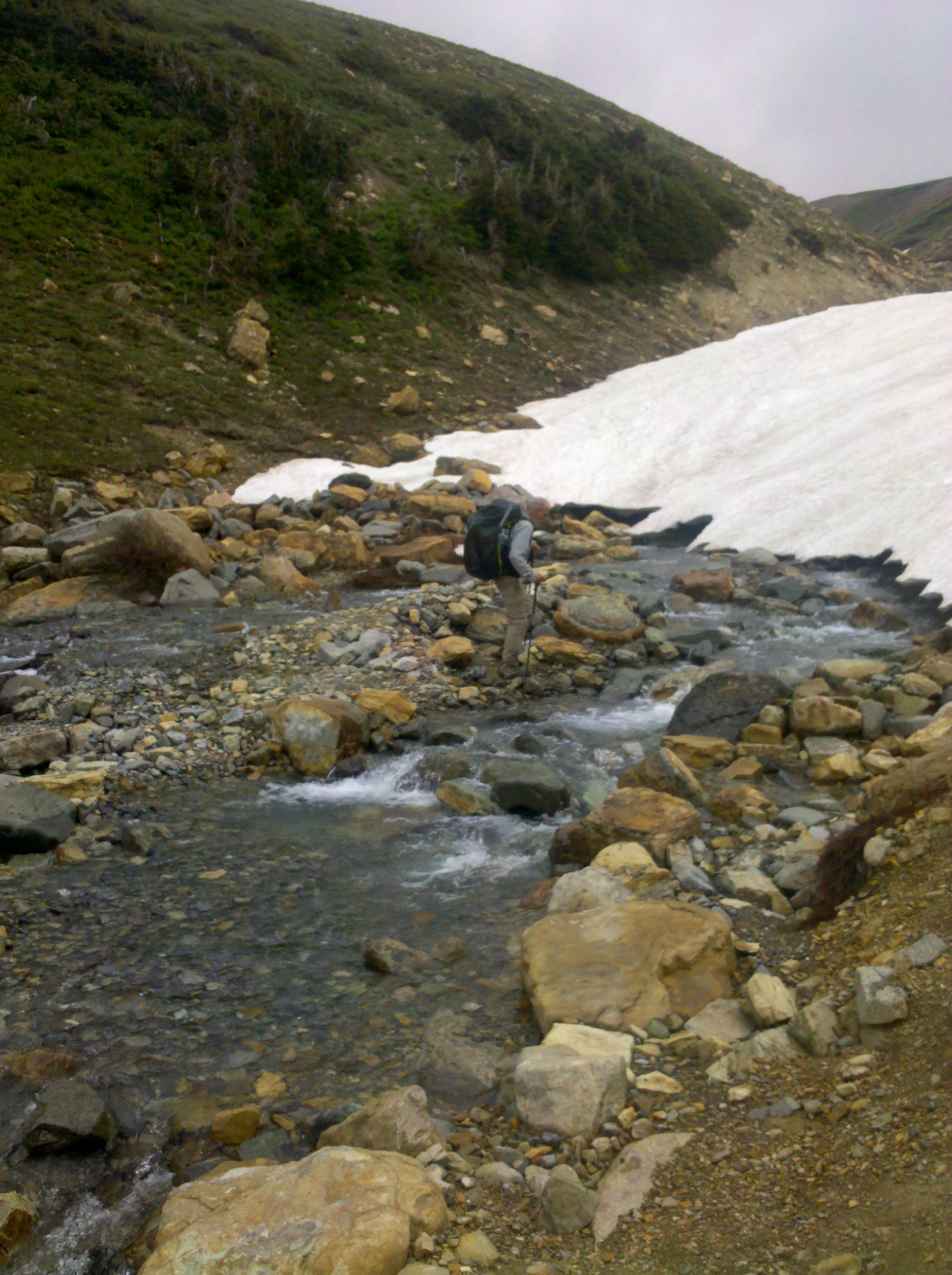
I woke the next morning in the dark, made a coffee then rushed to catch up with a hiker called Oldschool. A precise man with a love of the outdoors. He was also hiking the Divide and we agreed to hike together the next days, I was feeling relieved to have someone to hike with while in grizzly country. We hiked into St Marys and grabbed a hot drink from the hotel before heading out into the rain and thunder. Call it reckless, most hikers will stay indoors for lighting, but to hike thousands of miles in the same season, the safety margin is cut. We gained elevation, up into a whiteout into the freezing cold, and away from comfort. Early in the season snow still covers the trails and as we came up through the alpine flowers it soon became hard to navigate. On a steep hillside, the path disappeared into white hardened snow. A quick check of our general direction on the map, We put on crampons, brought out the ice axes and started across. It felt like hours and thunder rumbled overhead. I remembered reading once upon a time snow is a poor conductor of lighting and I kept telling myself this. We climbed quickly to the top of the pass and descended just as quick away from the rumbling monsters. The walk down was long but at the end of this day camp would be welcome and the sooner the better. We arrived at camp in the dark. Pitched up on Oldschools pitch (I was ahead of my permit) and slept. We agreed it would be good to have another early start. Each days rations I packed into individual ziplock bags, trying to vary the chocolate, potato and what ever treats I had for the day to keep it exciting. I liked this system of organisation. the food lived in a dry sack i would hang up the trees at night.
The next day was wet. The paths overgrown, fresh green vegetation soaking me, like walking through a river of ice. It was painful, but liberating to be out. The miles ground by with the underside of my feet aching. Each stop I would take off the shoes and socks and let them breathe. Full well knowing the depression of putting back on wet sock in ten minutes would be miserable. For lunch the small stove would come out and into the cup would go powdered potato and a few sprinkles of bacon bits for flavour. Another pass to climb, followed by a long descent, a short break then another climb, almost hypnotic, all thoughts leave and I keep walking. Towards the evening we come across a Moose, I had never really considered what to do if there was a Moose, so I stood bemused. Like most wildlife, it weighed me and Oldschool up, paused, and walked away. It seemed to move the whole forest around it as it forced with ease through the trees. We reached camp, pitched up and went to sleep.
I woke in the night to the sound of crushing and thumping, what could be making this sound? The nylon skin keeping me from the outside felt thin. I slept uneasy. I asked Oldschool in the morning if he heard it. To which he replied it is probably a bear, they sound like a drunk man stumbling about when they forage. We packed up our small camp and carried on upwards. Today there would be two passes. Walking over compacted snow we gained height in a large bowl aiming for where we knew our pass was. I was loving the alpine trees and spaces. I raced ahead and waited at the top of the pass for my friend to catch up. We knew in the next valley was a small store next to Two Medicine lake. A few hours hiking brought us to a welcoming owner who was in awe of what we were attempting, we received free breakfast wraps, as many as we could eat, and free coffee. I wasn’t expecting this but was told it’s know as trail magic. People who see what you’re attempting and want to help. We set off replenished with a final short pass to climb and from the top could almost see the hostel a few miles off. This was the end of the first leg. Glacier complete. It felt easy. Three days and the first hundred miles in. I was sore but happy, my back was holding up and I would have a beer to celebrate at the hostel. I booked in, did my laundry the next day and studied the next section of hiking so I knew how much food to buy from the small store in town.
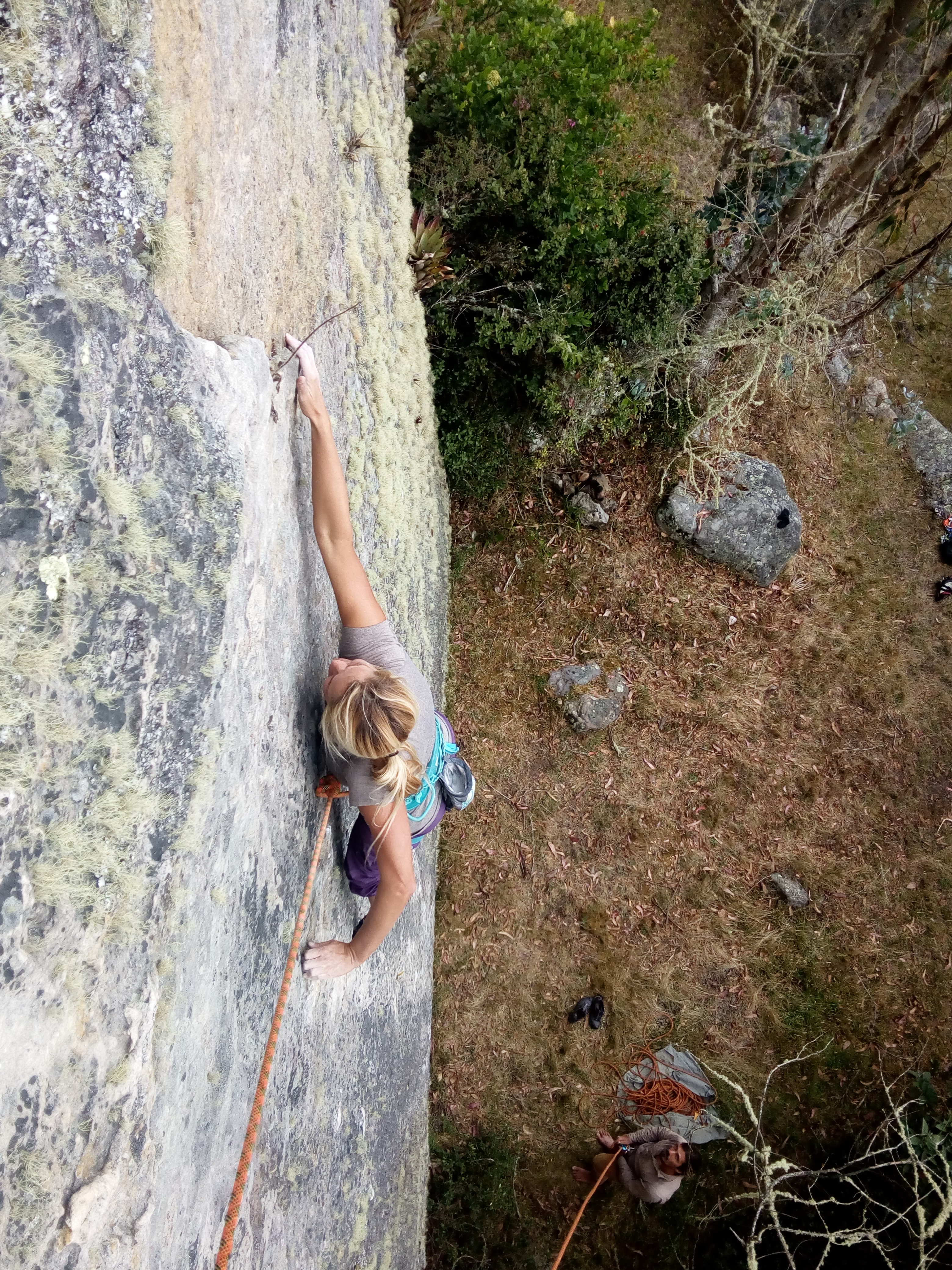
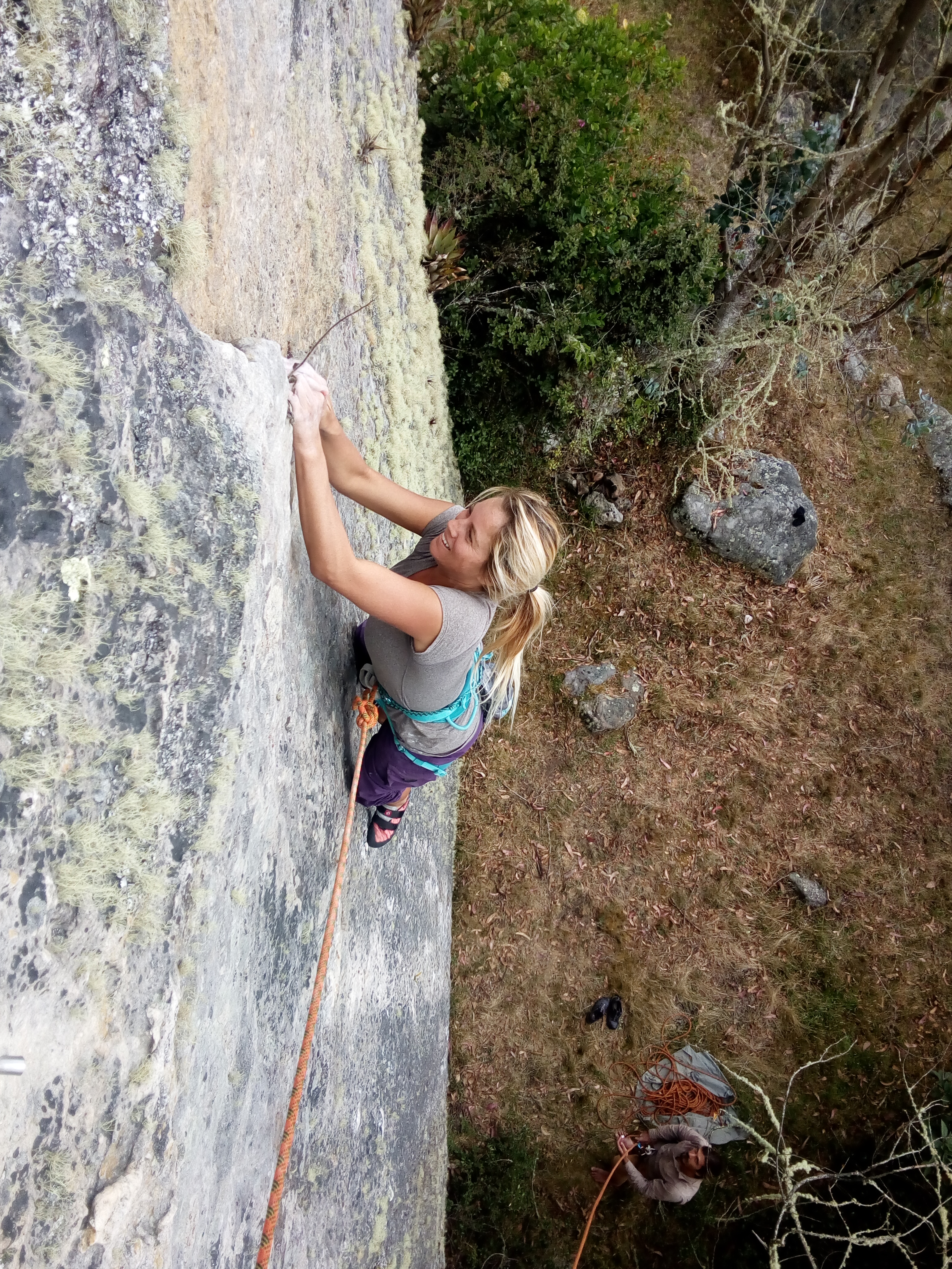
Once upon a time when I started this trip I was like a lone wolf, bounding across the meadows and mountains.. Then I met Karli, and we were two misfit wolves driving across the desert and mountains. Then Chris and Nicole came along, and we were a pack of wolves looking for bad ass climbs….
Knowing the Suesca main crag would be busy We decided to concentrate a weekend on the Valle De Los Halcones. According to the guidebook the land was private and all the bolts on the area had been cut off by the land owner due to climbers making a mess. Fortunately for us an American and another English lad, Jason and Sam, were living in Suesca and said we could park at their house right on the edge of the valley and they knew the land owners. They invited us to talk to them and after a brief few minutes of talking Chris had made it clear we would be careful and take everything out we brought in. The owner permitted us to enter the valley for 2000COP each (about 60cent each or 40p).
We grabbed our packs and headed over the rise into the valley. It felt nice to have a short walk in again. Despite going running most mornings including this one the small rise had me breathing hard. It could have been the pack of climbing gear and a 6 litre bottle of water and the 9000ft elevation, but hard work felt hard.
Entering the valley was like entering a lost world. Crazy knowing a mile away were hundreds of people climbing on top of each other. We walked around a while and found a big slab worthy of a play. All the bolts had been cut or removed so we ran a rope to a boulder further back and set up a top rope for the morning.
The start of the problem was hard. Real hard. First I tried, then Chris, then Karli, we all failed. The crimps were too small and shoes just weren’t holding. Nicole came next and some kind of witchcraft happened, she just cruised to a higher point. But was again stumped. The line was hard. Not being dismayed we all took a turn overcoming the hard part with some aid and climbed higher. The top 2/3rds of the boulder were awesome. Small crimps combined with good footholds and a couple of flake holds leaving a dyno to the top for a rounded edge.
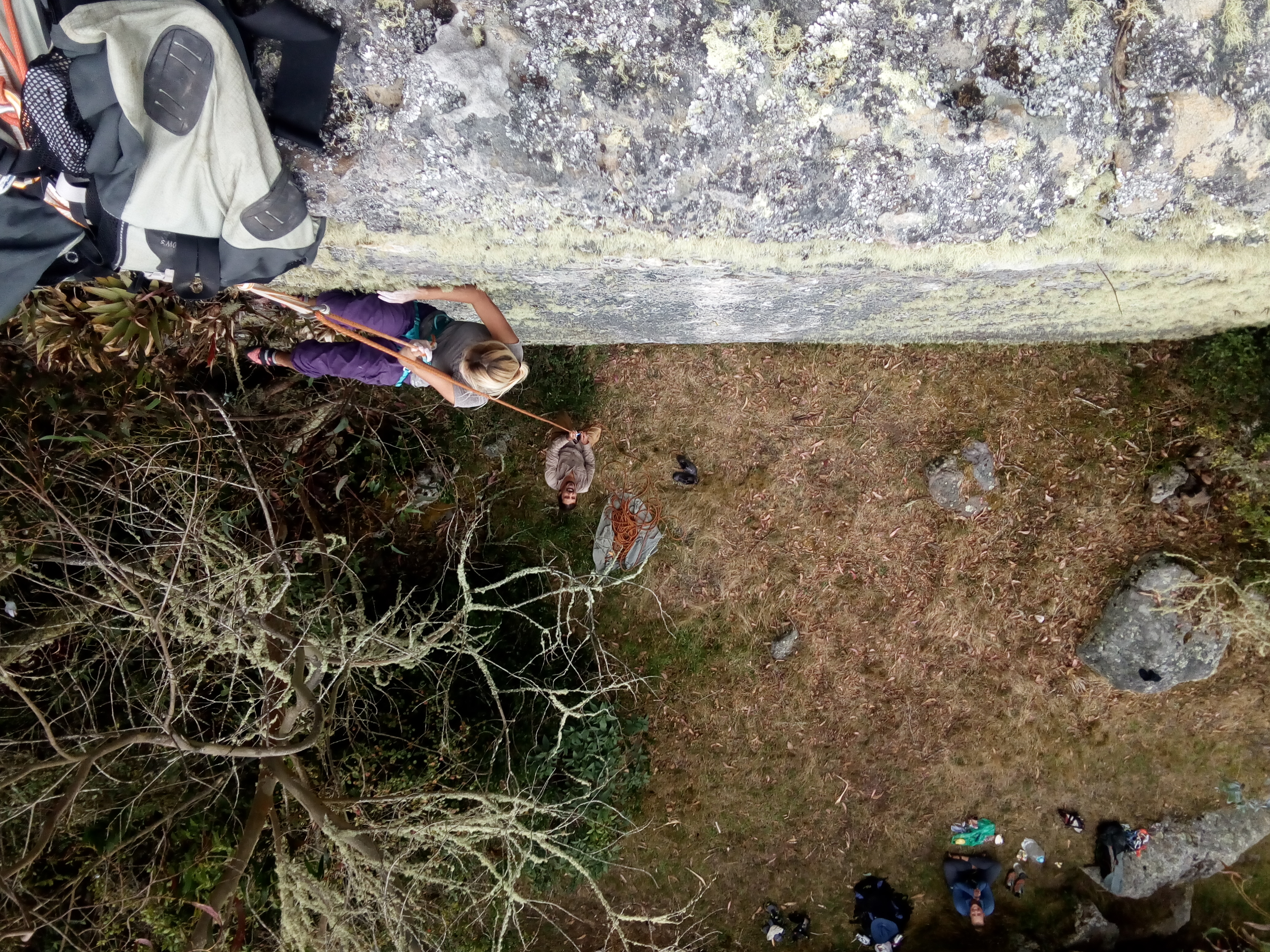
We took it in turns going for the top. I took the chance while not on the rope to run around to the top and lean over to get these shots.
sequence of climbing to falling. quite cool I think
After a while and getting the whole sequence linked we moved further down the valley to relax while climbing up and down some vertical/slightly overhanging but easy crag. At the end of the day we were all pretty beat and cold and headed back to town for 60cent beers and soup.
With thanks to Das_Karlo, Burritocharmer and Olas_y_montanas.
So, It was a week or so in Guatemala, Im not gonna lie, Its been bad. My keyboard is broken and I no longer ave te G or H keys, or backspace. Hence the Typos you are about to be subject to. There is a virtual keyboard which is just getting me by but its painfully slow. On top my laptop is under warranty but i need a permnant shipping address for 10days at least to ave it fixed.
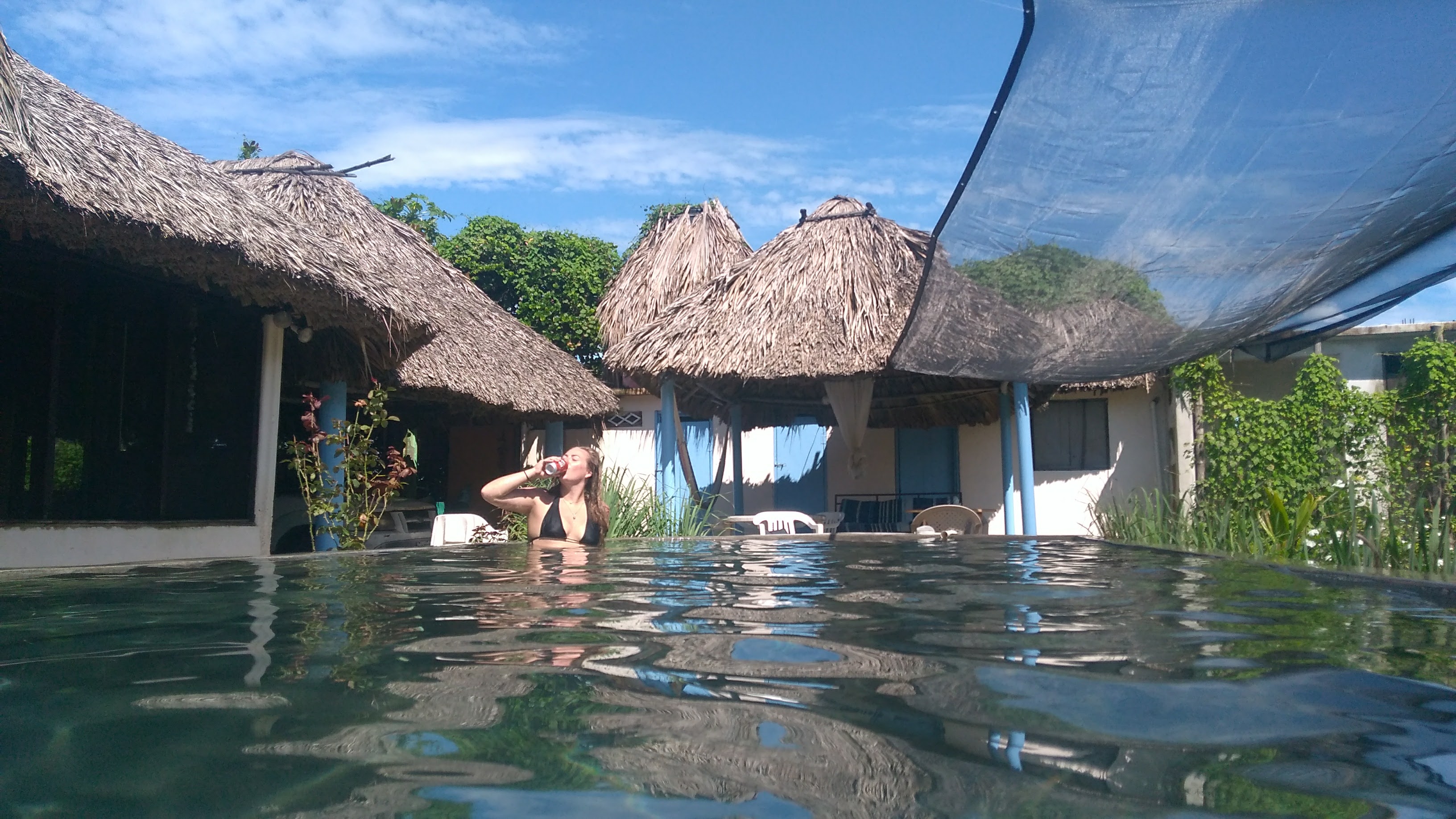
We tried to do a lot of tings out here. But the Guatemalan people were onto us. Everywhere we go there are tolls. For entering towns, for using roads, if they could charge, they did. We stopped a few days at lake Atitlan. We haggled a little for the 40q hotel room. The local volcano National Park entrance cost 100 Quetzales (about 10quid), so we didn’t enter the park. This is the most expensive entrance fee for one day in a park I have come across in the world. The problem is Guatemala has realized tourists have money, and charge accordingly.
Atitlan Used to be described as the most beautiful lake in the world. I couldn’t help but see a concrete high rise hotel race, a work of tourism. Instead of fishing, locals now drive tuktuks. I have also read there is a big problem with blue green algae which causes a odour problem, didn’t experience it though while there
The first volcano charge wasn’t too off-putting, as there are several active on our list to visit. We ditched out of Atitlan and drove for Fuego, which ajoins onto Acatenango. It provides a 5000ft climb through rain forest over black rock. We arrived the evening before the climb to smoke rising out the top and had a quick scout of the way up, a maze of twisting trails through the crops on the fertile slopes. In the morning we would set off at 3am for the sunrise from the summit. The forecast showed a clear window from 5am till 10am. We camped outside a guides house and in the darkest hour rose, picked up our prepacked bags, drank a caffine shot each and departed. The rain started 1000ft up. I didn’t know the tropics could reproduce weather similar to Scotland on a wet winter day. On went warm layers and waterproofs. But still painfully numb hands. By half way the rainfall was going up hill. We told ourselves it was definately going to clear despite the deterioration in visibility. The summit was a beautiful windswept mars like surface, but blackish.
We ran down the mountain to warmer weather, and by that I mean rain. The descent route went down deep narrow chutes washed out by the rain. It was great from running down, Karli fell over several times. At the entrance to the park attendants informed us we have to pay more money, another 50 each. We were up early enough to miss them, but they always catch you in the end.
In Antigua the situation worsened. It was like being in a western city. Nothing but hotels and hostels in every building, beautiful as they were. A hideous one way system tried to thwart our departure but after a hour or two we were out. The last volcano on the list was Pacaya. On arriving guides ran up to our vehicle stating we had to pay 100Q per person to climb up to a col, but an extra hundred was needed to go to the active rim. It wasnt allowed to climb without a guide. This was the final straw. We left and headed for the cost. Driving into the night and seeing motorcycles with no lights,dogs and people appear out the dark like ghosts and disappear as quickly. Bumping over every pothole, Karli telling me it will be a mile away, then two, then ten, we rolled up to a hostel late. It was owned by westerners charging 380Q for the last double room in the hostel. More than most western cities. This isn’t what we came her for. The hostel owner did however point us across the road to a restaurant that might let us camp the night. We crossed the road and found Soul Food Kitchen, with the owner Gary, a south African man who said we could camp for 40Q. That’s more like it. He also made brilliant curries for 45Q. We stopped a couple of nights relaxing. Finally someone not trying to extort us for trying to breathe. Even the local were eating there. Outside there was a lovely pool and we were welcomed to use the showers and wash clothes at no extra cost. He also allowed us to pick coconuts, with my feeble body hanging off one trying to pull it down. Then Karli wildly swinging a machete to try and open it. The local restraunt girl eventually helping.
Yesterday we crossed into El Salvador. After a few hours back and forwards at the border crossing not understanding a lot of what was happening we were in. Its much the same here. They have even embraced the american dollar, you cant get to a lakeside without paying for at least drink in a hotel. The lakeside road is lined by 8foot concrete with barbed wire and gates. The national park only has hotels, not even a car park, well, so far at least. C’mon central, what are you playing at. We should have known at the entrance to El Sal, as we were passed a Disney style map showing hotels, attractions, board hire etc.
Im not saying its all bad, it is beautiful. But I hate the feeling of being an ant trapped between concrete walls were even a forest cost money to be in.
My training routine has been interrupted by the cost of going anywhere that isn’t either 100 quetzal a time or guards with pump action shotguns telling us its too dangerous for us to be there. Seriously, every delivery wagon, even milk wagons come with their own armed shotgun guard! its one extreme or the other. O well, maybe something fun and free will present itself.
The second day of our Mexican journey was a lot of driving. We drove from half seven in the morning until around 7 in the evening. We made two stops for fuel and one for tacos. Ben felt the tacos were over priced-even ‘American in price’. But that’s only because his good friend led on that we would be eating only 8 cent tacos during our time here. But on that note, I’d like to mention that Ben refused food for the both of us throughout the entire day. I ate half a yogurt for breakfast while he enjoyed a stale cinnamon roll. My pleas for tacos throughout the day went on unheard until around 5pm when I finally held a pocket knife to his throat and forced him to pull over along with the rest of the traveling wagons. This is how we’ve decided to judge preliminary whether or not a restaurant will be favorable or not – is whether there is a gaggle of semi-trucks blocking our way in.
Anyways.
So we made three stops. Gas. Gas. Tacos. Our bodies were feeling sore at the end of the day. Not the kind we’re used to, where the muscles are sore from exertion, but rather from being confined to a small space for hours on end.
Our destination was a small city at the base of Pico de Orizaba by the name of Tlachichuca, and despite the both of us desperately wanting to be there by the time the sun fell over the mountains, we decided to aim for a small green patch on the maps which preceded the city by 90km. Upon arriving at the mysterious green patch on the map, we discovered our path barred by a barrier and a guard, almost military like. The guard approached us and introduced us to the national park that was hiding just beyond the gate, and let us know that we would be safe camping for the evening. He wished us a good evening and raised the barrier.
The winding dirt road eventually led us to find a quaint little camping spot for us to enjoy a pot of noodles accompanied by old sauce and a can of tuna. Only one mosquito bite later, and we were bundled up in the tent.
Day 3
The day began with thick cloud cover, left over dew, mossy trees outside our mesh windows, and Ben’s continued ranting over Reeces’ promised 8 cent tacos. As I took solace in the last few minutes with my sleeping bag, I was interrupted by Ben’s manly, high pitched, screams. Maybe I should have been more concerned, but instead I took my sweet time wiggling my shoes onto my feet before I leaned out the tent to make sure he wasn’t experience extreme blood loss. He wasn’t. He just hit himself in the head with the tent poled, blaming the moisture for his accident. (ben- it really was a slick pole)
We left camp without breakfast, and high hopes to find a spot in Tlechichuca where we could prop open the portable stove and boil up some oatmeal. Pleasantly, after winding our way down the opposite side of the mountain, we were greeted by a brightly colored Sunday market. After a few laps up and down the street, we found ourselves the proud new owners of a bag of spicy peanuts and hot potato chips. We ditched the idea of oatmeal when we came across a couple of ladies serving up tacos across from where we had parked. We were delighted to find out, after our meal, that our tacos and mystery drink had only cost us 13 pesos-about 75 american cent.
We left the market and continued our journey toward Orizaba. About an hour later we found a pharmacy where Ben was able to procure an anti-malarial for the next couple of months of our journey. They were cheap (about 30 dollars for a 70 day supply) and hopefully not counterfeit. Only the next few months will tell.
interesting roadside isgn
decorative streets after the first market
Eventually we found ourselves in Tlachichuca and again, tempted by the Sunday market they had going on. This one was large enough that there was a police presence to direct the traffic and had a good friendly feel. We bought a deep fried fish with chilli powder and lime, a corn on the cob (elote) with butter, cheese, chili powder, and lime (this disgust me but Karli loved it) and ice cream to finish with some nice notes of lime and coffee. Walking around the market I couldnt help but notice i was taller than everybody else and had to stoop continuously under the tarps shading the stalls.
We departed the market and drove up the volcano. The road started well and finished poor. The mighty subaru cruised to half way on the rutted mud track but the last 2000ft of trail are steep and so far evading us. Karli gave it a whacking great try rallying up the way, till a sharp turn and steeper terrain suited to 4x4s with low gears and knobbly tyres stumped us. The car told us it was not happy with a great deal of smoke from the clutvh. We have backed down to a flat area to regroup and work out a plan of attack on the remaining 6500ft of ascent.
Our campsite this evening is an abandoned village composed of 4 decomposing cottages, a common bathroom, and some sort of lookout post. Still trying to decipher what this area was used for (ben thinks cartel post due to the watch tower, but then again, Ben thinks everything is cartel), once upon a time. I sat up in the lookout post for a bit while Ben traipsed around, discovering whatever there was to be discovered. The echoing sound of a dogs bark accompanied us for the greater portion of an hour until Ben finally decided to locate the howls. He stumbled upon a shivering and scared pup sitting at the bottom of a 10ft hole. After a few moments he shouted for me to come over.
After a few moments of discusion and with the hole being muddy we unbolted the roof tent ladder and dropped it down. Karli put on a thick jacket and padded gloves and descended. The dog was cold, scared and snappish. She spent a about 15minutes gently stroking it to calm it down, we dropped a towel over to warm him and a short while later Karli picked him up and carried him up the ladder. The poor fella hunched for a few minutes berfore first slowly getting up and walking a few paces, then a little quicker, then he ran. The last we saw of him was a small speck bolting down towards the village. Not ever a thanks (but thats ok).
camp 1 on orizaba
laptop rigged for movies to rooftent
water filtration on the road
bahhhhhh
the road up in the clouds
We are now collecting rainwater with the help of a small roof and a tarp sheet.
After backing down from 12,500ft in the Subara which didn’t quite have the power to go up the volcano on the 4 wheel drive track, and having a nights rest we descended to one of the lower villages knocking on doors to find the local guiding company that could give rides up to the mountain hut. I will admit Karli’s Spanish was more useful here than my charade/ hand signal language. Eventually descending right back to the valley bottom we were directed after several attempts to the mountain guides hotel. We asked the owner Roberto for a lift to the hut for a summit attempt. He gave us a great price of 1600 dollars (Mex) which is around 80 US dollars for a ride up to 14,500ft(4420m, taking around a hour or so), ride down back to 10,000ft, clean water and an extra camping mat for in the hut. This is just out of the tourist season for the peak which starts in a couple of weeks after the rainy season. The ride up was rough, the mud trail we drove down in the morning was a raging torrent of washouts and collapsed road sections getting bigger by the minute. Half way up at one of the guides houses in a small village we changed to a beautiful old maroon jeep. The kind of machine where you hear two whacking great chunks of metal smash together when engaging 4 wheel drive mode. The part of trail that stopped us originally on our attempt was more impassable with water raging down. We were glad we descended when we did in the subaru, this was definately too much for the traction control, road tyres and low ground clearance. The guide told us its normal rain for this time of year. At one point stopping the vehicle to hack tonnes of mud to create a smooth run down into a dip where previously was a road. We arrived at around 14,500ft about 5pm in the afternoon feeling good for our summit attempt beginning midnight. Quickly prepping kit, preparing the evening meal-ramen and packing bags for the early depart. Karli wasn’t enthusiastic about eating the Ramen which made me slightly concerned because a lack of appetite up that high is not good. But to be honest I wasn’t overjoyed at the thought of them either. But we did have a big box full of it we bought back in the states so it had to be used. At about half 6 we went to bed ready for our midnight ascent.
the road up
the top of Pica de Orizaba, the mountain hut is behind the black rocky ridgeline to the left, this is taken from 12,000ft
Now, for the past weeks I had been going on about Altitude sickness to Karli to the point she was sick of hearing about it and didn’t want to know. I think this changed just before setting off at midnight when I became aware she wasn’t sleeping, had a cracking headache, and felt like she was going to vomit. To partially quote her, ‘Worst hangover Ever’.
We had been talking about this mountain for weeks. We had waited a week for my package and a few extra days for Karli’s package to arrive with the sole purpose of Orizaba in mind. We had been waking up to stare at it’s snow covered peak for the last few mornings. To get there and not even start the hike to the glacier was slightly disappointing, but AMS be AMS and you can’t fight the right decision for safety.
The journey here was fun, through the laughter and anger and smoke of trying to force a car up a muddy high altitude dirt road. Of filtering tarp rain water into a small pot and waking up with wet pillows and Karli’s deliciously prepared pancakes, making fools of ourselves trying to speak Spanish in a game of charades. There was so much more to this adventure than the mountain that was staring back at us.
We went into this mountain knowing we were close to the limit for acclimatising, the past week we slowly camped higher, the previous week had been spent around 5000ft. then 7000ft, 9000, 9000, 10,000, 12,000, and finally 14,500 (the hut height), which was a 6hour stop before a dash to the summit and descend back to 10k. We hoped to have longer but with nearly 10days of delayed equipment and being stuck near the US border, the time was gone. We went in with the knowledge a turn back was likely.
Karli seemed much better by the time we reached 10,000ft, though the headache persisted for a while. Roberto had a full breakfast of three courses waiting for us when we arrived back at the base and kindly let us use his hotel showers.
On any climbing trip the safety of the team comes first. Altitude sickness can hit anybody, no matter how fit or carefully acclimatised. There are a few basic rules – If you have symptoms, don’t go any higher, If you have symptoms, descend as soon as possible. If someone has symptoms, do not leave them alone. Symptoms- lack of appetite, headache, nausea, flu like. They progress to confusion, drunken like behaviour, eventually unconsciousness and can lead to death if not handled promptly. The only way to stop the symptoms is to descend. The worst part is it’s silent, and gets worse with time so stealthily it’s hard to notice. descending even a couple thousand feet can reduce it.
It’s a reminder of just how frail the human body is. Change altitude by a few thousand feet too fast and it can kill us. The standard advice is above 8-10,000ft (the point at which sickness usually begins) ascend at a rate of around 1000ft per day, and every 3000ft have an extra days rest. If possible, hike high, sleep low.
I don’t care that we didn’t make the mountain top, this was a cracking sunrise and great fun meeting locals on the mountain. And we are both down ok.
I thought the hikers diet of pop tarts was over, I thought I wouldn’t go back to that life style again, but I was wrong. If anything Karli has forced my diet to deteriorate even more. Poptarts, donuts, tornados, corndogs, really anything I can get my mitts on.
Last night we dropped down into the Grand Canyon from the South Kaibob Trail. Around 5000ft of descent. During the day the temp is around 42c which makes this too hot to descend with any rational mind. I watched others hiking up in it nearly passing out carrying empty flasks, not nearly enough mid day. I felt sorry for them, but knowing I was only carrying a half litre down myself to get to the bottom, couldn’t spare any. The river at the very bottom is the only water station on this route (carrying of a filter required). We set off at 3pm, and as we went down the burning sun started to cool. I wasn’t expecting such a good trail, wide, smooth and all the things a good trail is. We initially planned (in the loosest sense of the word, we actually just walked into the ranger station and picked up a free map) to do the Rim to Rim to Rim overnight. But upon reaching the river, we became a bit lazy, justifying only one descent by saying how busy we would be in the coming days, a first.
feet up
the last few miles out the canyon
moon lit sky
colorado river
we took these sandwiches on route, by the canyon bottom they were a over heated gloopy pasty mess
about 1500feet of canyon in view
ridgeline down the first half
explorer stance
After a while chilling by the river, and as the sun set we set off back up the canyon. Most the way up the moon shone bright and there was no need for head torches which was a relief as my battery warning light was flashing. On route there were beetles, scorpions, tarantulas and other weird insects. We drove a few miles out the national park then crashed out down a forestry lane.
about half way down
2/3 the way down
Karli on Black Bridge over the Colorado River
I have a fear of wasps, not a needless fear, but they sting me every few years when I let my guard down, I am always the victim and it is never provoked. This morning I was nearly a victim again. There is a hole in the roof tent we cannot cover (this aids in the closing of it). The wasp got in through the hole and decided not to leave through the un-meshed window. I protected myself as best possible by covering myself with my sleeping bag while instructing Karli to get rid of it. Climbing yes, Kayaking yes, snowboarding yes, winter mountaineering yes, I’ll take any without fear. But these tiny merchants of doom should be exterminated, I have no place in my life nor love for them.
We are now in California now, finding somewhere to camp the night. The next few days should have lots packed in.