Hiking The CDT- Part 17- Chama to Cuba N.M.

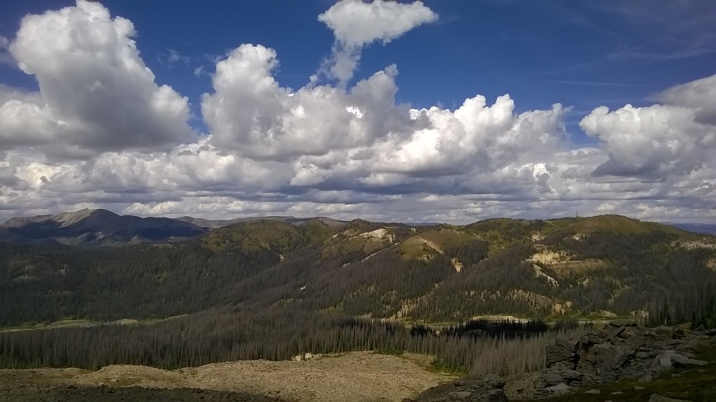
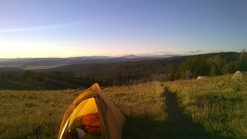
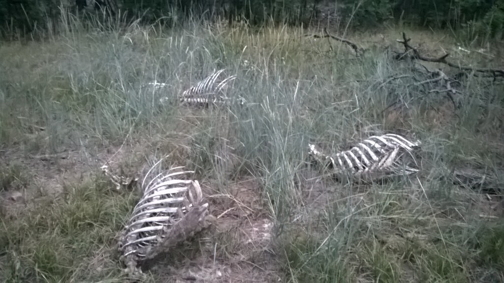
The slog on the road gave me plenty of mindless time to think. It would be an overnight trip, as my day was starting late. It’s a grind when you have only the thud of your feet for company. A car offered a ride but on telling them my plan suggested there was a national forest not much further that would make a good camp and wished me luck. After dark I arrived at the forest, walking back through thick trees to a small clearing out of sight. The night is long and full of terrors. I heard the odd vehicle on a forestry track and wondered what they could be doing at this hour, what heinous crime was afoot. On waking the next day I found the forest was full of skeletal remains of animals, not the most welcoming sight but not out of place in this forest. The evening before I noted a fuel station with a cafe, shop and bar. I figured it would be a good place for breakfast in the morning, and when woke I walked back the way for a coffee.

In a town along the way I went into a shop to buy water. On leaving a driver in a car outside offered a ride. I declined, wanting to hike as much of my route as possible and was glad I did. The driver became abusive, swearing and rhetorically asking if I was too good to get in his car, and screaming to get in the car. I noted the open bottle of what apeared to be whiskey or tequilla in the centre console. I went back in the store and hung around for a while until he’d gone. I kept an eye over my shoulder for the next miles of hiking. Even in the short time I’d been in this new state, New Mexico had a very different energy to it.

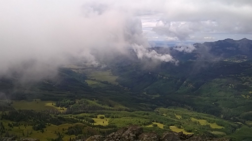
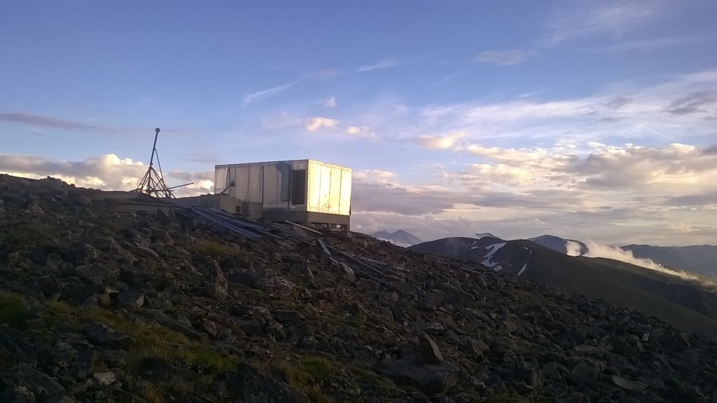
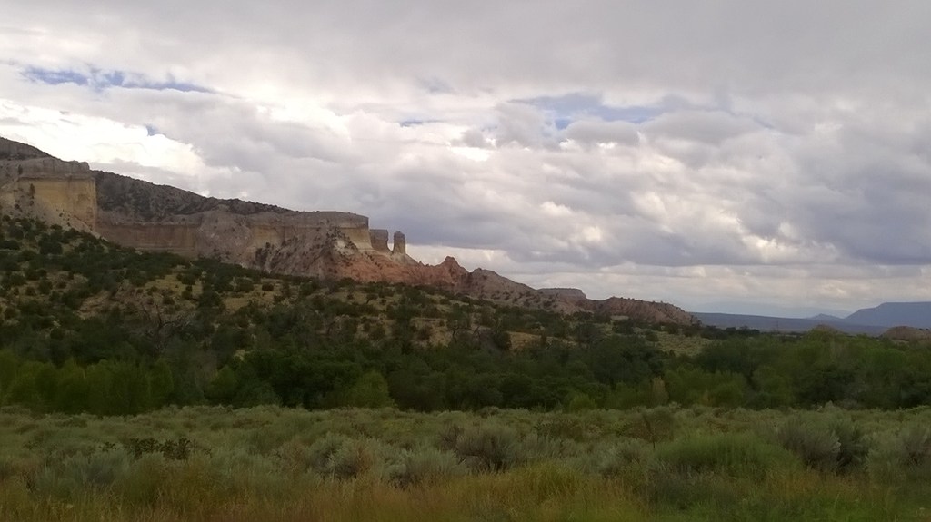
Maybe five miles before Ghost Ranch I came across red sandstone caves, a half mile or so from the roadside, it was pretty hot having been on a steady drop in elevation since Colorado. I planned on taking a break on my mini diversion to the cave, but arriving and finding no water I decided it wasn’t the place for a break. Turning back around, I decided not to sit down til I arrived at Ghost Ranch. The ranch itself was a few miles off to the side of road and added an hour to the day. I arrived at reception, booked onto the campsite and went to use the computer straight away. I was pleased to find a quick connection and high quality printouts. I printed the next few hundred miles. There wasn’t much to talk about here, few friendly campers to talk to and a quiet library. The night passed slowly and I was relieved to be on a trail and away from asphalt again the next morning.

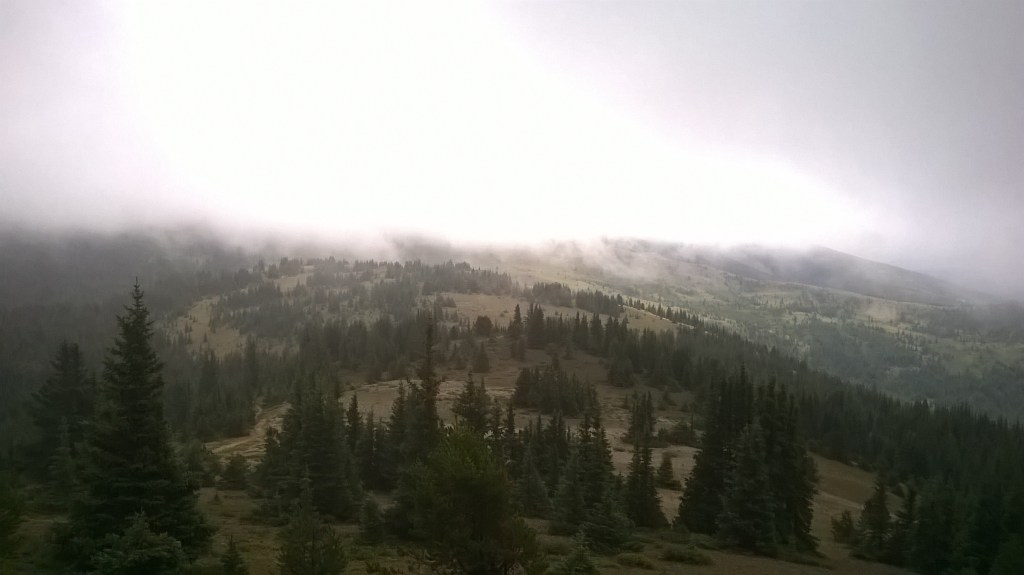
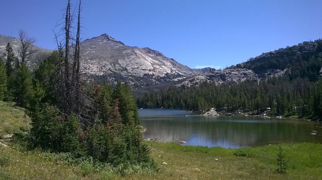
The next section started in arid land on hot dirt roads before eventually breaking off to trail. It climbed up slowly and into forested hills. There were many snakes, I guessed mostly corn snakes or similar and didn’t think they were venomous, but didn’t want to find out. I came across a lot of elk grazing that didn’t seem to fear me too much as I passed through. Creating a hill I came across a man on a quad bike, beer in hand riding around. On the back of the quad a beer cooler, on the front a compound bow. ‘Have you seen any elk around here? He shouted over his engine. I responded ‘no’ not because I hadn’t, but, quite honestly, I mean, really…you’re going to try to hunt elk while revving around with a beer in hand. C’mon, in man vs elk, those elk are gonna win, I didn’t want to interfere in the natural pecking order. I’m sure he was having fun but he was going home hungry every time. I imagine him getting home to a wife and saying ‘Nothing today honey, there aren’t any elk on these mountains this year’.

The trail wound down to crossing over a road before climbing again. There were annotations on the maps warning of experiences of hikers all through New Mexico. At this particular point, it warned of hikers that witnessed a drug deal. Arriving at the road myself, a few Harley bikers passed giving a thumbs up as they did. I have to be honest, that gave me positive vibes but I still wasn’t sure how I felt about New Mexico.

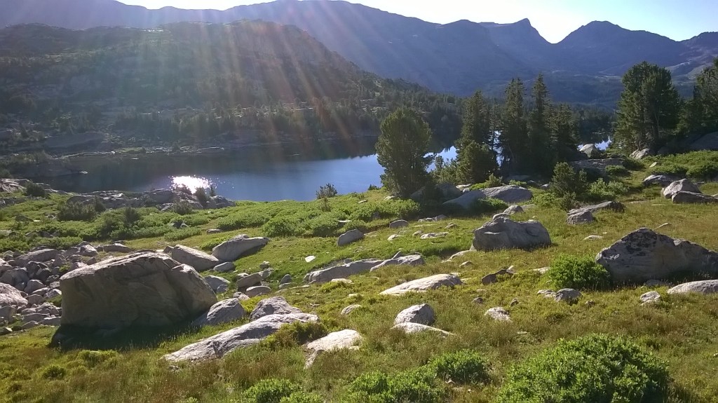
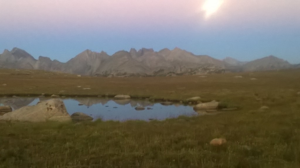
The area I hiked into was lush and green. Enjoyable. The route was faint but easy to follow but it was obvious I was beginning to run myself down. Dropping into Cuba N.M. I booked into a little motel for $30 dollars. I checked the remaining maps. My closest CDT finish was about 300 miles away. 300 miles from the end. I checked my calander. I had been hiking for 91 days. I figured there were 9 days to make the border at 33 miles per day. This was a pace I had been doing over high mountain passes easily, and now I had smoother desert walking to finish on. I was nearly done. I checked the distance I had apparently come, knocking off the area at Yellowstone and allowing for the alternates used. I had hiked at least 2300miles. I stocked up on food for the next section and went to bed. I was drained, and the morning I woke late. I packed my bag but I was struggling to get going. I lay there and accepted I needed at least rest, and more importantly a pharmacy or doctor. I booked in one more night. The day was slow with junk on tv. I figured if I made it to a bigger town there might be a doctor that could help. I checked the balance on my credit card one more time. It was dismal. I slept as much of the day as possible readying myself for the heat and miles that were to come.

Hiking The CDT- Part 16- Wolf Creek To Chama

Setting off from the hunter’s camp, I told Beads I would probably see her at a lake in around 30 miles to camp at and went ahead. The trail wound around rugged peaks on a grassy plateau before dropping into a deep forested valley. The climb out the other side felt steep though in retrospect probably wasn’t too bad. My stamina was dropping daily as the half dose of antibiotics worked it’s way out of my system. I rounded over the top of the mountain and in the next valley came across a hiker. The first thing I noticed about him was what he was wearing. Full waterproofs, zipped up head to toe. It was a pretty mild day, I was in shorts and a T shirt. I thought ‘man he must be warm’. As he came closer I noticed his pack more. It was huge. You could park the titanic in the main pouch and that would just cover the tip of the iceberg of what was in that pack. Then there was the extra attire. He was sporting a bear grylls style black and orange machete, worn stylishly on the waist. ‘Hows it going?’ I asked as he sat down to pass out. ‘This is hard work’ he explained as he unzipped his waterproof to reveal the fleece below, while sweat dripped from his brow. The sales man at an outfitters had definitely seen him coming. He told me he was hiking the Colorado trail from Chama (the next town along) and I can’t remember how many days he said he had been on trail for, but I was slightly alarmed. I wondered if he knew how far he had to go. I suggested he take off the waterproofs to be a little cooler and walk with as few layers as possible. I didn’t have the heart to tell him he should probably ditch everything to increase his odds of surviving the next days…or weeks.

Arriving at a beautiful blue lake surrounded by trees on a saddle, I decided the day was still young enough and this wasn’t the place to stop. Scenic as it was I kept going. Ominous clouds built in the sky once more as I studied the map. I reached a point where to go further would keep me on high ground for the next fifteen miles at least. The thunder clouds grumbled at me as I rose up the next climb. I decided to keep going, noting a tarn I could drop to in another five or six miles if things got bad. Needless to say, they did, and I found myself sprinting off the edge of a mountain once more. With the sky darkening I dropped to Green Lake. Once again a little off route. Arriving at the lake as electric cracks shattered the sky over head, I found a sign saying ‘no camping’ at the lake. I don’t know what they would have advised a single hiker arriving alone at dusk in a lightening storm to do, but I walked a short way from it and pitched up. Within moments, heavy hailstones started and the wind picked up as the back of my tent buffeted down onto me. I will be honest and say I was not convinced the tent would hold up to much more. I held my foot against the top of the tent in an effort to stop the supporting pole from breaking. Soon it became cold even inside my sleeping bag. I began contemplating that I might have to get dressed and walk all night to avoid hypothermia if the tent broke. The lighting seemed to settle over the small valley I was in and stay there. Over this hike it seemed most the time lightning struck inside a valley, it would restrict itself solely to the valley. In retrospect, maybe I would think twice about constantly sprinting into valley’s each time a storm appeared.

This was a long night. I was tired, and a bit fed up. Ten or fifteen minutes would pass then another huge strike would light up the tent. I put in my earphones to try to block it out, but it wasn’t much of a help. I had no concept as to whether the strikes were getting closer or further away, but I remember feeling that each strike might be my last. During the day in these high areas you walk past hundreds of trees and one in every so many would be a lightning struck tree, destroyed and charred. A daily reminder that lightning can strike anywhere, and it is a frequent and dangerous event. Later I found out from some locals that during this storm a motorcyclist had gotten off his bike at the top of a nearby pass to take a photo and was struck dead.

The next morning I woke to scattered clouds and the calm sort of forest you might seek out for a day’s hike. There was a small path that had led down into the area I had camped in, but it went back the way. I hiked to the south side of the valley and scrambled my way up the large rocks on the other side. I walked out across the hill til I found the path I should be on. I knew Beads would be a long way behind, but when coming across my muddy footsteps in the trail after seeing none the past miles, would be confused where I had come from. The trail slowly wound around and down towards Cumbres Pass. A sign on the ridge warned of dangerous snow conditions here in winter times. I would bet the original north bound hikers would come to this and think twice about proceeding. Nobody wanted to post hole, and nobody wants to be buried alive in an avalanche. I arrived at the pass early morning and started walking down towards the town of Chama. There weren’t many cars passing and I figured the descent into New Mexico was a welcome one. The temperature would warm the further I went. I wouldn’t have to suffer through cold nights any more.

My walk down was long and I arrived much later in the afternoon than I had planned. I had a 50/50 mentality for the the next section and would need more maps to advance. My hike now hinged on it. I spent an hour walking around to find a computer, eventually coming to the local library and printed out my new maps. They were black and white and low quality. This posed a problem. I printed them as far as ghost ranch, the next stop, hoping the resort could help. I booked into a motel and sat on the bed trying to decipher them. Imagine all the contour lines, forests, rivers, roads and any other features on a map being grey and pixelated. I had a pen to try to highlight what should have been a red line for the trail, but couldn’t. The maps were useless. A short while later I received a text message from Beads. She was in a bar down the road and wondered if I was still in the town. I walked down to join her. She had this one last section to hike for her trail to be finished, but would be taking a few days off at Ghost ranch first with more friends and I would probably cross her walking the other way in the next days. She split the motel room with me and headed off the next day morning.

I carried on my search in the town for a better quality map, before eventually giving up. I was at a little bit of a loss. I could have asked to join Beads, but wanted my route to be a continuous southwards line. I knew that many hikers had walked the road here coming north from Ghost Ranch to avoid snow so there was a possible way south. I called the ranch and asked if they had a computer and printer I could use and they informed me they had a reasonable quality system I could use as well as cheaper camping for CDT hikers and good food. The dullest alternate on the CDT. A dry roadside for 45 miles. But it would keep me going and get me back on trail. At least on a main route I wouldn’t have the worry of running out of water.

Hiking The CDT- Part 15- Monarch Pass to Wolf Creek Pass

I had an extra night off on the BML campsite just outside of Salida before hitching to the pass the next day and continuing my hike. The sky was misty as I walked high and alone on an alpine ridgeline. There was the odd low grumble from deep in the mist but the kind that didn’t feel threatening. It was nice having complete silence. I arrived at a small shelter to eat my next bag of ranch dressed salad, a favourite for a first day on trail, and was joined by a few more hikers. After lunch with them I headed off and laid down a few miles. I camped the night on a perfect meadow with views all around listening to the sound of Johnny Cash playing from my phone. The next day I crossed a second road and met a couple hiking the Colorado trail aiming at sixteen miles per day. It was an effort for them and It seemed like they were having a fun time trying. I knew by the time they had covered the next seven miles I would be over the horizon. The rest of the day I didn’t pass anybody else. I don’t think much of a map would be needed through this area as the whole route was well marked with both CDT and Colorado Trail markers. I originally was going to take the Creede cutoff, a shortcut used by a lot of hikers which veers straight down a valley to avoid some of the mountains, but on reaching another hiker who seemed a little unsure of how much further to hike, opted to carry on with him for a bit and take in some more of the San Juans. I still had a bag full of food and decided it was worth the extra effort here. The scenery each day improved and just became better and better. The air crisper and the mountains more defined. I had checked my account balance before leaving Salida and was aware the costs had been stacking up. I was well into debt at this point but felt so free I could barely care about it at the time. I figured I would be working the second I arrived home. Coming out of this area before the end of this section was a hill called Snow Mesa, a large flat plateau. It wasn’t living up to it’s name in the summer months I was there, but I would love to come back and see it in the winter.

I hitched down into Lake City, which to my surprise was not a city but a small town with not much more than a grocery store and hostel. The hostel owner was an Irish man who had started the CDT and like many before him in many other places along the way, just never left a town he arrived at. He charged full price to those on the Colorado trail but gave a discount to those hiking the CDT. I was appreciative of that. The next day me and the other hiker I had met took the free ride the town offered back up the pass, a shared service by the locals who had realized the income attached to thru hikers. I wasn’t feeling great again. The energy that had come back a week before was now gone. The half course of a prescription had not been enough, I was certain now that was my problem. I decided on the Creede cut off and headed down the road. I would be lucky to finish this hike but knew I could. In fact, there was a chance I could make the Mexican border in under 100days from my start date. A solid achievement.

Welcome to the long slow demise of the Benjamin. I hiked down from the town and followed the Rio Grande for a short while before crossing at a bridge to follow a gravel road back up the other side. It annoyed me I had to walk a big loop to get to a point I had been relatively close to initially, but I didn’t fancy a swim. This was an alternate quite a few hikers would use to ensure completing the trail both at the start and end of the season, and I know Tribhu and Beads had probably gone this way. I was glad I had hiked at least a small part of the San Juan Peaks. I felt beat but kept hiking. I can’t for the life of me remember why, but as the road turned to trail, I stopped. The trail was a gentle rise up through forest, nothing noteworthy jumping off the map. I turned back, and decided to have a side track. On the way down from Creede I could see a large gorge. It looked fantastic compared to the forest trail in front of me. I didn’t know exactly where it went, as my map stopped right on the edge of it I decided to have my own alternate. I rejoined the main road, slightly annoyed I had just wasted several miles walking up and started my new adventure. The Wagonwheel gap/canyon was a beautiful tall sandstone canyon, far different from the surrounding mountains. It took a little road walking before I came across a usable trail in the canyon and I resented the striking of my feet on the hard surface to get there. I recognised a name on the sign as being a town to the side of Wolf Creek Pass, (a short way further on) and decided it would be my own version of the trail before I rejoined the official route. It felt exhilarating for the first time in months to not be following an exact line down hundreds of sheets of map. To go where the map could not take me. I found out this is where the closing scenes to ‘The Lone Ranger’ was filmed a few years ago. It was a fantastic canyon and I wondered how many spaghetti westerns had been shot here, and indeed if any outlaws had been brought to an end here in real life. I became despondent further down when I found what I believed would be a BLM forestry style area to camp was actually a small housing development now. To add to it there was an official camp area but it was too pricey for me. Miles and miles on, it started raining lightly and was getting dark. Maybe my alternate had not been such a good idea. I knew there had to be some form of hiker friendly accommodation in this town, but had no idea where it would be.

A car drove over and window wound down. ‘I saw you hiking all the way back up in Creede, you’ve been covering some distance. Do you know where to stay?’ She said. ‘Not yet, I’m working on it’. I responded. ‘Hop in before you get soaked’ the old lady shouted. ‘I can drop you at the motel, or you can stay at my house, there is a guest bedroom. I guess your one of those long distance hikers, you were really shifting’. I thanked her for the invitation. Every time I received help on this trail it was a real morale boost. This time even more so. It wouldn’t have taken long to find the accommodation, but I was glad of the offer of a free night that wasn’t on a fourty year old mattress in a run down motel. On route to the house a short way away all I could think was you shouldn’t be doing this little old lady, the world is a dangerous place. Over dinner I told her of the journey so far and early morning thanked her for the hospitality. It seemed to make her month hearing of a bold adventure. I picked up a donut from the store then hiked on for several hours turning down rides, until eventually accepting a ride to the top of the pass from a car. I arrived at Wolf Creek Pass around lunch. I knew at this point ethically I had just cut a few miles of trail, but, the temptation be being on trail with daylight left was great. I stood for a short while talking to a motorcyclist and touring cyclist. The leathered up biker was telling us of the 5 day long distance ride he was doing and how hard it was on the body, a real feat of endurance. I appreciated it was probably hard, but honestly, I don’t think he had any idea of how hard it was for the cyclist to self propel over the same distance, or for a hiker to walk it. The cyclist and I kept quiet.

I hiked into the area and followed an impressive ridge that circled the ski resort. I was feeling reasonable and content to hike. If you ever get a chance, the Southern San Juans are beautiful peaks. Towards the evening nearing a forestry road pass, I came across Beads sat on the trail drinking a beer. She said Tribhu left the cans to the side of the trail and a note saying ‘well done’. He had shot off ahead a day or two before to finish his hike at this point, where he left the trail due to snow earlier in the year. Beads still had a few miles of her hike left but would be finished soon enough. Just down from us was a small hunting camp. It was a group of dads that every year would come out on an elk hunting trip with the tent, quad bikes and for a few days forget their responsibilities. We camped with them for the night. As well as eating some brilliant chilli con carne combined with fun camp banter into the late night, they gave us some jerky style elk sticks to carry on with. Not coming across many hunting camps in the UK (we tend to lack anything other than rabbits and sheep) was a new experience and I figured just about as American as it can get. They had a large military tent, a propane heater to warm it and tables and chairs set up. They all slept in hard sided vehicles and shuddered at the thought of spending a night inside a piece of nylon fabric, separating them from the bears.

Hiking The CDT- Part 14- Copper Mountain To Monarch Pass

Waking in the morning we waited around for Tribhu for a while before deciding to do a slow walk up our next pass. We passed a gent on his way down and he asked ‘Hey, are you Beads and Ben? Your friend is racing ahead looking for you!’. I told Beads I would head off and try to catch up. Hiking off ahead and gaining the top of the mountain, I could see Tribhu all the way down in the next valley. I jogged the next few miles and caught up. We ambled along to the next pass then hitched into Leadville. This town is at around 11,500 feet and the air up here feels clean and dry. We book into the hostel for the night and went for a grocery shop, buying a few beers and heading back to drink them. There is an ultra race going on and the hostel seems to be the epicenter of the it, with competitors from around the world staying. I had admiration for all those people heading off to run 50 to 100 miles in one push. They seemed equally shocked though at the thought of doing over 30 miles a day, day in and day out for months. Beads arrived a couple of hours later, and we chat away the evening with other adventurers before getting a ride back to the trailhead the next morning.

This day becomes my worst on trail. We ate breakfast a short way out and came across a cooler box with iced drinks for hikers on the trail. Its pretty cool to come across unexpected cold drinks when the water you have to drink is always hot and unpleasant. We had planned to climb Massive Peak on the way past as an extra bit of excitement in the day. I was going slow, so told Tribhu I would catch up with him at a junction for the summit trail a short while ahead. I hiked, I sat, I tried to eat but couldn’t. My stomach hurt. I hiked a short distance more. I sat down. I hadn’t felt so drained in a long time. What should have taken forty minutes took a couple of hours. I felt like I was going to pass out on a gentle incline and knew this wasn’t right. When I eventually arrived at the junction, Tribhu was concerned. We opted not to hike much further that day and for my second time over the last thousands of miles, we had a camp fire. Eventually Beads caught up and joined us. I couldn’t stomach dinner and went to lie down. I felt like I had been booted in the stomach. A couple more hikers from the Colorado trail joined our camp and after a while I got back up feeling a little refreshed. This had happened for a few afternoons previous and I put it down to a small stomach bug.

The next morning I felt fine, so me and Tribhu set off ahead of Beads to climb Mt Elbert, she would keep to the trail and see us later. We started up the trail and an overpowering smell of laundry detergent lingered in the air. It was confusing to say the least. What was this chemical smell doing up the mountain? It became stronger as we climbed. It was a busy Saturday with low lightening possibility and within minutes we started running into people. We pretty much ran past the crowds on the way up and it was so bizarre, all of the individuals had this smell. It could have been that each member of this particular crowd was just overzealous with the detergent the night before. But I like to think I had adjusted to being in nature more, and using less detergent, was ultimately starting to notice the unnatural things more than ever. It’s no wonder bears and elk run as soon as they are near people. Reaching the top and running the final ridge to the summit we snacked then started our descent to Twin Lakes, dropping the 5000 feet we viewed as a pleasant side track.

Once at the general store in town we found Beads sat outside with a few more hikers drinking a beer. We found out Mumford and Sons were playing a big gig in the town of Salida that evening. Not wanting to miss it, we hitched off trail for some festivities. After talking with Bead and Tribhu in the town we decided I likely had Giardia. The symptoms I had had over the last days fit in with the parasite. One of Bead’s friends who had come to see her, happened to have half a course of Metronidazole sat in the glove box of his car. It had been there for a few years, but not wanting to waste a trip to an expensive hospital, I opted to take what was on offer and at least see if it fixed the problem. If it seemed to, I could go get more. I forgot to mention earlier in this blog, somewhere around Yellowstone, my water filter had began to block up and became a hindrance. I stopped using it and decided to be like the other hikers not filtering. It felt pretty cool just drinking directly from streams. Beads was another hiker that didn’t filter water. I guess when you try to be like the cool kids, you get caught out. I have wondered how many of the hikers that don’t filter water carry the parasite without any symptoms? How many are able to kick it themselves? I guess all I know is my body isn’t that good.

The gig was good fun and the next day we headed back to trail. I said I was going to hang around for a day in Twin Lakes and didn’t want to push while being on antibiotics. But after the others left and I had finished breakfast and sat for a couple of hours I felt a renewed energy. I picked up my pack, and headed out once more. I didn’t walk this day fast. I intentionally mozied along, listening to music and enjoying the sights, while packing in a couple of mountain passes before nightfall. The Collegiate peaks are beautiful, grey mountains skirted with deep greens and browns with trails running close to their summits. It had a very different feel to the peaks further north on the divide. Its funny through here, I was trying to take is slow but still found myself covering a lot of ground. I couldn’t remember the last time I had felt so energised and awake, it was like being back at the start of the trail again. I figured that coming up higher into Colorado, it had been altitude making it harder. But now began to suspect it had been Giardia. I felt like I could have ran a marathon with my pack on, such was the return of the energy. I didn’t think I would see Beads and Tribhu again, but guess with the extra spring in my step, soon caught them up. Later in the day I found them at a lake, beneath Tincup Pass sat in the shade. I joined them and hiked on. We camped by a second lake and enjoyed hot chocolate after a ramen dinner supplemented with cashew nuts. This was becoming an enjoyable way to pad out the same mush, giving extra crunch. By this point I really felt I needed to hike at my pace. Neither faster or slower than the others, but to listen to my body and have a little trail to myself again. I hiked out at Monarch Pass with them but opted to give myself an extra evening off in Salida and a little more space on the trail.

Hiking The CDT- Part 13- Grand Lake To Silverthorne

In the hostel in Grand Lake, I found myself upstairs digging through the hiker box. A hiker box is a box of random things along main trails. Hikers ditch items into them after realising they don’t need them, or ending their trip. They can be a real treasure trove or just a pile of worthelss junk. Hats, packs of ramen noodles, torches, maps. All kinds. This particular one was useful for me, as I was once again out of maps. I opened it to find the Northbound CDT hikers ditched maps, which now became useful southbound. Win. I also found a selection of cereal bars and snacks to add to my stock. Not long later another hiker checked in. Her trail name was Beads. I had met her earlier back before Anaconda. She had been hiking with the bubble, but had already hiked sections in between at an earlier date, so had skipped ahead and here I found her. I said I was going to take a look around the town but we could grab food later. Down in the reception a note had been left for me. Tribhu and Kirsten had stopped by moments before, dropping of a nice shiny new sleeping bag. After finding out I wasn’t a couple of days behind as they had thought I was, wrote down where they were staying and a mobile number. I gave them a ring and later on the four of us, plus another hiker, turned up into town and went for dinner. The all-american restaurant that we stopped in had a floor layered with peanut shells left by the previous diners.

The next day Tribhu and I headed off towards the Devils Thumb, a prominent rock pillar back up on The Divide. The map had noted a serious blowdown had happened the previous winter and it was true. A good few hours were spent hopping and crawling over a completely downed forest beside Lake Grandby. Afterwards the trail dropped momentarily towards a campground where we stopped for a beer. One thing the Colorado section of trail is great for is there is always beer nearby. We hiked on past Monarch Lake and up towards the divide. Camping in a meadow just before.

In the morning the climb was tedious. It was sweaty from the word go and I had an awful time, but cresting onto the ridge line, the views high up became phenomenal walking between 10,500 and 13,500 feet for the next few days. I know I said in the last blog I would be far more careful about thunderstorms, but what can you do. The first thunderstorm of the section was on James’ Peak. We opted to take an over mountain route with some scrambling instead the official hike to the valley. A giant cloud rolled over right as we crested the summit, and we descended in a rush to a ridge that would take us onto Mt. Bancroft. We sheltered in a small pocket on the ridge between two large blades of rock. We listened to the lightening crack around us, but felt reasonably secure in our small haven. An hour or so passed before we moved off again as the clouds appeared to be dissipating. It was well into the evening by now and we arrived at what seemed to be an old weather station high on the mountain. A couple of collapsed weather vanes and radio towers scattered the area, and a large deserted aluminium box stood tall. With another large cloud approaching fast, we decided to stop the night in the old metal box. Inside, the old wooden floor had collapsed but we sorted a few boards into sleep-able decks and rolled out our sleeping bags. That night I was hassled by a persistent mouse determined to get my food. I lost a lot of sleep chasing it away, and kept re-awakening to the sound of its teeth against the fabric of my drybag. In the morning I woke to discover it had pooped in my shoe as vengeance for denying it the goods.

The next day we woke with little water (we had been up on this ridge most the previous day) but had a long gentle ridge that would descend and bring us to Berthoud Pass. The pass was slightly infuriating. We were out of water but could hear we were only a few feet from it. The stream here had been capped off with a large steel grid that was padlocked down. After a while we accepted we wouldn’t be able to get any water and moved on, climbing back up the ridge on the other side. In another few miles there would be a stream. A few hours later we arrived at Jones Pass, joining a forestry road. This was just in time for the next lighting storm. There was no possible fight so we chose flight, sprinting down the road to seek what we perceived to be the increased safety of the trees lower down. The bright flashes struck all over, keeping our motivation to move high. At the bottom we took a long lunch as the storm continued to rumble, filling our tired bodies with-you’ll never guess it-more ramen. We could see lighting strike higher up where the trail would carry on and overcome the mountainside, and there was no hurry to be there. We watched a movie on my phone and eventually decided the rumbles had quieted enough for us to carry on. On nearly gaining the ridge, the rumbles started again, thankfully not breaking into flashes. On top we were treated to a sight of hundreds of Elk littering the mountain, watching them scatter as they spotted us. We were quite a few hours behind schedule due to the lightning storms, and Kirsten was going to be waiting at the other end of the trail for us for quite a while. As the sky faded from blue to yellow to grey, we dropped into one last valley before crossing a river and slowly making our way up the hillside towards Ptarmigan Peak. Enshrouded in the inky black, Tribhu led the way, and I kept looking over my shoulder expecting a wildcat to launch from the dark and take me out. I really wished I was hiking in front. Tribhu had a small LED lantern fixed onto his waistbelt for lighting. When turned around from a distance, out of the dark, he resembled something I can only describe as Legolas with glowing crown jewels. We couldn’t find the trail but slowly meandered up the hillside, stumbling and getting stabbed by invisible branches as we made minimal progress. Our batteries started to fade but in torchlight ahead we spotted a small white shining bead fixed to a tree. From this bead we see the next and realise we have found the trail, like little stars of hope in the dark forest. Getting late and feeling tired we accept we won’t be flying over the hillside and not really knowing how much of the climb is left we pitch up on some poor grass for the night. The clouds were in thick and everything seemed damp.

In the morning we woke to find we had a stones throw of a hike to the top. On top, Tribhu managed to message Kirsten and tell her we were OK. She hadn’t panicked and presumed we were just a little delayed. The sun shone gloriously on this grass covered peak, giving a great view down into Silverthorne. I remember this descent felt long. Really long as it would slowly wind down the mountain towards the finish. The smell of pine once again permeated the air, awakening the senses. Reaching the end of the trail Kirsten was waiting with iced coffee for us both. After a much needed coffee and thoughtful deliberation, Tribhu and I decided to hike the last few miles into town. Although the ride would have been nice, Tribhu wanted to ensure that his footsteps connected completely from one end of the country to the other.

In town, we found a fitness center with pay-for showers and my first scale since I’d left England. I’d lost 30 pounds in the last two months, which came as a surprise seeing as I had stuffed my face at every opportunity. Tribhu would spend the day in town with Kirsten, and I spent the day shopping for a new pair of shoes before I met Beads at a brewery in Dillon. The bartender serving us gave us our beers for free, thinking a thru hike sounded pretty cool. Trail magic strikes again. After dark, Beads and I slowly hiked up the valley towards Copper Mountain to pitch our tents. We were treated to a firework display down in the town as we ate more ramen and waited for Tribhu to catch up.

Hiking The CDT- part 10- The Wind River Range

The Wind River Range is one of the most Spectacular Places On Earth. The mountains seem endless, the views breathtaking, the wolves wild, the lakes blue /green and the hiking some of the best I would encounter. So good that when I had the chance, I came back a second time.

I hitched to the pass with a local guide who had just finished on Garnett Peak, the highest mountain in Wyoming. I was feeling reasonable strong but still my shin pained a little. Taking care on descents I would manage to keep the pain to a minimum and slowly recovered as I crossed this section. I think it is around 180 miles. Arriving at the Pass I walked several miles down forestry lanes meeting the occasional thru hiker coming North, the first one I met was nervous about grizzly bears. I gave him my can of bear spray and told him of my encounter with a Grizzly Bear, it had been good and I felt lucky to have had it. Grizzly bears don’t get much further south than the Wind River range, and I figured I would rather not have the weight of a can. Since I started this trip it had swung from my chest strap on a piece of cord . Thru hikers rules, every ounce that can be ditched should be ditched. I hiked a good way as light rain splattered down keeping me soaked and cold. I eyed up a cross country route marked on the map that would save on a lot of distance, but was over high open ground. Lightning started cracking overhead, splitting the sky into fragments. A second later thunder would boom and the ground would tremble. I opted for a walk the long way through the forest, feeling secure with dense forest towering all around. I had good music and passed the afternoon comfortably.

Hiking has a lot of slow lessons. It teaches you any wrong decision is yours alone, any frustration is yours alone, and if you’re angry you have no one to blame for being where you are but you. If you’re scared, you have to learn to deal with it alone. I think a lot of people never become comfortable with spending time with themselves but the lesson of solitude and experiencing all emotions while being alone is powerful. There is nothing more therapeutic than being isolated in the wilderness. In cities people always have the stimulus of the others around them, and seek reassurance or spread blame for things not going right. But in always having people around, you never learn self reliance and patience. I think this trail teaches a lot about both.

I camped the night in a small cluster of trees at the top of a pass. The night was brutally cold, freezing over everything including my tent and shoes. It was a slow wake up and I felt almost hungover with dehydration. I had a slow coffee then dropped the tent to shake off the frost, and packed to move. I could hear wolves howling nearby. I hadn’t considered wolves being out here and on hearing them the process went through my mind- they are pack animals and I probably look like an injured animal to eat? But surely they are scared of people, there must be hunters? But this close to a National Park would anybody ever be here to fire a gun and scare them? I would never have an answer and my only option was to proceed as I was. I shivered as I started walking, finding it difficult to get warm blood flowing. It’s difficult to be happy until you feel warm in such a place. But as the sun rises and scatters across the hillside, the feeling of being home comes back. I listened to a few audio books while hiking here.

On this second day towards the end, I bumped into another hiker called Race. I would hike the evening and camp at the top of the pass with him. Having another hiker helped slow the pace and it was great having the evening meal with someone else. It blew my mind when hiking how in a morning I would look across the horizon thinking it was a long way, and by the afternoon I would be over it and onto a new horizon. Each day this would happen, it kept going, and going, and going. There was seemingly no end. It was perfection. I was in an endless cycle of hiking with endless views. Race was meeting a friend at a campground, but I carried on alone and began climbing up into the real mountains.

As I started to climb, the slightly high sides on the trainers dug into my ankle on both sides. It didn’t take long to abrase to the point my ankle was rubbed raw, and reddened with pinpricks of blood. I tried to persist but the pain was high. I sat down. I didn’t fancy trying another four or five days of this. I opened the top of my pack and took out a pair of small scissors to start cutting away at the trainers to lower the sides. I slapped some microscope tape over my skin where it was worn for a little more protection from brushing against trousers and plants etc. I then proceeded to hike. It was such a relief. I climbed up through the forest and broke out into a steep boulder strewn valley. Barron and grey granite that was cold in heart and touch. The first route for me would be Knapsack Col. It’s an alternate to the main route (I think?) but fantastic high alpine environment with a beautiful tarn. There is no real trail but the route is over boulders following obvious directions from one valley to the next. Over the next day the views of granite would be broken up with valleys full of hundreds of small pools and lakes.

A small gap breaks up the mountains between the North and South on the CDT route across meadows with lakes. Here I ran into many Northbound hikers. Probably the mass of them. I didn’t talk too much. Thru Hikers in opposite directions understand the difference it makes getting extra minutes of daylight. I camped before the second section of mountain. Here there was a highly recommended alternate better than Knapsac col, but I didn’t want to break myself again. I was pushing still over 30 miles per day. I knew this route would give more interesting climbs but the official route that wound around the peak would do for now, it still had plenty to climb and scenery.

Near reaching my final pass I was close to running on fumes, and my food was nearly depleted. I had taken other hikers advice back in town and carried less food than usual, and here it kicked me, it wasn’t my style. I was fortunate to come across other hikers that were on a weekend break. When they asked what kind of food I bring on a hike like this, I laughed and shower them a near empty bag saying I guess I was subsiding on cosmic rays and and positive attitude. The said they were hiking out but still had loads of food and showered me in great snacks. It provided thousands of extra calories in much more entertaining food than I would normally carry including some home made beef jerky and energy shot style sweets. This was epic. As I dropped down the other side of the pass the path was steep shingle, not much fun, but I knew this would be my last big descent of the area. As I moved I was now being powered by a sudden high calorie diet. I was a day and a half from being out of a long section and ready for a day off trail. I arrived in the evening to a national forest campground. Pitching up on the gravel after dark I was happy there was less than half a day to the next pass.

In the morning I hiked on, with the trail eventually joining some gravel road then breaking across country one last time to the roadside. The roadside was a small layby on a brow with poor view in either direction. A hard place to hitch from. When a vehicle can see you at good distance, the driver has a chance to weigh things up. When they see you in passing, the chance of a ride is almost always gone. Two northbound hikers were on the other side of the road and had been there an hour. I joined them for a while trying to hitch before I decided three was too much of a crowd and I would try to find a better layby further down. Moments after walking away a car passed me and started beeping the horn frantically. It was Tribhu and Kirsten. I chucked my hat into the air to celebrate and ran over. They were dropping a couple of other hikers off at the pass and now giving us a lift back down.