In the hostel in Grand Lake, I found myself upstairs digging through the hiker box. A hiker box is a box of random things along main trails. Hikers ditch items into them after realising they don’t need them, or ending their trip. They can be a real treasure trove or just a pile of worthelss junk. Hats, packs of ramen noodles, torches, maps. All kinds. This particular one was useful for me, as I was once again out of maps. I opened it to find the Northbound CDT hikers ditched maps, which now became useful southbound. Win. I also found a selection of cereal bars and snacks to add to my stock. Not long later another hiker checked in. Her trail name was Beads. I had met her earlier back before Anaconda. She had been hiking with the bubble, but had already hiked sections in between at an earlier date, so had skipped ahead and here I found her. I said I was going to take a look around the town but we could grab food later. Down in the reception a note had been left for me. Tribhu and Kirsten had stopped by moments before, dropping of a nice shiny new sleeping bag. After finding out I wasn’t a couple of days behind as they had thought I was, wrote down where they were staying and a mobile number. I gave them a ring and later on the four of us, plus another hiker, turned up into town and went for dinner. The all-american restaurant that we stopped in had a floor layered with peanut shells left by the previous diners.
The next day Tribhu and I headed off towards the Devils Thumb, a prominent rock pillar back up on The Divide. The map had noted a serious blowdown had happened the previous winter and it was true. A good few hours were spent hopping and crawling over a completely downed forest beside Lake Grandby. Afterwards the trail dropped momentarily towards a campground where we stopped for a beer. One thing the Colorado section of trail is great for is there is always beer nearby. We hiked on past Monarch Lake and up towards the divide. Camping in a meadow just before.
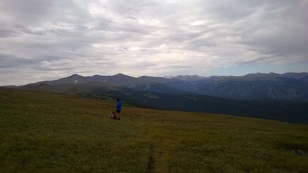
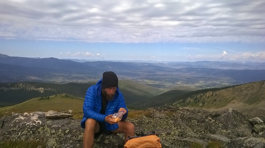
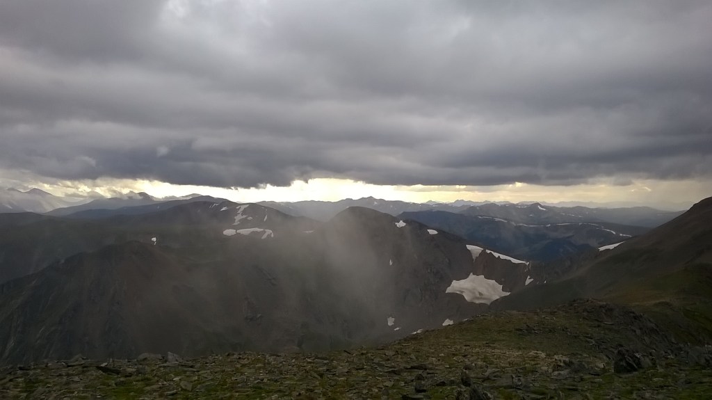
In the morning the climb was tedious. It was sweaty from the word go and I had an awful time, but cresting onto the ridge line, the views high up became phenomenal walking between 10,500 and 13,500 feet for the next few days. I know I said in the last blog I would be far more careful about thunderstorms, but what can you do. The first thunderstorm of the section was on James’ Peak. We opted to take an over mountain route with some scrambling instead the official hike to the valley. A giant cloud rolled over right as we crested the summit, and we descended in a rush to a ridge that would take us onto Mt. Bancroft. We sheltered in a small pocket on the ridge between two large blades of rock. We listened to the lightening crack around us, but felt reasonably secure in our small haven. An hour or so passed before we moved off again as the clouds appeared to be dissipating. It was well into the evening by now and we arrived at what seemed to be an old weather station high on the mountain. A couple of collapsed weather vanes and radio towers scattered the area, and a large deserted aluminium box stood tall. With another large cloud approaching fast, we decided to stop the night in the old metal box. Inside, the old wooden floor had collapsed but we sorted a few boards into sleep-able decks and rolled out our sleeping bags. That night I was hassled by a persistent mouse determined to get my food. I lost a lot of sleep chasing it away, and kept re-awakening to the sound of its teeth against the fabric of my drybag. In the morning I woke to discover it had pooped in my shoe as vengeance for denying it the goods.
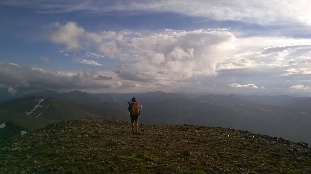
The next day we woke with little water (we had been up on this ridge most the previous day) but had a long gentle ridge that would descend and bring us to Berthoud Pass. The pass was slightly infuriating. We were out of water but could hear we were only a few feet from it. The stream here had been capped off with a large steel grid that was padlocked down. After a while we accepted we wouldn’t be able to get any water and moved on, climbing back up the ridge on the other side. In another few miles there would be a stream. A few hours later we arrived at Jones Pass, joining a forestry road. This was just in time for the next lighting storm. There was no possible fight so we chose flight, sprinting down the road to seek what we perceived to be the increased safety of the trees lower down. The bright flashes struck all over, keeping our motivation to move high. At the bottom we took a long lunch as the storm continued to rumble, filling our tired bodies with-you’ll never guess it-more ramen. We could see lighting strike higher up where the trail would carry on and overcome the mountainside, and there was no hurry to be there. We watched a movie on my phone and eventually decided the rumbles had quieted enough for us to carry on. On nearly gaining the ridge, the rumbles started again, thankfully not breaking into flashes. On top we were treated to a sight of hundreds of Elk littering the mountain, watching them scatter as they spotted us. We were quite a few hours behind schedule due to the lightning storms, and Kirsten was going to be waiting at the other end of the trail for us for quite a while. As the sky faded from blue to yellow to grey, we dropped into one last valley before crossing a river and slowly making our way up the hillside towards Ptarmigan Peak. Enshrouded in the inky black, Tribhu led the way, and I kept looking over my shoulder expecting a wildcat to launch from the dark and take me out. I really wished I was hiking in front. Tribhu had a small LED lantern fixed onto his waistbelt for lighting. When turned around from a distance, out of the dark, he resembled something I can only describe as Legolas with glowing crown jewels. We couldn’t find the trail but slowly meandered up the hillside, stumbling and getting stabbed by invisible branches as we made minimal progress. Our batteries started to fade but in torchlight ahead we spotted a small white shining bead fixed to a tree. From this bead we see the next and realise we have found the trail, like little stars of hope in the dark forest. Getting late and feeling tired we accept we won’t be flying over the hillside and not really knowing how much of the climb is left we pitch up on some poor grass for the night. The clouds were in thick and everything seemed damp.
In the morning we woke to find we had a stones throw of a hike to the top. On top, Tribhu managed to message Kirsten and tell her we were OK. She hadn’t panicked and presumed we were just a little delayed. The sun shone gloriously on this grass covered peak, giving a great view down into Silverthorne. I remember this descent felt long. Really long as it would slowly wind down the mountain towards the finish. The smell of pine once again permeated the air, awakening the senses. Reaching the end of the trail Kirsten was waiting with iced coffee for us both. After a much needed coffee and thoughtful deliberation, Tribhu and I decided to hike the last few miles into town. Although the ride would have been nice, Tribhu wanted to ensure that his footsteps connected completely from one end of the country to the other.
In town, we found a fitness center with pay-for showers and my first scale since I’d left England. I’d lost 30 pounds in the last two months, which came as a surprise seeing as I had stuffed my face at every opportunity. Tribhu would spend the day in town with Kirsten, and I spent the day shopping for a new pair of shoes before I met Beads at a brewery in Dillon. The bartender serving us gave us our beers for free, thinking a thru hike sounded pretty cool. Trail magic strikes again. After dark, Beads and I slowly hiked up the valley towards Copper Mountain to pitch our tents. We were treated to a firework display down in the town as we ate more ramen and waited for Tribhu to catch up.

nearing the top of James Peak, with large clouds rolling in 
walking the top instead of taking the lower paths 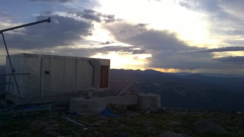
sunset 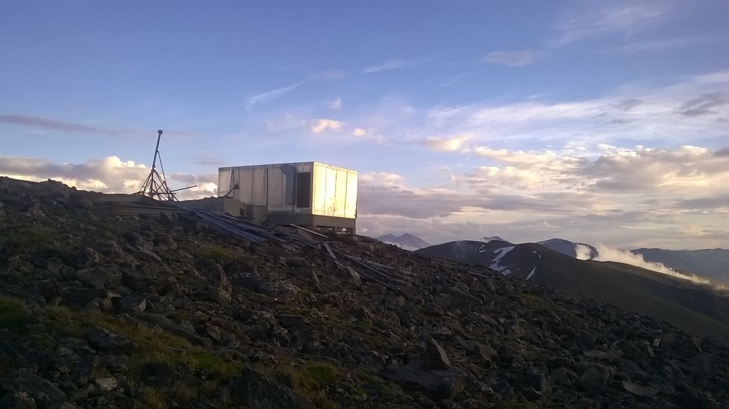
base for the night, morning view 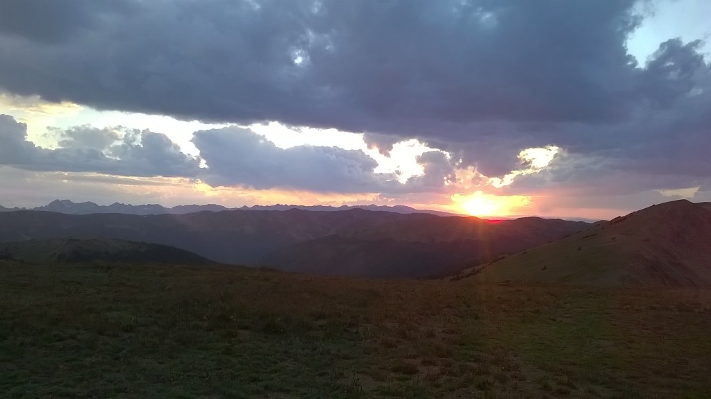
sunset on the last evening before descending into the valley 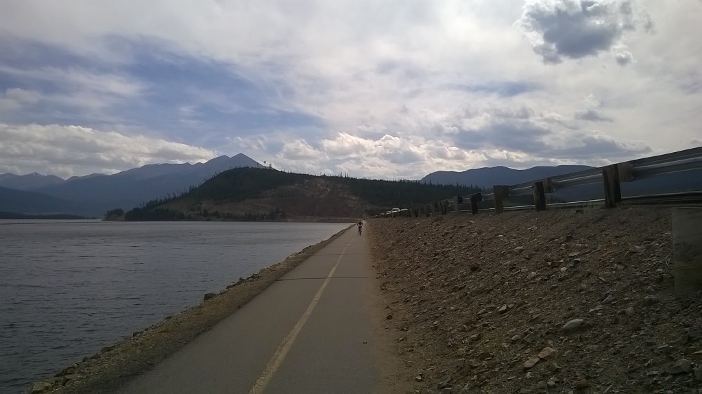
reservoir between Silverthorne and Dillon 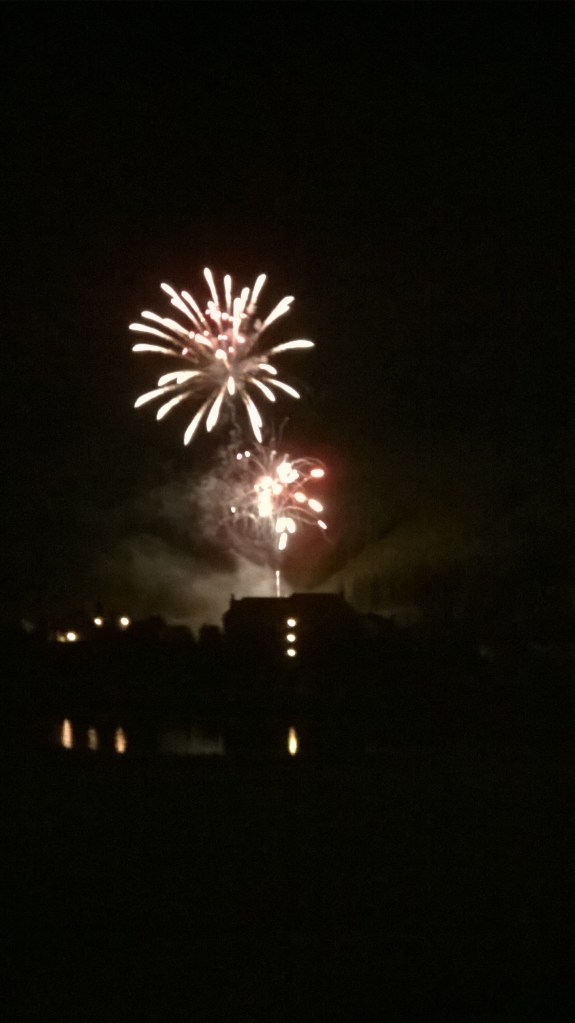
a free firework display to eat dinner to at Copper Mountain


