Hiking The CDT- Part 7-Leadore To Lima

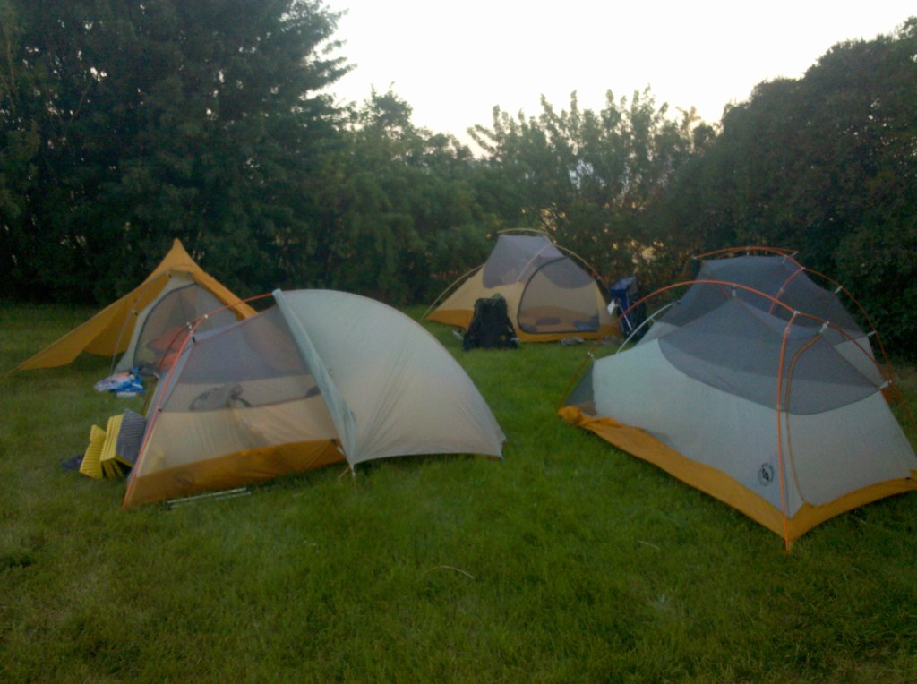
Nothing in my life mattered at this point apart from hiking. Hitching back to the trail, I felt good and was ready to lay down miles. The only considerations I had at this point were eating enough food, and not getting too lost. While in Missoula, I paid a trip to the outdoor store and bought a new bigger camping pad. I was becoming tired of sleeping on dirt. It was a plush Big Agnes Air Core insulated pad, around three inches of comfort, with raised rails on the side. It was like the Rolls Royce of camping pads. In some ways I preferred it to a real mattress. The down side, sitting for a prolonged period in the evening and blowing into it to inflate. But the extra weight and time I viewed as worth it.

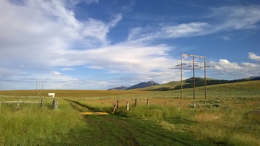
The CDT through this area is poorly marked, and you will not find sign posts helping out. It was a maze of forest, small hills and large open areas. I was out ahead hiking on my own on the first day and sat in a wooden throne on a lakeside. I ate some Doritos, and contemplated this next section. My habit would be to study the next ten to fifteen miles of map, and paint a visual picture of what it might look like and where I might turn. I would note things like how high the hill would be on one side and how far up it I would need to be to find my path. The details that can be gleaned from a map can be quite surprising with practice. If there was no trail, I would pick a landmark in the distance and walk towards it. If I could not see a horizon, I would take a bearing on my compass and just walk, combining it with the knowledge I would hike around a mile every twenty minutes. Later that day when the others caught up, Trackmeet in a detectives voice stated ‘Ben, I know it was you sat on the throne at the lakeside, there were dorito crumbs, ranch flavour to be exact, and I know that’s your flavour.’ … Busted. There was no denying.

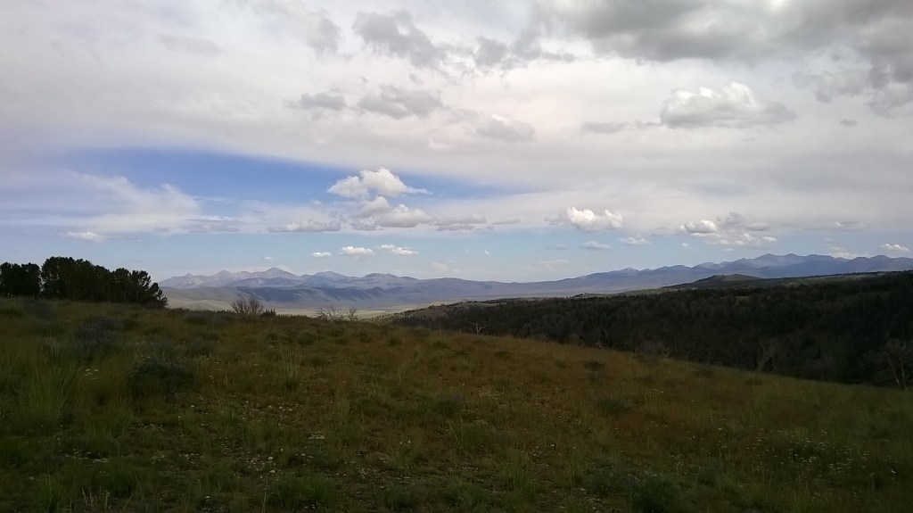
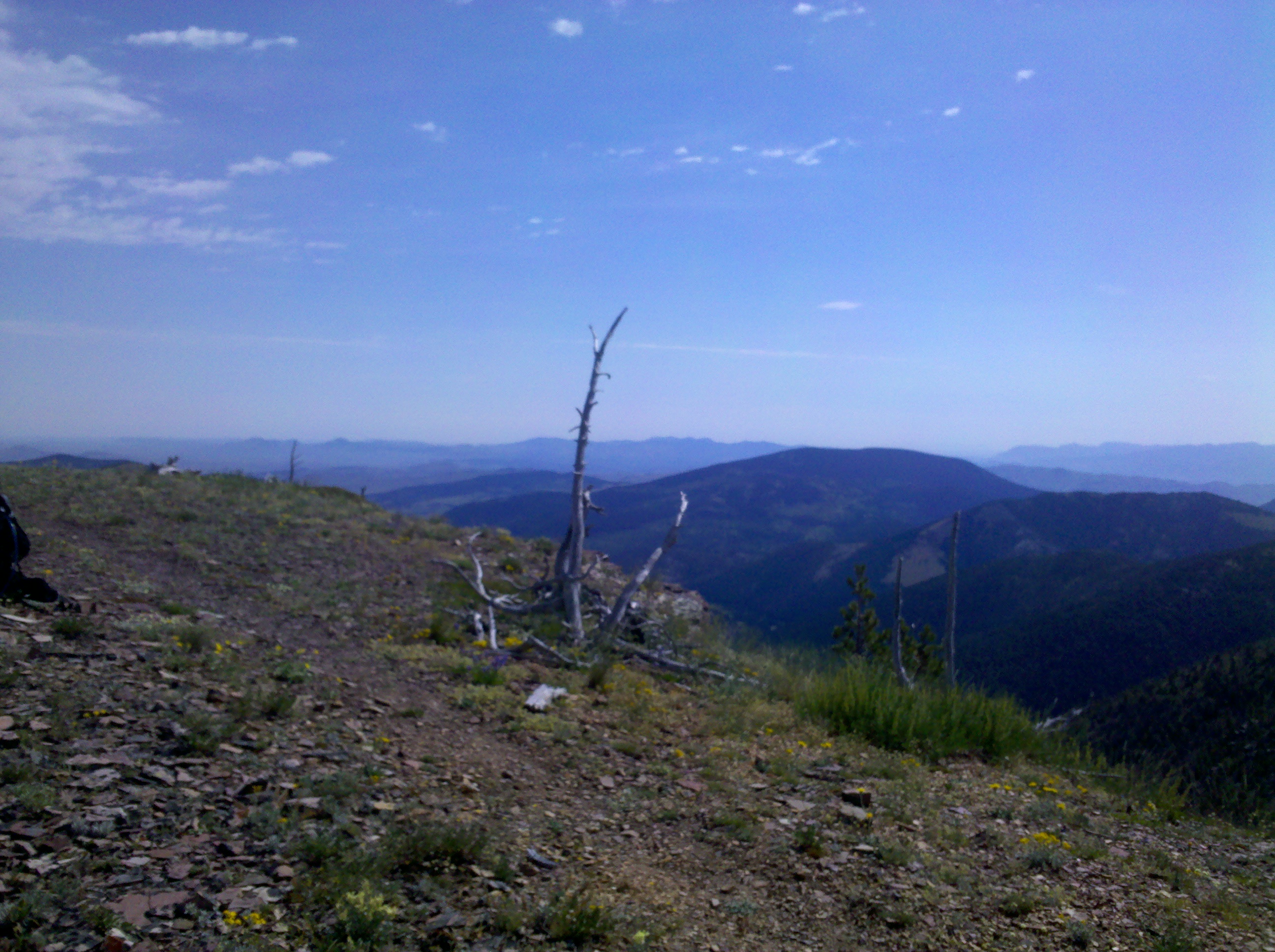
We hiked on a way and came across one of the most ‘American B movie’ sounding areas I have been to in my life. The “US Sheep Experiment Station”. Like something out of a Sci-Fi movie gone wrong. Who knows what black sheep lurk around the trees. I didn’t see any sheep but can only presume in this area they were bigger, meaner and more inclined to eat meat than their smaller cousins elsewhere in the states. In this section trees became sparser as I hiked and so did the trail. Often disappearing for 5-10 miles at a time. I had to pay a lot of attention and found if I didn’t check the map I would become lost quickly, and trying to reconcile yourself with a map in high heat with little water becomes draining fast. I know the others had an easier time using their phone to navigate, but there is a sense of satisfaction knowing you can carry yourself through the wilderness without aid.

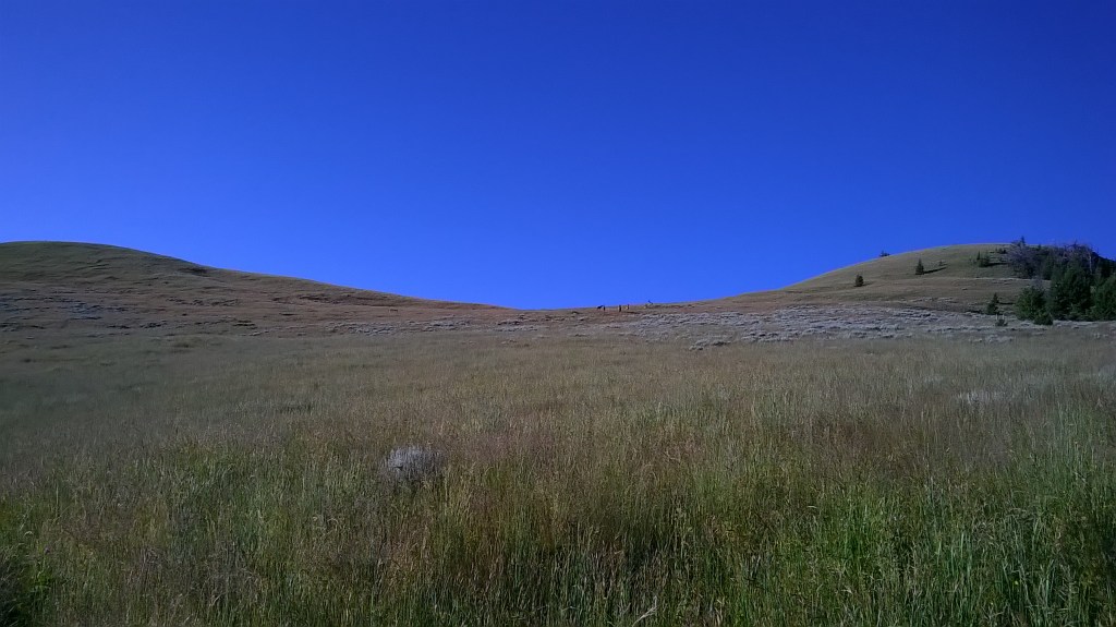
On the second day I was coming into a large open vista that sticks in my memory, I stood on the edge of a hill looking at the miles I had to cross. Lighting was striking the ground maybe fifteenth miles off to the North. I double checked the map. The clouds were moving in the direction of the opening I was eyeing up. If it struck while I was out there, there would be no shelter. But like everyone seems to say, you gotta get the miles in. So I proceeded. It’s admittedly quite insane to hike into something you know will happen. Having lightning striking the ground within a short distance really makes you question what your doing in the middle of a large, flat opening on your own.

I picked up my pace and started across the clearing. But my effort was for nothing as right in the middle rain began lashing down and lightning began to strike. There was a small depression of ground that dipped maybe four feet and I hastily pitched my tent and crawled in to shelter. I suddenly didn’t fancy the few miles to the other side and bunkered down like this felt slightly more secure. It was like mortar rounds dropping around me without warning. All I could do was sit and hope the shallow scoop and 15d nylon tent was enough to protect me from the million volts spasmodically striking the area around me. But just as quickly as it had come it was gone and within a quarter hour it went silent. I packed up my soaked tent and hiked on. These sort of quick hitting lighting storms happen daily in the Rockies and trying to hike a ridge from one end of the country to the other exposes you to a daily barrage of fear.

On my final day in this section I was dropping off the ridgeline from one valley to the next searching for water. Earlier I had noted on my map it looked like the last water would be a stream before climbing onto the ridge, and made a mental note to MAKE SURE I PICK UP WATER. I forgot when walking past it and carried on up the hill. Near the top I realised the mistake but it was a big hill and I didn’t want to turn back. This turned into a torturous mistake. From maybe five miles along the ridge I dropped a little way into one valley, hoping for water. Nothing. I climbed back up, I then dropped off the other side of the ridge into another valley, still nothing. I climbed back up, I was wasting so much time and effort for being lazy in the first instance. I dropped into one more valley, there was a slow trickle of water in a cow infested area. It had Giardia written all over it, but I did have a filter. I slowly filled two bottles as mosquitoes stabbed into my neck, face, and legs. Swinging to kill them and dumbly holding my breathe through the agony. When the bottles were filled I brushed myself all over and ran clear, climbing up the other side of this valley and back to the ridge. On the ridge I sat down to eat biscuits and relax. I had just wasted a couple of hours I didn’t need to. The sky was clear and sun beating down on this weary hiker.

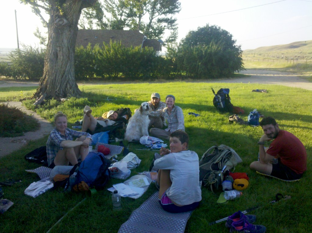
Off in the distance I saw a hiker approaching, and I figured I would wait til they caught up. At the speed I’d been going I still didn’t think it was Spark, Trackmeet or Carrot. I waited, glad to be away from the pain of the valley. The hiker caught up with me. ‘Hi’,. I said. ‘Hey’ came the response. ‘I’m Tribhu, you must be Ben’. We talked about how he had been a little behind me for weeks. How every hiker he had spoken to told him an English guy was just ahead. It must be crazy hearing every day someone is just a hair whisker ahead of you. Like a shadow that can’t be caught. Then we talked about the next road crossing. On the map there was a star mark with the annotation to call a number and refer to ‘the star’ for a ride. The number given was the motel owner in the next town and he would gladly pick up a hiker in return for a nights stay in the motel. It was on the edge of an interstate and as such not a place to be hitching. Tribhu said ‘Well, I’m a pretty fast hiker but my girlfriend is going to be waiting for me on the roadside. If you hike fast enough you can have a lift into Lima(the next town/gas station)’. More than happy with the prospect of a ride instead of 10 mile road walk, I joined him.

It was a scorching day and I didn’t want to miss this ride so I laid the pace hard. At the end of the first climb I looked back down to him. A moment later he reached the top of the climb and said ‘ Whoa, I didn’t realise you could hike this fast, I haven’t met many other hikers that can do this pace’. I didn’t say it, but the truth was I was hiking so fast because I didn’t want to miss my ride. We carried on chatting over the next miles both focused on the next point of water. Marked as a trough in a valley, we made particular note of it as it’s where we would drop off the ridge line, and it would be the valley we walk out of. As we descended, the heat intensified and the ground became flat and barren. We hiked at a near jogging pace for many hours, I think averaging around 4mph. The time ticked slowly while maintaining focus on pace. I was dehydrated and it was a bit exasperating. By the time we hit the road I was done for the day. Officially the trail paralleled the road for a mile but I decided that was enough. I felt like I had run a marathon and said goodbye to Tribhu. I would cross the road and wait for a ride here. I was burned.

Twenty minutes later Tribhu pulled in with his girlfriend and gave me a ride after finishing the extra mile. The Motel we arrived at ten minutes later was cheap and cheerful. Not renovated since the day it was built, it was a time capsule to a gone era. I did a shop for food from the gas station then showered, watching pools of baked on dirt wash off in waves. I chucked my clothes into a washing machine and sat back, trying to focus on an old rerun movie that was playing on tv. A short while later Tribhu was at the door to tell me he would be taking the following day off with his girlfriend and I could have a day off too or see him further down the trail. I went to sleep and the next day feeling rejuvenated, decided to hike. Waking late I went into the reception, a friend of the Motel owner was heading back in the right direction but only half way. I was grateful for the ride and left a quickly jotted note on Tribhu’s windshield. I ended up walking about an extra 5 miles that morning and although I lost an hour and a half to it, I wasn’t concerned. I felt bedded into the trail and was at home in my world.

Hiking The CDT – Part 4 – Helena To Anaconda

Back at the pass after a successful pit stop in Helena, Kathleen and I hiked on, starting early afternoon. At this point my feet were toughening up and developing thick callus. I ditched my uncomfortable hiking shoes and picked up a set of cheap trainers. With a new level of comfort we advanced. Most of this day was spent walking through thick forest, breaking into meadows, some old forestry trail long since disused and overgrown. Reclaimed by nature, the trail either wasn’t well marked or we just weren’t on it. At one point a tree on the other side of the valley fell and we were there to see and hear it. In the hundreds of years it had stood tall and grown, surviving storms, droughts, fires and weathering. In this blink of an eye it was gone., the last day of its long life. I would be on this earth for half its own life span if I am so lucky, of the thousands of trees over the thousands of years, that moment was its last and life goes on, just like mine one day will. I hope it left a good dent.

We were cutting across country on a rough bearing according to where we thought we should be on the map. It was a little cooler today and we went at a steady pace. We knew ahead of us somewhere was a hiker bubble. The ‘bubble’ is a main group of hikers much like a peloton in a cycle tour. One fact I hadn’t mentioned so far is all the hikers that started on the Mexican border and hike up to the San Juans in Southern Colorado had been stopped by high snowfall, but this stoppage coincided with the trail opening up enough at the Canadian Border, so many of the hikers did what is know as a flip-flop. A jump to another part of the trail, to start hiking South. We knew from the last trail log (a small ledger kept at trailheads, signed by everyone who passes) that the bubble was on this trail earlier in the morning. And we were likely to see them the next day. Kathleen hoped her two friends would be near by. We were taking a break at the side of a gravel forestry road close to sunset, and, while deciding which route to take, heard a shout from the brush beside the road. Another hiker was at down relaxing waiting for the bubble to catch up. Some how we had trimmed time by cutting across country and managed to get ahead of them. A few minutes later they arrived. We all pitched up inside the brush and sat chatting till dark. Waking the next day the whole group set off in a broken manner. After hiking til around mid day with some of the group, we came across Kathleen’s friends having lunch by the river. The next day was spent ambling along and chatting. I was running on solar power and my phone spent most the time dead so I didn’t get many photos of this section. I won’t start on the hassle with the roll up solar panel I thought was the solution to all my life’s problems, but in the next town would replace it with more suitable means. The penultimate day of this section, was known as the Anaconda Cutoff .

The Anaconda Cutoff, as in title, cuts off a large loop from the official trail, 90 miles to be exact off the 3100mile hike, and most CDT hikers opt for it. By opting for it you pass through the town of Anaconda. Which is a cracking small town with shops, motels and even a small bowling alley. Logistically easier but with the downside- a very long boring roadwalk for 15 or so miles into the town.

The walk was long and passes both a juvenile Penitentiary and a state prison, with signs warning not to pick up hitch hikers from the roadside. I imagine the look of a bunch of scraggly people hiking outside them causes nervousness among the locals. We approached the road section on the evening and a local informed us the campsite we were aiming for on the edge had closed down, and invited us to camp on his front lawn instead. The so called trail magic had struck again. I was quite surprised a stranger would show this kindness to a group of 8 hikers. I had more expected a pointed shotgun and ‘Get away from my property!’. The next morning we completed the trudge along the road and into town. First port of call- Mcdonalds. Everybody likes a good burger and a group of lean calorie consuming hikers are no exception. The bubble of hikers intended on spending the night in town but I knew a town stay would kill the bank and I was hungry for more miles. I did a shop for food and while I was on the pavement outside the store a police man came over and asked what I was doing. I looked near homeless, with a dirty shirt and mud-up shoes. I told him what I was attempting. “Wait here” he exclaimed before driving off. Ten minutes passed and he pulled back in. In a bag were maybe 10-15 dehydrated hikers meals, the kind that weren’t in my budget but sold at any good outdoor store for $5-10 dollars a piece. Having the option of scrambled eggs for breakfast, chilli con carne for lunch and a curry for supper was a real treat. He also gave me a fabric police badge from his precinct as a memento and a story behind the numbers on it with a reference to lawless times. Being something you cant just buy easily, its a favourite memento. I still have it.

I said goodbye to the bunch and hiked off down the road to the start of the next range I would hike. This had a great feel, my legs sped along. It was another ten or so miles of road walking, which was interrupted by a local running out her house to give me an ice cream. I could get used to these surprises. I found the forestry trail that would lead onto my next footpath.  The target I picked for the night was a lake. I was glad not to be stopping in a town for a day off. Here is a rough equation, if I pay $70 for a motel room the night I get into town, $20 on breakfast, $20 on lunch, $35 on dinner, $70 more for the final night’s sleep then I’ve spent $215 for the 24 hour town stop as a minimum. A stop like that every 150miles on a trail like the CDT would be around an extra $4000. To hike a bit further and have a better chance of finishing my hike, more like it. I carried on climbing the 4×4 track until I passed a sign banning bikes and cars, from here it deteriorated significantly until I was smashing through brush knowing I must have taken a wrong branch earlier. But in words echoed eternally through the minds of many a hiker ‘Always push forwards’, and so I did.

Eventually I pushed far forwards enough to break through to the trail I was supposed to be on. As the sun began to dip I pitched my tent beside a lake, ate one of my new tasty meals, and zipped into my tent to sleep. I felt a little lonely that night knowing everybody else would be back in the town bowling and drinking the night away. It was also a strangely spooky place, I had bad vibes from it and didn’t sleep easy. It looked so idyllic when I had arrived, but as I lay I imagined this grassy constriction being visited by larger creatures in the night. But enough, tomorrow, I would start hiking big miles in a way I didn’t know was possible. It was time to let loose.

2015-07-03_21-33-13_358
The Place I pitched up for the night

Hiking The CDT – Part 3 – Lincoln To Helena

On a Sunday morning we rose up and went to the roadside to hitch back up to the pass. It was quiet, with the odd car heading to church I guessed. Not many rides going for three people. It took an hour before a van pulled over and a gent told us to hop in. Dropping us at the pass we climbed straight up, thousands of feet til the vistas opened up. A beautiful day. Today each of us went at our own pace, with me out ahead. I sat on a rock for a while. Now, you might guess I’m about to paint a perfect picture, taking in scenery before me. But it is on this rock I left my first pair of sunglasses. A pair I bought from the gas station for $19.99, and honestly, I liked them. But didn’t like them enough to hike back 5 miles. Sod it, I would hike without. And how painful it proved on the eyes. I learned from this to make it so I couldn’t possibly lose another pair again, by using a bit of cord around the neck. I would have mocked it as a child but my how I now understood why people with glasses do it.

On we walked until the next pass over the road. Early in the day I sat and read the map waiting for the others. The maps- Now, over the years of people attempting to hike this trail a man called Jonathan Ley decided to make a downloadable version of them designed for A4 letterhead paper which we all have a printer for. On these map are annotated details, thinks like ‘spring located here’ which, when mainly following a ridgeline, is mighty handy to know and helps plan where your next water source is. Or contact details for local Motel owners willing to give a ride to the pass and back. At this particular point on the map where I sat the annotation said ‘this is the only water source for the next 18 miles’. I’ll be honest – I cant remember if that’s exactly what it said, but know it well, I filled up to capacity my 4 litres of water and let the others know.

As we walked I also told Oldschool and Kathleen that after the next town I planned on picking up the pace and trying for some bigger days. As my aspiration was growing but bank account was not. We finished the day camped at the roadside below the next climb. The next day would be one to remember.

At a time of year when one expects cool temperatures, Helena Montana was experiencing a heatwave. Up the mountain it was no different. It was scalding heat. Missing sunglasses was tolerable, but this heat was not. Combined with the heat was a 24 mile dirt roller coaster with no source of water, which doesn’t sound bad but it was. Lots of up and down, for mile after mile. With little in the way of respite. The issue with the continental divide is it tries to follow a dividing ridgeline. My dehydration was so bad my tongue would stick to which ever part of my mouth it touched, and pull off painfully when I tried to move it. Salt was crystallising all over my body and face. Down at Helena it was 38c (100f) and while it was a little cooler a couple of thousand feet up, it was no joke. We were aiming at a dot on the map marked as a spring. The hours ground by painfully. This was probably the worst dehydration I had ever experienced. Dust kicked off the path with every step. I was a long way past sweating, there was no water left to sweat out. When the spring came in to site it was joyous. I was ahead of the others and walked towards it confident in my saviour of a small puddle of water. Fenced off to prevent cattle contaminating it I climbed over and approached the boxed off cool water, cool fresh clean water, an ice cold beverage of mountain spring water which was… full of dead rodents. My heart sank. The lid to the spring was ajar, and inside many dead rodent, possibly squirrel like, but in their state, hard to make out. It was torture, the choice between this contaminated water, or dehydration. The others arrive. I showed both of them. Even with a filter it wasn’t a prospect I would look forwards to.

The next spring on the map was 5 mile further. After for how far we had walked, that isn’t far. But after a day of being dried out slowly by the burning sun. It was. Sometimes luck in life is low, but for us it changed so quickly. A couple on a quad bike in the distance were passing, we waved at them and they came over. Explaining our situation we asked if they had any water. They said no. But, the husband reaches over to the cooler box on the back of the quad bike. He pulls out an ice covered bottle of Cocacola. ‘We do have these though, and some fresh fruit on the ice’. If ever there has been a commercial worthy moment on the face of this planet, this was the moment. The planets had aligned.  I took the bottle….. Slowly unscrewed the cap. Paused, the condensation ran down the side onto my leathered hand. I held it up into the light to experience the translucent syrup in all its glory… turned sideways… and poured. At that moment, no one had ever experienced a more perfect silhouette of a man drinking ice cold heaven. Sounds good huh? In reality flies were buzzing around driving me insane and the Cola almost felt like a burning cold, I gasped for breathe and drank again. Man it was good. The couple gave us a mobile number and an invitation to their house when we made it to the pass for showers, food and laundry. What a day.

Feeling like a million dollars we hiked on into the evening. It started raining. Then came the lighting. I watched from the edge of the tree line, seeing it cracking across the sky and striking the field before me. The flat land between me and the next car ride. That was enough for the day. We went back into the trees a little way and pitched up for the night. Flashes bringing full illumination to the inside of my tent before reverting to blackness. I sipped a small amount of Black Velvet Whisky I had in my pack and went to sleep. This was a pass day, Oldschool was up in the dark and ready to go. These are the days you want to get into town early, enjoy civilisation to the max then get out by evening. We hiked on through down beautiful lanes the last 10 miles. Arriving at the pass we stuck thumbs out and moments later were on the way down again. This time riding in a pickup with a man shocked about the news of Caitlyn Jenner. Its funny five how years on I still remember that detail. Down in the town Oldschool told us he was taking some time off the trail, it had been a rough few days. The trail was living up to reputation. I don’t think it’s the trail itself that is hard, but the massive variation of extremes over such a long distance as a body is pushed hard. In the town, Kathleen rang the number we had and the wife came down with ice cold spring water from their home for us. Man, the simple things in life. We went to our new friends house, showered, had our clothes washed then headed back to the supermarket to resupply and go on. By this time over 400 miles into the hike and half of my intended hike I thought was possible. On the way over to the main road we passed a bunch of kids selling fresh lemonade, which in the heat couldn’t be more welcome.

Maybe this whole hike is just about making cold drinks taste better than ever.

Falling into the dream with Montana

So, today I cycled 83 miles on dirt road, I would have stopped earlier, but I really despise flies and knew from the 47th mile at the 83rd mile there would be a pint of refreshing ale and a swimming pool as a reward. 4 pints later and I’m still telling myself there is time for the pool. I have pitched my tarp sheet in a nice rv/motel park borrowing a towel as I carry non.  Tomorrow will descend on Yellowstone. Hoping to get in early to beat the park entrance fee. I am really settling into this trip now.

The days riding was shear joy, open dirt roads, few climbs and great views (i do enjoy climbs but not at 32c (90f). Playing my repeated playlist again and again I felt like a Don singing out loud with no one to complain. One 4×4 vehicle on the road did pull over to talk, the couple inside had been to my home Lake District and talked of the great beer and a lovely 3 weeks there. I do believe Montana is getting close to brilliant beer, or maybe I am just enjoying drinking more of it.  I covered today’s distance in around 6 hours including stops where I attempted to take timed photos with no luck, I spent much time running back and forward and I have lots of ridiculous photos of my back running from the camera, there seems to be an auto motion sensor fighting me; I will sus this sometime soon. I am just over the border in Idaho and don’t think I will be back in Montana again in the near future, quite a sad thought, its been brilliant, the snow, the river crossing, the downed trees, the heat, the views, the cycling, the humbling experience and the friendliest people you could meet in the world who invited me to drink beer with them, introduced me to their families and opened their homes to me.  Sky, Sarah, Josh, Gov, Aram, and the many I knew only for a few hours. thank you all.

I will miss you Montana, goodnight.

The Bob Marshall Wilderness

Three and half days, around 120miles, Swollen Rivers, Downed Trees, Postholing in Snow and Blisters

The Bob Sounds Sweet and innocent, like and old friends coming to greet you, thats kind of what I expected, as I have been through before. But 2 years ago when I passed through it was a low snow year. This time it was heavy.

It starts with a pleasant easy trail through forest to lure you in. Then comes a river which is the start of it. Wading across the fun begins. There are about 14 crossings in the next 8 or so miles, spaced out with short walks on trail that has not received yearly maintenance yet. Because of the heavy winter snow the trail teams haven’t been clearing the fall trees yet. But as the day goes on and the crossings vary, some shallow and fast, some deeper and slow, all of them dumping copious amounts of stones in our shoes, and the legs beginning to numb up from the cold the excitement of another crossing fades quickly, we laugh though. Im hiking with Josh again, His supreme fitness pulling me though and my vague memory of the route making for easier navigation. Its not terribly hard in ‘The Bob’ but its nice not to consult maps. Towards the end of the day I begin to flag (around mile 32) but Keep pushing, As the light begins to fade we pitch out tarps at around 38 miles in. I cook up some noodles and stare down the game trail I have just pitched next too. Would any bears use this at night? Im too tired to care too much, finish tea, and climb into my bag.

The next day I wake feeling brilliant like the trail has brought me back to life, the blisters I have don’t seem to cause any hinderance in walking, I recall the route from last time and we do a short bit of cross country through forest to find the trail a bit higher, over a small pass and into Strawberry Creek, the last time I was here the trails had been cleared, this time it was clambering over one tree after another. At the bottom of the creek, a trail team has just entered the valley, I can’t help but feel if I set off 2 weeks later, it would have been an easier walk. The team warns us about the river level and that they wouldn’t do the crossing lower down. But we have come so far and not wanting to be deterred push on. The crossing was at an island, at the far end a cluster of blown down trees and branches washed together and holding under pressure from the water provide access to the island, Crossing this I could hear the water rushing below. On the island we go through some bushes and reach the second crossing, its high, fast flowing, and plenty of downed trees with branches pointing down to create traps and nasty endings if you were swept off your feet. Slightly higher seemed the best bet. Its the only crossing I did not photo due to the more real danger. Over this river and the Bob goes wilder.

We meander our way up the next valley, sometimes walking up the waist deep stream where the path has been washed away. Its snow melt water and very cold. Climbing higher we enter the snow line. I had planned on having lunch at Davis Lake but after slipping, sliding, potholing the way there, along with the wind beginning to howl, and arriving to a half frozen lake, we quickly eat some snacks, put on extra layers and push on to Switchback Pass. I am glad I kept my ice axe now as this required a steep traverse of a few hundred meters followed by a short enjoyable ascent up a slope to gain the pass.  We are aiming for a ranger station in the next valley. Its cold, my feet hurt with blisters, and as we descend it begins to rain on and off. 7 miles, doesn’t seem far. By the last mile and a half I’m slowing, Josh is ahead. The downed trees here are humbling, the physical effort required at the end of a long day really push me. As I clamber over and through the only way I can see possible my pack snags and pulls. 1 Mile to go I tell myself, as around every corner even the smaller trees seem bigger hurdles,  half a mile, and the kind of agitation hearing a dentist drill causes sets in. As the station comes into sight I see Josh gathering fire wood. Im relieved, I join him. We camp with out sleeping bags lay out on the porch saving the effort of pitching tarps for another night.

In the morning I wake, turn on my stove for hot coffee and drain my blisters with a pin as I wait, the drop in pressure instantly relieves the dull pain. This morning starts with a river crossing within seconds, followed by a long gentle ascent up a valley, at one point we can’t see the trail for downed trees, so we scramble down the hillside, clamber along the valley floor and climb back up further along. We head for Chinese Wall, an impressive cliff we will follow for 5 miles. When we gain sight all we can see is the snow we will have to get over. Its been a sunny morning and this makes the going hard, potholing at 1mph for around 3 miles. But the snow clears and progress speeds. Along the footpath I can see big bear prints and wildcat prints. I wonder how recent they all are. After 3 full days of hard work and battered feet I’m tired. We descend the final time towards the Augusta Hitch, I have already said I’m getting off here to rest. Josh is ahead but I see no sense in tiring myself to catch up. I sit down by a river eating trail mix, pitch my tarp and sleep. The next morning I have 10 easy miles of good trail to the trailhead. Im kinda glad ‘The Bob’ is over, pretty as it is.

Glacier Park- Cold, Wet and Happy part 1

So, Me and my friend Josh have just finished hiking Glacier park.

Day 1…..  After getting permits we started from Chief Mountain on the Canadian border crossing. Walking through long meadows, and hiking to the top of Red Gap Pass, which was clear of snow, the descent down made easier by glissading a snow field on the other side instead of walking the switch back path. At the bottom of the valley as we come through a clearing a grizzly bear pops up and runs a few metres, we hear what we think is another bear in the trees and walk quietly on. From half 1 to half 8 we cover 20miles and feel like progress in the park will be good.

Day 2….. The morning starts well with a black bear encounter , Josh leading the way and the bear jumping up about 10meters away and sprinting to a safer point away from us(see pic). We take this as a good sign and keep hiking. Around 8am it starts raining, heavy. As cold as it is we push on, occasionally climbing over the downed trees from the winters avalanches, the forces involved in stripping the hillside and tumbling and splintering them to pieces must be immense. A few hundred feet up the valley we hit the snowline. The path cannot be seen so we make our own route, crossing snow bridges and keeping in awe of the tree tops pointing out of the snow. Because of the heavy rain we decide to scramble out own line up the pass instead of risk unstable snow slopes. The wind cuts to the bone through our wet layers so stopping is no option. We push as fast as we can to the top and descend over the other side, crossing snow slopes at pace axe in hand to arrest and falls. As we descend we pick a route carefully to avoid the cliff edges and weakening snow bridges, some looking no more than 6inches thick and spanning metres over icey rapids we hear running below. By the time we descend to the going to the sun road we are struggling to stay warm, shivering and jaws chattering. We decide the safest call it to bail out route and come back with dry gear. 7 hours of continuous rain and wind whilst winter mountaineering was not the original plan. 25miles covered this day. Finished by 3pm.