Back in the Hostel in East Glacier I was having a day 4 off. I was sat around other hikers and being given useful but not useful unconfirmed facts like ‘the Bob’ has the highest population density of Grizzly Bears anywhere in the lower 48 states. But this wasn’t the concern, the concern was that now the easy part was over, the real trail begins, the reason the CDT had its reputation. The Bob Marshall Wilderness section covers approximately 200miles of trail. For hikers that planned it, you can mail a package to a ranch at around mile 160 that will collect if from a town and hold it for a fee, but I hadn’t planned thus didn’t have the luxury. I would have to carry enough food for 200miles. 200miles, over 8 days that would be 25 miles a day. Food for 8 days. in hydrated food around 2kilo a day (the weight of a 4500kcal ration pack, which i wouldn’t be using, but it was a good point of reference) or 16 kilos for the 8 days. 33lbs of food. That didn’t seem reasonable. I needed to do more miles. Having just done that kind of mileage through glacier park at over 30 miles per day, it seemed doable. I would aim for 6 days through ‘The Bob’. 33miles per day.
This seemed like a fun kind of challenge, a bet which had me pitting myself against nature. The weight of my bag when packed was heavy, but I streamlined and scraped away every possible gram. The clothes I arrived with, gone to the hiker box, the extra wrapping from food, gone, and just enough fuel to get to the next town. Oldschool asked what I planned on doing about resupply and after telling him my plan we agreed to hike together. At this early point I was already thinking beyond the first 800 miles I set myself the challenge of hiking. My intended daily mileage had just doubled from 18 per day to 33. Early in the morning while the others in the hostel slept we crept out the door and headed for the trail. Inside the National park the trails are well marked and mostly maintained. Outside, the maintenance drops. It gets wilder.
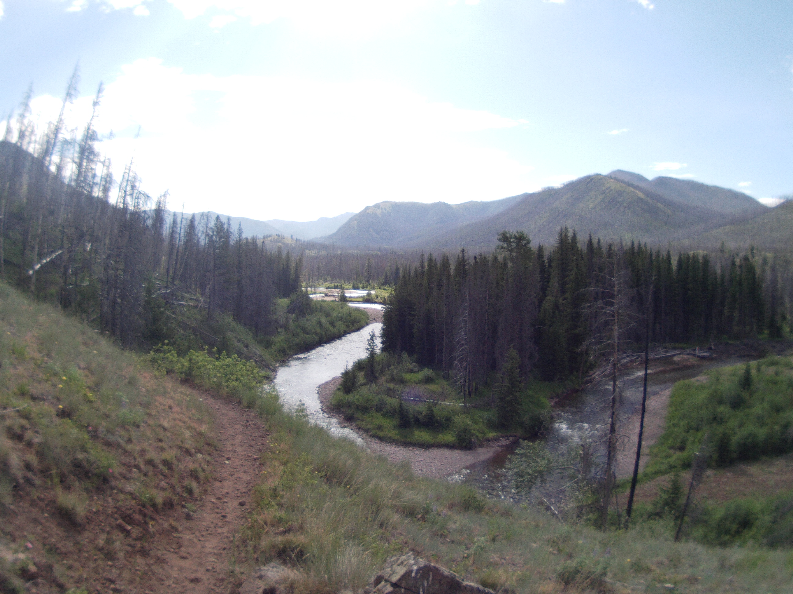
The day off allowed my feet to recover fully and we were motoring along at a steady pace, we picked a crossing over the highway as our place to have a break, 15 to 20 miles down the way. Marked with a large spire memorial to Theodore Roosevelt. Here we met a small group of hikers already having lunch that set off the evening prior. We hiked together a few miles before one in their numbers decided she wanted to cross the bob faster and so joined us. 185 miles to go. Hotsprings, our new hiker called herself, was also aiming to hike the divide and liked the slightly faster pace we were at. The first few miles were pleasant, after which, for maybe 10 miles we crossed the same river maybe 20-30 times. Each time the shock of icey water stabbing into our feet. The crossings were interspersed with meadows that were alive with birds and fresh air. Towards the end of the first day we chanced upon a cabin, a trail worker had taken up residence in ready to start clearing downed trees from the winter. I enjoyed chatting with him but as the sun began to fade we headed off to find a camp of our own. When travelling in bear country there are three options for camping and food storage. First is a bear canister, a great way to store food, screw the lid on, place it a small way from your tent and your done. Simple, but it takes up space and adds a kilo or two to your pack. Second is a bear bag and cord for hanging it in a tree, my chosen method. Its light, cheap, sometimes easy. What they don’t mention is when it is darkening, and you try to find a tree high enough and with a limb wide enough to be out of reach of a bear, your options are not plentiful and often non existent, taking precious time you wish you were off your feet. Time after time I chucked a small stick with my cord attached high into the tree, only for it not to clear the branch. Or get nervous about how close to the tree the bag was, or worry about the bear knocking the cord from the small tree it was tied off to. After what felt like an hour of attempted hanging, I crawled into my sleeping bag and started dreaming of a bear running off with my food.

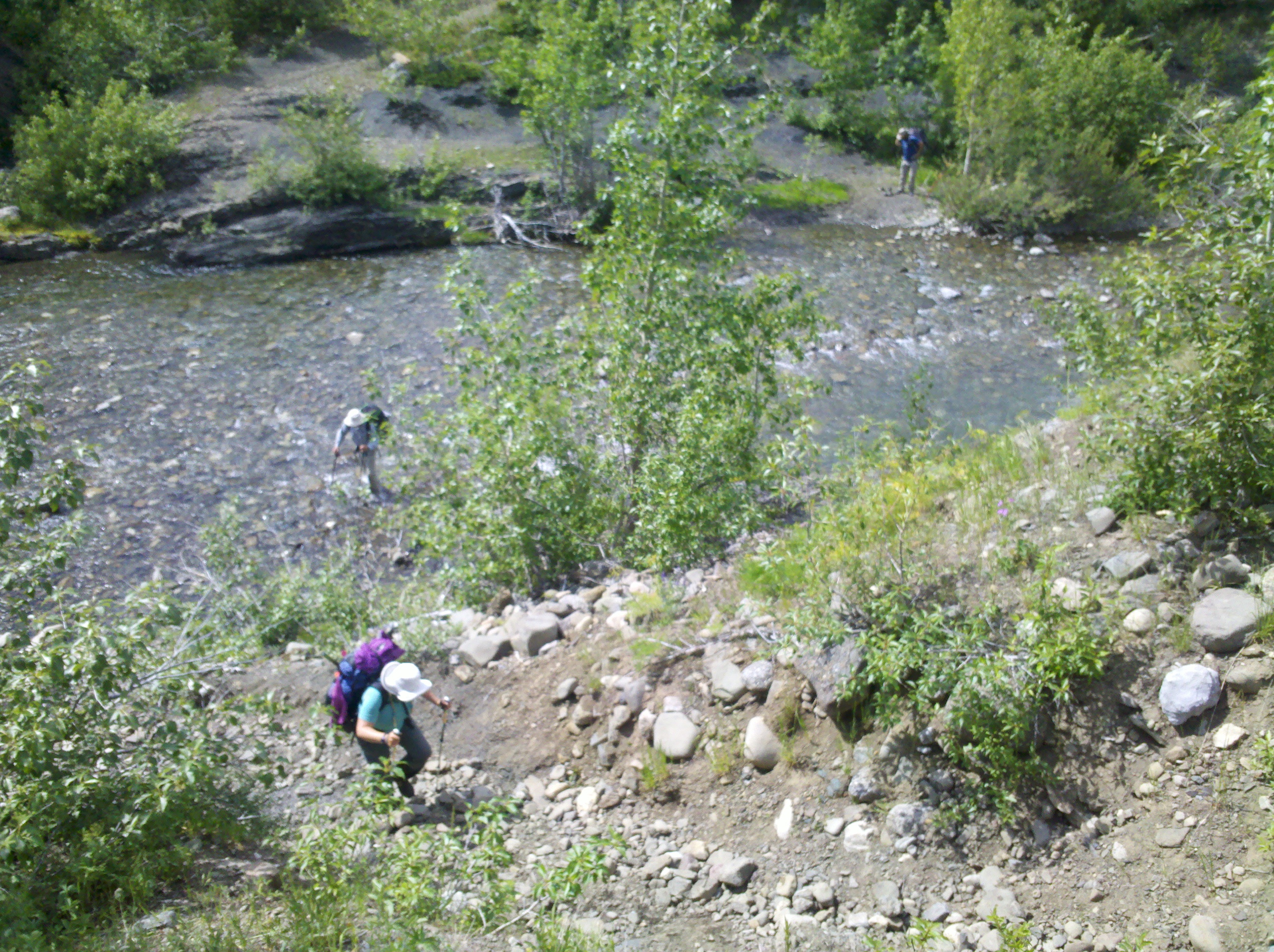
We woke in the morning and hiked on, miles and miles up and down valleys twisting and winding, clambering over downed trees, deciding which route to take. We started hiking through an area of burned forest, which is pretty at first, but gets tiring and provides little shade from a burning sun. I still had my ice axe and crampons in pack just in case but in the baking heat it felt ridiculous carrying these useless lumps of metal. This day was mainly uneventful, coffee breaks, hiking, river crossings until I came across a mobile phone off in the grass to the side of the path, still charged but without its owner. Towards the end of the day while still in the burn area, we opted to camp on a small island in the middle of a river crossing giving us a safe distance from potential falling trees. I wonder what could have happened to the owner. Likely being a thru hiker I could post it on a hiker forum when we get out. Tonight we used the third option of food storage and least advised, sleeping with it in the tent.

In the morning we carried on through the burn and as the valley narrowed we came to what appeared to be an abandoned ranger station, except, there was a tent on the porch, it wasn’t a reach to imagine this tent with a hiker on the trail in front of us could have lost a mobile being used for navigation. ‘Hello!!’ I shout expectantly, hoping not to startle. The response came back and a minute later there stood Kathleen, I discovered she had entered the wilderness a few days before us hiking with a couple of friends, lost her phone, ran back to find it saying she would catch up in a day and walking miles back and not finding it, and not sure which way her friends went, opted to stay put with an educated guess more people will pass. Extremely happy her phone was back she opted to join us and we shared a little food to help top her supplies up. Not a lot, but a token of help. Now we were four. She packed up and our procession carried on. We climbed up and up to Switchback Pass, legend has it there are 99 switchbacks (zigzags to make the ascent easier). I’ll be honest, some of the switchbacks went uphill on the downhills and were a little infuriating when you hike a half mile and finish 20 yards from where you started. I was hungry by the bottom, the pointless turns ground at me as I imagined how far down the trail I could have been otherwise. Five miles on was a station where we had a small fire and washed in the river. It marked the next camp and the start of a bad habit sleeping with food in the tent. I told myself it was reasonably safe, with each days food being divided into ziplock bags and then packing into a rolled up drybag it was reasonably odour proof. Maybe the bears will be offended by my smell before they ever smell the food.


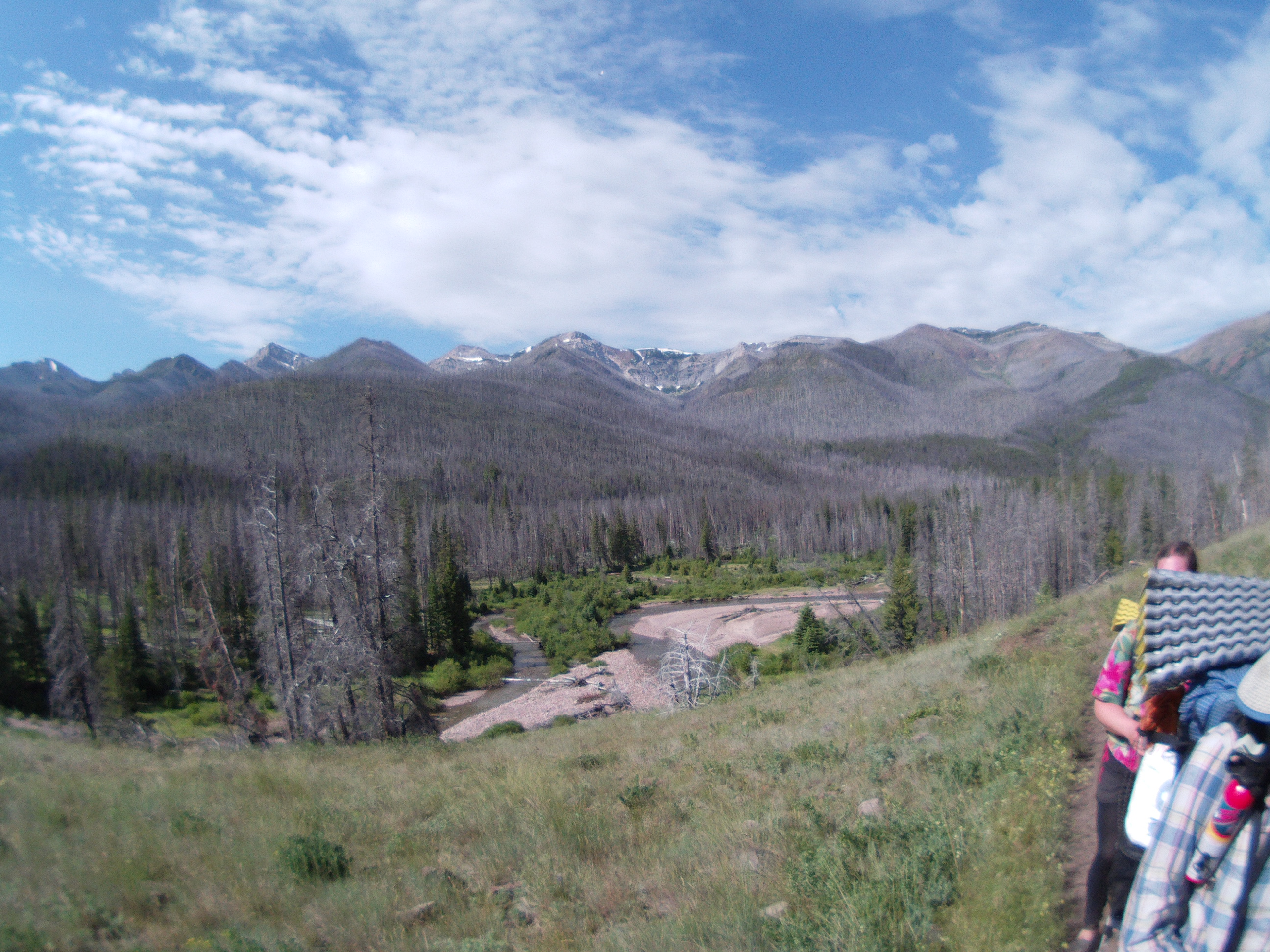


I hadn’t been paying any attention to mileage too much, just knowing walking dawn till dusk would be enough to fulfil the feat. I did notice hiking in a bigger crowd of people, the pace slows significantly. I kept walking ahead on my own, then relaxing and waiting for the others to catch up. I enjoyed this and feel it gave a lot more space to enjoy the wilderness at its own level but still be social. The next day we climbed a pass and stopped by a lake for lunch. I went ahead and dropped over to the Chinese Wall, a spectacular 12 mile cliff with lush green meadow at its foot. Lots of wild cat prints make me keep an eye over my shoulder. I waited for the others at the other end then we dropped down the valley, down and down thousands of feet as we exited the wilderness area. Camping beside the river I stretched out, feeling it a little in my back. We were 10 miles short of the 160mile ranch.
This was day five and right on track we arrived near the ranch mid day. Meaning if we kept pace by tomorrow evening we would be in a town eating good food. The potato, chocolate, and oats diet gets a bit bland, and even the odd bite of beef jerky still leaves me feeling empty. The small forest carpark we spilled out onto would be the end of the hike for many, but we start climbing the next valley up and up. We also left behind Hotsprings, who was having foot problems and I would bet was relieved to be somewhere she could stop. Wishing I had something tasty to eat consumed a lot of my thought process as the climb carried on. This section I didn’t take too many photos, but I had fun, As the light dulled we pitched up and were done, safe in the knowledge the next day would have less than 25miles. By mid afternoon my shoulders could take off the pack.
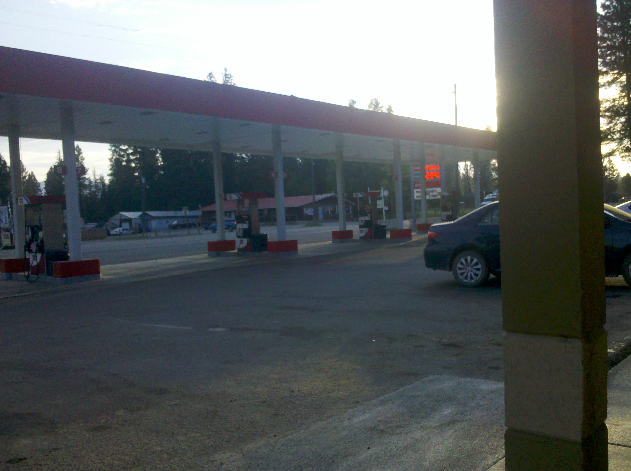
Day Six- the heat, Oh the unrelenting heat, and the pointless ups and downs, who made this trail? Why are we going over every single bump? This time Oldschool was ahead after getting up earlier, leaving me and Kathleen to catch up the rest of the day, we felt sure he would be around the next corner at every bend but somehow was burning the miles quicker than we could. We arrived at the pass and stuck our thumbs out. Within a few minutes a ride drove past, then on noting us drove past again, then finally on the return stopped. ‘I was trying to decide if I should or not?’ we hopped in. It was a student who was pretty high and proudly blasting Pulp through the stereo when he realised I was British. Down we sped in the town. Oldschool was already waiting and relaxing. I went into the gas station and bought a large Cola, drinking it in seconds. For some reason the water had started tasting bland in the mountains. Every sip I had was sucked through a micro filter screwed onto the water bottle, and it was effort. But the CocaCola flowed free! I was keen to get resupplied and going back to the pass, but Oldschool was pretty burned. We sorted a motel room between the three of us for around 30 dollars, I took the floor. I hadn’t planned on any town stops after East Glacier, my budget was a shoe string. It felt good knowing the longest section of hiking was over though. No other section was 200 miles.
Could I hike this whole trail?