Three and half days, around 120miles, Swollen Rivers, Downed Trees, Postholing in Snow and Blisters
The Bob Sounds Sweet and innocent, like and old friends coming to greet you, thats kind of what I expected, as I have been through before. But 2 years ago when I passed through it was a low snow year. This time it was heavy.
It starts with a pleasant easy trail through forest to lure you in. Then comes a river which is the start of it. Wading across the fun begins. There are about 14 crossings in the next 8 or so miles, spaced out with short walks on trail that has not received yearly maintenance yet. Because of the heavy winter snow the trail teams haven’t been clearing the fall trees yet. But as the day goes on and the crossings vary, some shallow and fast, some deeper and slow, all of them dumping copious amounts of stones in our shoes, and the legs beginning to numb up from the cold the excitement of another crossing fades quickly, we laugh though. Im hiking with Josh again, His supreme fitness pulling me though and my vague memory of the route making for easier navigation. Its not terribly hard in ‘The Bob’ but its nice not to consult maps. Towards the end of the day I begin to flag (around mile 32) but Keep pushing, As the light begins to fade we pitch out tarps at around 38 miles in. I cook up some noodles and stare down the game trail I have just pitched next too. Would any bears use this at night? Im too tired to care too much, finish tea, and climb into my bag.
The next day I wake feeling brilliant like the trail has brought me back to life, the blisters I have don’t seem to cause any hinderance in walking, I recall the route from last time and we do a short bit of cross country through forest to find the trail a bit higher, over a small pass and into Strawberry Creek, the last time I was here the trails had been cleared, this time it was clambering over one tree after another. At the bottom of the creek, a trail team has just entered the valley, I can’t help but feel if I set off 2 weeks later, it would have been an easier walk. The team warns us about the river level and that they wouldn’t do the crossing lower down. But we have come so far and not wanting to be deterred push on. The crossing was at an island, at the far end a cluster of blown down trees and branches washed together and holding under pressure from the water provide access to the island, Crossing this I could hear the water rushing below. On the island we go through some bushes and reach the second crossing, its high, fast flowing, and plenty of downed trees with branches pointing down to create traps and nasty endings if you were swept off your feet. Slightly higher seemed the best bet. Its the only crossing I did not photo due to the more real danger. Over this river and the Bob goes wilder.
We meander our way up the next valley, sometimes walking up the waist deep stream where the path has been washed away. Its snow melt water and very cold. Climbing higher we enter the snow line. I had planned on having lunch at Davis Lake but after slipping, sliding, potholing the way there, along with the wind beginning to howl, and arriving to a half frozen lake, we quickly eat some snacks, put on extra layers and push on to Switchback Pass. I am glad I kept my ice axe now as this required a steep traverse of a few hundred meters followed by a short enjoyable ascent up a slope to gain the pass. We are aiming for a ranger station in the next valley. Its cold, my feet hurt with blisters, and as we descend it begins to rain on and off. 7 miles, doesn’t seem far. By the last mile and a half I’m slowing, Josh is ahead. The downed trees here are humbling, the physical effort required at the end of a long day really push me. As I clamber over and through the only way I can see possible my pack snags and pulls. 1 Mile to go I tell myself, as around every corner even the smaller trees seem bigger hurdles, half a mile, and the kind of agitation hearing a dentist drill causes sets in. As the station comes into sight I see Josh gathering fire wood. Im relieved, I join him. We camp with out sleeping bags lay out on the porch saving the effort of pitching tarps for another night.
In the morning I wake, turn on my stove for hot coffee and drain my blisters with a pin as I wait, the drop in pressure instantly relieves the dull pain. This morning starts with a river crossing within seconds, followed by a long gentle ascent up a valley, at one point we can’t see the trail for downed trees, so we scramble down the hillside, clamber along the valley floor and climb back up further along. We head for Chinese Wall, an impressive cliff we will follow for 5 miles. When we gain sight all we can see is the snow we will have to get over. Its been a sunny morning and this makes the going hard, potholing at 1mph for around 3 miles. But the snow clears and progress speeds. Along the footpath I can see big bear prints and wildcat prints. I wonder how recent they all are. After 3 full days of hard work and battered feet I’m tired. We descend the final time towards the Augusta Hitch, I have already said I’m getting off here to rest. Josh is ahead but I see no sense in tiring myself to catch up. I sit down by a river eating trail mix, pitch my tarp and sleep. The next morning I have 10 easy miles of good trail to the trailhead. Im kinda glad ‘The Bob’ is over, pretty as it is.

Chinese Wall

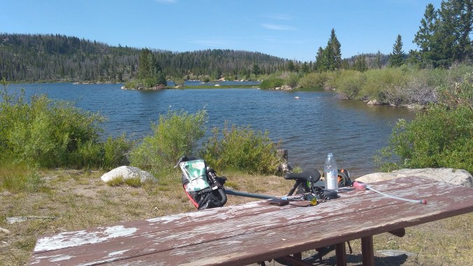
the half frozen Davis Lake

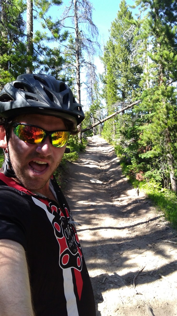
trees over the trail for miles

Towards the top of Switchback Pass

river crossings- one of over 25 that day
")


")

")